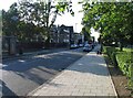
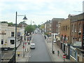
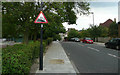
Area Overview for SE27 9UA
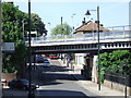
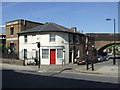
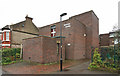
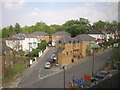
Photos of SE27 9UA


Area Information
Living in SE27 9UA offers a distinct residential experience defined by density and locality. This specific postcode covers a small residential cluster encompassing an area of 7.7 hectares. The population stands at 1368, creating a compact neighbourhood where residents know one another well. You will find this to be a tightly knit environment where the local community thrives within a defined geographic boundary. The high population density of 17759 people per square kilometre suggests a vibrant street life but also limited garden space. This area functions as a core residential hub rather than a sprawling suburb. Daily life revolves around the immediate vicinity, with most essentials within walking distance. Prospective buyers looking for homes in SE27 9UA should appreciate the conciseness of the locality. The area maintains a clear identity separate from the broader surrounding regions. You are living in an established pocket of South London where the scale of the development is manageable yet fully connected to the city. The intimate size means noise and activity are more immediate, yet the focused nature of the setting provides a sense of stability for long-term residents.
- Area Type
- Postcode
- Area Size
- 7.7 hectares
- Population
- 1368
- Population Density
- 5821 people/km²
The property market in SE27 9UA is characterised by a substantial stock of traditional housing rather than modern apartment blocks. Houses form the predominant accommodation type, which defines the streetscape and neighbourhood character. A significant portion of these homes are owner-occupied, with a home ownership rate of 49%. This statistic indicates that the area is not a boom-and-bust rental hotspot but a stable residential zone. Buyers seeking properties in this postcode should expect to find family homes on individual plots rather than parts of larger developments. The smaller area size of 7.7 hectares further limits the volume of available housing compared to wider boroughs. This constraint often drives up the value of the specific properties available within the SE27 9UA boundary. With nearly half of residents owning their homes, the local market likely values security and stability over rapid turnover. You will find fewer student lets or short-term tenancies here. The mix of owner-occupiers suggests a community deeply invested in the maintenance and long-term improvement of their homes. If you are purchasing a home in this location, you are entering a market where residents tend to stay put for extended periods. This stability can make navigating local schools and social groups much smoother for new arrivals.
House Prices in SE27 9UA
Showing 37 properties
| Address | Type | Beds | Baths | Last Sale Price | Last Sale Date | |
|---|---|---|---|---|---|---|
| 46 Norwood Park Road, London, SE27 9UA | Semi-detached | 3 | 1 | £762,500 | Oct 2025 | |
| 56 Norwood Park Road, London, SE27 9UA | house | - | - | £675,000 | Jun 2025 | |
| 66 Norwood Park Road, London, SE27 9UA | house | - | - | £487,500 | Mar 2025 | |
| 18 Norwood Park Road, London, SE27 9UA | house | - | - | £650,000 | Aug 2024 | |
| 16 Norwood Park Road, London, SE27 9UA | Terraced | 3 | 1 | £665,000 | Apr 2024 | |
| 12 Norwood Park Road, London, SE27 9UA | house | 3 | - | £815,000 | Aug 2022 | |
| 2 Norwood Park Road, London, SE27 9UA | Semi-detached | 3 | 1 | £725,000 | Mar 2022 | |
| 26 Norwood Park Road, London, SE27 9UA | Semi-detached | 4 | - | £850,000 | Sep 2021 | |
| 30 Norwood Park Road, London, SE27 9UA | Semi-detached | 3 | 2 | £737,500 | Jun 2020 | |
| 28 Norwood Park Road, London, SE27 9UA | Semi-detached | 3 | 1 | £770,000 | Sep 2019 |
Energy Efficiency in SE27 9UA
Your lifestyle in SE27 9UA is supported by a diverse array of amenities within practical reach of your doorstep. Five retail locations serve the daily shopping needs of residents, including Budgens Gipsy, Tesco Streatham, and Lidl West. These supermarkets ensure that groceries and household essentials are always accessible. Transport options are plentiful, with five rail stations, five tram stops, and five ferry piers readily available. You might take a tram from Harrington Road or a train from Gipsy Hill depending on your destination. For long-distance travel, five bus stations are nearby, ranging from the Green Line Coach Station to London Victoria Coach Station. Furthermore, five ferry piers provide waterway access, including Vauxhall St George Wharf Pier and Battersea Power Station Pier. While specific park names are not listed in the immediate amenity data, the proximity to major transport hubs implies easy access to broader recreational areas. Dining and leisure options are concentrated around these retail and transport nodes. The presence of major chains like Tesco and Lidl anchors the local economy around convenience. Residents can easily commute while still enjoying local high street offerings. This blend of infrastructural strength and commercial availability creates a low-friction daily life. You do not need to travel far to complete routine tasks or start a weekend outing.
Amenities
Schools
| Rank | School | Type | Entry gender | Ages |
|---|
Explore more schools in this area
Go to Schools tabDemographics
The community in SE27 9UA reflects a mature and established demographic profile. The median age is 47, indicating that the area is heavily populated by adults between the ages of 30 and 64. This age range represents the most common group living here, suggesting a neighbourhood dominated by established families or professionals with significant life experience. Home ownership stands at 49%, meaning nearly half of the residents own their properties outright or with a mortgage. The remaining households are likely renters, creating a balanced mix rather than an overwhelming landlord dominance. The predominant ethnic group is White, which forms the core of the local cultural fabric. Accommodation types are primarily Houses, pointing towards a preference for detached or semi-detached living over flats. This contrasts with high-density urban zones and suggests a lower-rise environment. The data does not show specific deprivation indices, but the age and ownership figures imply a settled population with financial stability. You are looking at an area where long-term residency is the norm. The demographic consistency helps foster a predictable community atmosphere where practical needs take precedence over trend-chasing lifestyle choices.
Household Size
Accommodation Type
Tenure
Ethnic Group
Religion
Household Composition
Age
Household Deprivation
NS-SEC
Explore more demographic insights in this area
Go to Demographics tabPlanning
Planning Constraints
- Flood RiskPremium
- Ramsar Wetland SitesPremium
- Area of Outstanding Natural BeautyPremium
- Protected Nature ReservePremium
- Protected WoodlandPremium