Area Overview for SE27 9JL
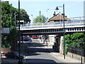
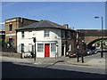
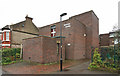
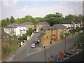
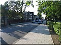
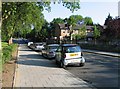
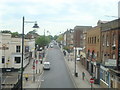
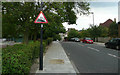
Photos of SE27 9JL


Area Information
Living in SE27 9JL offers a contained residential cluster within the broader South London landscape. This specific postcode serves approximately 1,887 residents, creating a tight-knit environment where neighbours often know one another. The area functions as a small pocket of life, distinct for its focus on domestic habitation rather than commercial expansion. You will find that daily routines revolve around access to local services and proximity to wider transport hubs. The population density supports a quiet existence, yet it remains well-connected to the city's arteries. You can expect a neighbourhood defined by its manageable scale. The community here prioritises stability, with households settled enough to maintain strong local ties. While SE27 9JL might appear small on a map, its position ensures it does not feel isolated. The area provides a front-line experience of living in South East London, balancing the need for community convenience with the desire for residential calm. Whether you are considering this spot for its quietness or its gateways to the rest of London, the physical footprint of these homes supports a structured way of life. You gain direct access to the wider world without being overwhelmed by it.
- Area Type
- Postcode
- Area Size
- Not available
- Population
- 1887
- Population Density
- 5473 people/km²
The property market in SE27 9JL is defined by a heavy reliance on flat living. Flats constitute the primary accommodation type, reflecting the architectural history and land use of this specific postcode. Only 32 per cent of residents are home owners, which indicates that the area functions largely as a rental market or a mix of rented and owned stock. You should expect to find more private renters than outright owners when surveying the local estate listings. This profile suits buyers looking for managed living or landlords seeking steady tenants, but it presents hurdles for those needing to secure mortgage-backed equity quickly. The low ownership rate suggests high transaction volumes driven by tenants changing leaseholds rather than owners building equity over decades. You will find that flats dominate the streetscape, offering access to amenities without the need for extensive grounds. Prospective buyers must navigate a market where availability is driven by turnover rather than empty inventory. The housing stock is specifically designed for the demographic currently residing here, prioritising unit size and location over detached solitude. Understanding this 32 per cent ownership split is crucial for your financial planning in this cluster.
House Prices in SE27 9JL
No properties found in this postcode.
Energy Efficiency in SE27 9JL
Your daily life in SE27 9JL benefits from a dense network of amenities within practical reach. Retail options are strong, with Tesco West, Sainsburys West, and Co-op West ready for your weekly shop. Five distinct retail outlets mean you do not need to venture far for groceries or household essentials. Transport diversity shapes your leisure potential, with five railway stations, five metro points, five ferry piers, and three major coach stations nearby. You might catch a train to West Norwood or catch the ferry at Vauxhall for an afternoon outing. Five rail hubs including Tulse Hill Station and Gipsy Hill Station ensure you can travel quickly across South London. Three bus-style coach connections through Victoria and Green Line stations give you access to national networks. You will find that the lifestyle here is convenience-driven, relying on the sharpness of these local links. Whether you prefer a five-minute walk to a Co-op or a quick tube ride to the arts district, the infrastructure supports it. The presence of these five retail and five transport categories per category creates a textured environment. You buy your coffee at Co-op West or catch the tram to Clapham South with equal ease. This accessibility defines the character of living in SE27 9JL.
Amenities
Schools
Families considering homes in SE27 9JL have access to several educational establishments nearby. Norwood Park School operates as a primary institution, providing foundational education for children within the immediate catchment. You will also find Park Campus and Park Campus Academy listed as other nearby options, which serve various age groups and educational needs. These schools are situated close enough that parents can realistically choose them for their children's schooling. The presence of both primary and other school types indicates a mixed educational landscape catering to different stages of development. You do not find a single dominant academy dominating the skyline but rather a spread of options including Norwood Park School. This variety allows parents to select based on specific curriculum needs or proximity. The proximity of these venues means that morning commutes are short, fitting well with the median age profile of the residents. Whether you require a crèche, a grammar pathway, or a comprehensive setting, the area places educational facilities within practical reach of the majority of flats in SE27 9JL.
| Rank | School | Type | Entry gender | Ages |
|---|
Explore more schools in this area
Go to Schools tabDemographics
The community in SE27 9JL reflects a mature profile, with a median age of 47 years. This indicates that Adults aged between 30 and 64 years represent the most common age range within the cluster. You are looking at an area where established families or individuals in later career stages dominate the resident count. This demographic skew suggests a population that values stability and has likely put down roots for the long term. Home ownership stands at 32 per cent, meaning the majority of residents do not own their properties outright. Consequently, you should anticipate a significant proportion of private rentals alongside the smaller stock of owner-occupied homes. The predominant accommodation type consists of flats, which aligns with the urban density of this specific postcode cluster. The ethnic composition is predominantly White, shaping the cultural dynamics of the locality. You will find a community familiar with the rhythms of multi-generational British suburban life, even if the housing stock is modernised. These figures confirm a settled demographic less focused on rapid turnover, creating an environment where local traditions endure.
Household Size
Accommodation Type
Tenure
Ethnic Group
Religion
Household Composition
Age
Household Deprivation
NS-SEC
Explore more demographic insights in this area
Go to Demographics tabPlanning
Planning Constraints
- Flood RiskPremium
- Ramsar Wetland SitesPremium
- Area of Outstanding Natural BeautyPremium
- Protected Nature ReservePremium
- Protected WoodlandPremium