Area Overview for SE27 9EZ
Photos of SE27 9EZ
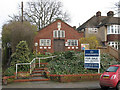
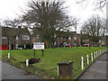
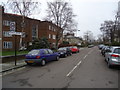
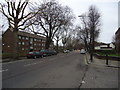
100 photos from this area
Area Information
Key information about the SE27 9EZ including its size, population, and administrative classification.
- Area Type
- Postcode
- Area Size
- 2.1 hectares
- Population
- 1760
- Population Density
- 8844 people/km²
House Prices in SE27 9EZ
61
Properties
£1,208,593
Average Sold Price
£187,500
Lowest Price
£2,500,000
Highest Price
Showing 61 properties
| Address | Type | Beds | Baths | Last Sale Price | Last Sale Date | |
|---|---|---|---|---|---|---|
| 53 Chestnut Road, London, SE27 9EZ | Detached | 5 | 3 | £2,025,000 | Jul 2023 | |
| 55 Chestnut Road, London, SE27 9EZ | Maisonette | 3 | 1 | £2,250,000 | Jun 2023 | |
| 9 Chestnut Road, London, SE27 9EZ | house | - | - | £1,650,000 | Jul 2022 | |
| 67B Chestnut Road, London, SE27 9EZ | Maisonette | 3 | - | £600,000 | May 2022 | |
| 13 Chestnut Road, London, SE27 9EZ | house | - | - | £1,770,129 | Feb 2022 | |
| 33 Chestnut Road, London, SE27 9EZ | house | - | - | £2,500,000 | Dec 2021 | |
| 19 Chestnut Road, London, SE27 9EZ | house | - | - | £1,750,000 | Jun 2021 | |
| 61 Chestnut Road, London, SE27 9EZ | house | - | - | £2,400,000 | May 2021 | |
| 59 Chestnut Road, London, SE27 9EZ | Semi-detached | 5 | 3 | £2,200,000 | Oct 2018 | |
| 69 Chestnut Road, London, SE27 9EZ | Terraced | 4 | 1 | £637,000 | Aug 2018 |
Page 1 of 7
Energy Efficiency in SE27 9EZ
Amenities
Schools
| Rank | School | Type | Entry gender | Ages |
|---|
Explore more schools in this area
Go to Schools tabDemographics
Household Size
Family (3-5 people)
most common
Accommodation Type
Houses
most common
Tenure
70
majority
Ethnic Group
White
most common
Religion
N/A
most common
Household Composition
N/A
most common
Age
47
median
Adults (30-64 years)
most common
Household Deprivation
N/A
with no deprivation
NS-SEC
63
in Lower managerial occupations
Explore more demographic insights in this area
Go to Demographics tabPlanning
Planning Constraints
- Flood RiskPremium
- Ramsar Wetland SitesPremium
- Area of Outstanding Natural BeautyPremium
- Protected Nature ReservePremium
- Protected WoodlandPremium