Area Overview for SE27 9BE
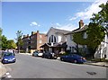
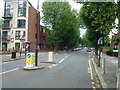
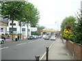
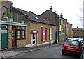
Photos of SE27 9BE


Area Information
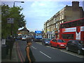
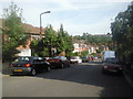
SE27 9BE is a specific postcode area covering a small residential cluster within South London. You will find roughly 1,656 people calling this location home, creating a compact neighbourhood with a distinct community feel. Living in SE27 9BE means experiencing a suburb defined by its density and proximity to wider transport hubs rather than sprawling open spaces. The area sits at the heart of the London SE27 postal district, offering a practical base for daily commuting and local activities. Residents here enjoy immediate access to major junctions and public transit routes without needing to travel far into the city. This small residential cluster provides a convenient setting for those who prioritise location over vast gardens. The population size contributes to a sense of locality while maintaining easy reach to the broader South London borough. Daily life revolves around the practicalities of urban living, where walkable distances to stations and shops form the rhythm of the day. You can expect a environment where household noise and community events take centre stage within this tightly knit grouping. The area represents a straightforward choice for buyers seeking a defined address with clear boundaries and established services.
- Area Type
- Postcode
- Area Size
- Not available
- Population
- 1656
- Population Density
- 9528 people/km²
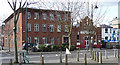
The property market in SE27 9BE is characterised by a significant reliance on rental accommodation, with home ownership standing at just 44%. This figure indicates that slightly more than half of the residents rent their properties rather than own them. You should expect a housing stock heavily weighted towards flats, which aligns with the high density of this specific postcode area. This type of accommodation suggests a design focused on compact living spaces within multi-unit buildings suited for modern urban lifestyles. For buyers looking at homes in SE27 9BE, the lower ownership rate often reflects the high cost of entry for single-family detached houses in South London. Instead, the market offers a variety of apartment options that allow residents to live in prime locations without the luxury of extensive private gardens. The 44% ownership figure also hints at a strong presence of buy-to-let landlords and first-time buyers navigating the stairs. This dynamic creates a fluid market where property values remain sensitive to national interest rates and rental demand. Understanding this balance is essential when viewing flats in this cluster. You may find more rental listings than owner-occupied homes available for purchase. The prevalence of flats supports a community where neighbours live overhead or beside each other, fostering a specific type of urban camaraderie. This housing model fits the area's population perfectly, accommodating the 1,656 residents in a space designed for efficiency and connectivity. Buyers here trade ground for space and instead pay for location and convenience.
House Prices in SE27 9BE
No properties found in this postcode.
Energy Efficiency in SE27 9BE
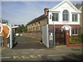
Living in SE27 9BE offers immediate access to a variety of retail and transport options within practical reach. You can find five key retail locations nearby, including Co-op Tulse, Iceland West, and Co-op West. These supermarkets provide essentials and weekly shopping trips without requiring a long journey into central London. For journey planning, five rail stations lie close by, including Tulse Hill Station, West Norwood Station, and West Dulwich. This variety allows you to choose a departure point based on your destination and time of day. Public transport diversity extends to the Underground network as well. Five metro stations serve the wider area, such as Clapham South, Tooting Bec Station, and Stockwell Station. This interconnected web of rail and tube lines means you can travel across South London with ease. If you prefer water transport or connections to the river, five ferries operate nearby at Vauxhall St George Wharf Pier, Battersea Power Station Pier, and Millbank Pier. These routes offer scenic alternatives for commuting into central London. Additionally, three major bus and coach terminals, including the Green Line Coach Station and London Victoria Coach Station Arrivals, link you to national travel networks. This amenities density ensures that daily household needs are met quickly. You grab groceries at Iceland West or browse local offers at Co-op Tulse before catching a train. The presence of multiple transport hubs reduces reliance on cars for routine errands. Your lifestyle centres on convenience, with key services just minutes away. This variety supports a flexible schedule where work and leisure blend seamlessly without long travel times
Amenities
Schools
| Rank | School | Type | Entry gender | Ages |
|---|
Explore more schools in this area
Go to Schools tabDemographics
The community in SE27 9BE skews towards older residents, with a median age of 47 years. Adults between the ages of 30 and 64 represent the most common age range, indicating a population comprised of working professionals and established families rather than young students or pensioners. You will likely encounter a neighbourhood where career-focused individuals seek stability and proximity to transport links. This age profile suggests a desire for convenient commuting and reliable local amenities to support mid-life activities. Home ownership levels stand at 44%, meaning roughly half the residents rent their properties while the other half own their homes outright or with a mortgage. Flats constitute the primary form of accommodation in this postcode. This housing stock aligns with the demographic trend towards smaller, space-efficient living solutions typical for a population centre of this size. The predominant ethnic group is White, reflecting the historical settlement patterns of South East London. A 44% ownership rate signals a mixed market where both landlords and owners share the streets. Affordability and access to property often drive these figures in urban postcodes. The concentration of flats supports a diverse range of household types, from couples to sharers. You should anticipate a steady mix of tenants and owners navigating daily life within this residential cluster. The demographic structure points to a stable community less likely to undergo rapid generational shifts in the short term.
Household Size
Accommodation Type
Tenure
Ethnic Group
Religion
Household Composition
Age
Household Deprivation
NS-SEC
Explore more demographic insights in this area
Go to Demographics tabPlanning
Planning Constraints
- Flood RiskPremium
- Ramsar Wetland SitesPremium
- Area of Outstanding Natural BeautyPremium
- Protected Nature ReservePremium
- Protected WoodlandPremium