Area Overview for SE27 0RP
Photos of SE27 0RP
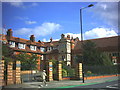


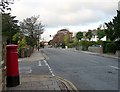
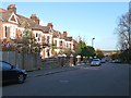
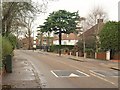
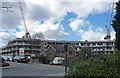
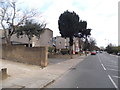
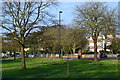
100 photos from this area
Area Information
Key information about the SE27 0RP including its size, population, and administrative classification.
- Area Type
- Postcode
- Area Size
- 1.2 hectares
- Population
- 1540
- Population Density
- 10384 people/km²
House Prices in SE27 0RP
42
Properties
£762,996
Average Sold Price
£85,000
Lowest Price
£1,365,000
Highest Price
Showing 42 properties
| Address | Type | Beds | Baths | Last Sale Price | Last Sale Date | |
|---|---|---|---|---|---|---|
| 125 St Julians Farm Road, London, SE27 0RP | Semi-detached | 5 | 3 | £1,365,000 | Jul 2023 | |
| 119 St Julians Farm Road, London, SE27 0RP | Semi-detached | 5 | 2 | £1,300,000 | Aug 2018 | |
| 117 St Julians Farm Road, London, SE27 0RP | house | - | - | £1,291,000 | Jun 2016 | |
| 115 St Julians Farm Road, London, SE27 0RP | house | 6 | 3 | £835,000 | Dec 2013 | |
| 121 St Julians Farm Road, London, SE27 0RP | Semi-detached | 4 | - | £850,000 | Nov 2013 | |
| 133 St Julians Farm Road, London, SE27 0RP | Semi-detached | 4 | - | £899,950 | Sep 2013 | |
| 145 St Julians Farm Road, London, SE27 0RP | Detached | 4 | - | £570,000 | Dec 2012 | |
| 107 St Julians Farm Road, London, SE27 0RP | house | - | - | £810,000 | Jan 2010 | |
| 109 St Julians Farm Road, London, SE27 0RP | Terraced | - | - | £800,000 | Oct 2007 | |
| 147 St Julians Farm Road, London, SE27 0RP | house | - | - | £200,000 | Nov 1998 |
Page 1 of 5
Energy Efficiency in SE27 0RP
Amenities
Schools
| Rank | School | Type | Entry gender | Ages |
|---|
Explore more schools in this area
Go to Schools tabDemographics
Household Size
Family (3-5 people)
most common
Accommodation Type
Houses
most common
Tenure
63
majority
Ethnic Group
White
most common
Religion
N/A
most common
Household Composition
N/A
most common
Age
47
median
Adults (30-64 years)
most common
Household Deprivation
N/A
with no deprivation
NS-SEC
44
in Lower managerial occupations
Explore more demographic insights in this area
Go to Demographics tabPlanning
Planning Constraints
- Flood RiskPremium
- Ramsar Wetland SitesPremium
- Area of Outstanding Natural BeautyPremium
- Protected Nature ReservePremium
- Protected WoodlandPremium