Area Overview for SE26 6HU
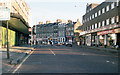
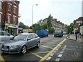
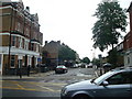
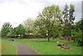
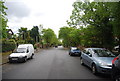
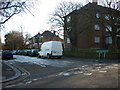
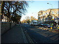
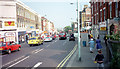
Photos of SE26 6HU
Area Information
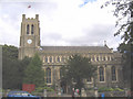
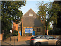
Living in SE26 6HU offers a grounded experience within the Penge and Cator Ward of the London Borough of Bromley. This specific postcode covers a small residential cluster characterised by historic depth and practical convenience. The area functions as a quiet residential pocket approximately 3.5 miles west of Bromley and 3.7 miles north east of Bromley town centre. You are situated near coordinates 51.42156, -0.036794, placing you in a location that has evolved significantly over centuries. Once a small hamlet attached to the manor of Battersea, Penge gained independence in 1888 before merging into the London Borough of Bromley in 1965. Your daily life benefits from proximity to historic landmarks like the Crooked Billet, the oldest public house in Penge dating to at least 1601. The neighbourhood retains ties to Victorian Victorian expansion as a fashionable suburb near the Crystal Palace. Thomas Crapper, the plumber who developed the U-bend, retired to 12 Thornsett Road in this locality. You reside in an environment where historic estates, such as those associated with the Cator family, influence the local landscape. Stone Farm and Beckenham Place feature prominently in the area's ancestry. Interestingly, your surroundings are about 5.6 km from the main town centre of Bromley, yet you access modern infrastructure effortlessly. This postcode represents a stable environment where history meets contemporary utility.
- Area Type
- Postcode
- Area Size
- Not available
- Population
- 1883
- Population Density
- 4020 people/km²
You are looking at a property market heavily skewed towards specific accommodation types in SE26 6HU. Flats dominate the housing stock in this exact postcode area. The statistics indicate that 48% of residents hold their home through ownership, leaving just under half of the population in the rental sector. This split creates a competitive environment for buyers, particularly those seeking flats in a prime South East London location. Because the area contains such a high concentration of flats, the market dynamics differ significantly from brick-built suburban estates common elsewhere in Bromley. As a buyer targeting SE26 6HU, you must navigate a space where flats account for the majority of listings. The prevalence of this housing type means you will encounter fewer detached or semi-detached houses than in other parts of the Kent connection the area shares with Bromley. The 48% ownership rate suggests significant competition between owner-occupiers and landlords renting these units. Your options depend heavily on what is currently listed for sale versus let in this small cluster. The data shows a clear typology: this is a flat-first environment. If you prefer a large garden or a specific Victorian terraced house style, you may find fewer examples here compared to wider Penge. The market reflects the physical reality of the site, where vertical living predominates over sprawling low-density development. Understanding this split is essential for your purchasing strategy in this distinctive location.
House Prices in SE26 6HU
No properties found in this postcode.
Energy Efficiency in SE26 6HU
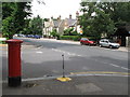
Your lifestyle in SE26 6HU is supported by a diverse array of amenities located just moments away. Retail options include Sainsburys Lewisham, Tesco Sydenham, and Tesco Penge, ensuring you have easy access to groceries and daily necessities. Transport connectivity is equally impressive, with five rail stations including Penge East and Penge West Station within your reach. You can also utilize five metro stops such as the Beckenham Road Tram Stop and Harrington Road Tram Stop for short hops across the borough. Five ferry termini provide alternative routes, including Greenwich Pier and Masthouse Terrace Pier, linking you to the Thames. Two major bus and coach hubs sit nearby, specifically the Green Line Coach Station and Victoria Coach Station, facilitating travel beyond the immediate London borough. These facilities mean you do not need a car for most trips. Your daily life involves walking to shops in Sydenham or Penge before catching a tram or train. The presence of multiple university-affiliated amenities and coach stations adds to the bustle of the wider area, even if this postcode itself remains quieter. You enjoy the convenience of having retail and transport options concentrated within a short walking distance. The proximity to Sainsburys Lewisham and the various tram stops means your day begins and ends with minimal logistical friction. Living in SE26 6HU grants you access to these vital services without the delay of long commutes.
Amenities
Schools
| Rank | School | Type | Entry gender | Ages |
|---|
Explore more schools in this area
Go to Schools tabDemographics
The community in SE26 6HU is defined by a mature population profile. Four thousand eight hundred inhabitants live here, with the median age recorded at 47 years. Adults between the ages of 30 and 64 years constitute the most common age range within this very specific residential cluster. You are joining a neighbourhood where the population count stands at 1 883 residents. This demographic profile suggests an area attracting those seeking stability rather than transient urban energy. Accommodation types reflect this settled nature, with flats being the predominant form of housing across these grounds. Ethnically, White serves as the predominant ethnic group in this specific postcode area. Home ownership stands at 48%, indicating that nearly half of the residents have bought their property rather than renting. This figure suggests a market where long-term residence is common. The concentration of adults in the 30-64 bracket aligns with the prevalence of flats, which often appeal to individuals who have moved away from family homes or require low-maintenance living. You find a population that values established roots over rapid turnover. The data confirms this is a mature environment where residents have likely prioritised ownership. The specific breakdown shows a clear alignment between the age of the population and the type of accommodation available in this distinct cluster.
Household Size
Accommodation Type
Tenure
Ethnic Group
Religion
Household Composition
Age
Household Deprivation
NS-SEC
Explore more demographic insights in this area
Go to Demographics tabPlanning
Planning Constraints
- Flood RiskPremium
- Ramsar Wetland SitesPremium
- Area of Outstanding Natural BeautyPremium
- Protected Nature ReservePremium
- Protected WoodlandPremium