Area Overview for SE26 5NL
Photos of SE26 5NL

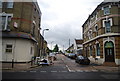
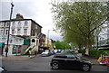
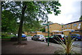
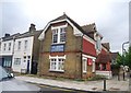
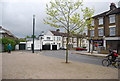

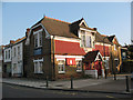
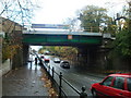
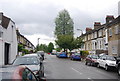
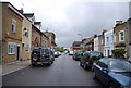
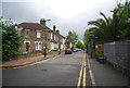
100 photos from this area
Area Information
Key information about the SE26 5NL including its size, population, and administrative classification.
- Area Type
- Postcode
- Area Size
- 2.3 hectares
- Population
- 1609
- Population Density
- 6165 people/km²
House Prices in SE26 5NL
23
Properties
£805,682
Average Sold Price
£142,500
Lowest Price
£1,300,000
Highest Price
Showing 23 properties
| Address | Type | Beds | Baths | Last Sale Price | Last Sale Date | |
|---|---|---|---|---|---|---|
| 12 Alexandra Road, Sydenham, London, SE26 5NL | Semi-detached | 4 | - | £1,300,000 | Aug 2025 | |
| 17 Alexandra Road, Sydenham, London, SE26 5NL | Semi-detached | 4 | 2 | £1,285,000 | May 2025 | |
| 8 Alexandra Road, Sydenham, London, SE26 5NL | house | 4 | - | £1,300,000 | Apr 2021 | |
| 7 Alexandra Road, Sydenham, London, SE26 5NL | Semi-detached | 4 | 1 | £1,160,000 | Mar 2021 | |
| 19 Alexandra Road, Sydenham, London, SE26 5NL | house | - | - | £600,000 | Aug 2019 | |
| 10 Alexandra Road, Sydenham, London, SE26 5NL | house | - | - | £900,000 | Nov 2018 | |
| 13 Alexandra Road, Sydenham, London, SE26 5NL | Semi-detached | 5 | 1 | £1,100,000 | Oct 2018 | |
| 1 Alexandra Road, Sydenham, London, SE26 5NL | Semi-detached | 4 | - | £585,000 | Apr 2013 | |
| 11 Alexandra Road, Sydenham, London, SE26 5NL | Semi-detached | - | - | £335,000 | Aug 2005 | |
| 2 Alexandra Road, Sydenham, London, SE26 5NL | Semi-detached | - | - | £155,000 | Apr 1999 |
Page 1 of 3
Energy Efficiency in SE26 5NL
Amenities
Schools
| Rank | School | Type | Entry gender | Ages |
|---|
Explore more schools in this area
Go to Schools tabDemographics
Household Size
One person
most common
Accommodation Type
Flats
most common
Tenure
53
majority
Ethnic Group
White
most common
Religion
N/A
most common
Household Composition
N/A
most common
Age
47
median
Adults (30-64 years)
most common
Household Deprivation
N/A
with no deprivation
NS-SEC
52
in Lower managerial occupations
Explore more demographic insights in this area
Go to Demographics tabPlanning
Planning Constraints
- Flood RiskPremium
- Ramsar Wetland SitesPremium
- Area of Outstanding Natural BeautyPremium
- Protected Nature ReservePremium
- Protected WoodlandPremium