Area Overview for SE26 5HY
Photos of SE26 5HY

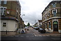
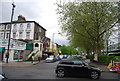
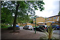
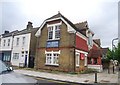
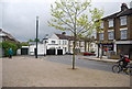


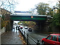
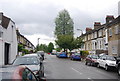
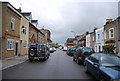
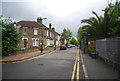
100 photos from this area
Area Information
Key information about the SE26 5HY including its size, population, and administrative classification.
- Area Type
- Postcode
- Area Size
- 8035 m²
- Population
- 1609
- Population Density
- 6165 people/km²
House Prices in SE26 5HY
36
Properties
£545,761
Average Sold Price
£105,000
Lowest Price
£970,000
Highest Price
Showing 36 properties
| Address | Type | Beds | Baths | Last Sale Price | Last Sale Date | |
|---|---|---|---|---|---|---|
| 48 Wiverton Road, Sydenham, London, SE26 5HY | Semi-detached | 4 | 2 | £940,000 | Jan 2025 | |
| 16A Wiverton Road, Sydenham, London, SE26 5HY | Terraced | 5 | - | £915,000 | Nov 2024 | |
| 50 Wiverton Road, Sydenham, London, SE26 5HY | Semi-detached | 4 | 2 | £860,000 | Jun 2024 | |
| 14A Wiverton Road, Sydenham, London, SE26 5HY | Terraced | 3 | 1 | £877,500 | Nov 2023 | |
| 52 Wiverton Road, Sydenham, London, SE26 5HY | Semi-detached | 4 | 2 | £890,000 | Mar 2023 | |
| 14 Wiverton Road, Sydenham, London, SE26 5HY | Semi-detached | 4 | 1 | £970,000 | Jan 2023 | |
| 44A Wiverton Road, Sydenham, London, SE26 5HY | Detached | 3 | 1 | £575,000 | Jan 2018 | |
| 28 Wiverton Road, Sydenham, London, SE26 5HY | Semi-detached | 5 | 3 | £815,000 | Sep 2015 | |
| 46 Wiverton Road, Sydenham, London, SE26 5HY | Semi-detached | 4 | - | £675,000 | Mar 2015 | |
| 10 Wiverton Road, Sydenham, London, SE26 5HY | house | 5 | - | £450,000 | May 2013 |
Page 1 of 4
Energy Efficiency in SE26 5HY
Amenities
Schools
| Rank | School | Type | Entry gender | Ages |
|---|
Explore more schools in this area
Go to Schools tabDemographics
Household Size
One person
most common
Accommodation Type
Flats
most common
Tenure
53
majority
Ethnic Group
White
most common
Religion
N/A
most common
Household Composition
N/A
most common
Age
47
median
Adults (30-64 years)
most common
Household Deprivation
N/A
with no deprivation
NS-SEC
52
in Lower managerial occupations
Explore more demographic insights in this area
Go to Demographics tabPlanning
Planning Constraints
- Flood RiskPremium
- Ramsar Wetland SitesPremium
- Area of Outstanding Natural BeautyPremium
- Protected Nature ReservePremium
- Protected WoodlandPremium