Area Overview for SE26 5HB
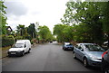
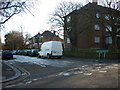
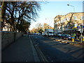
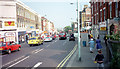
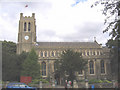
Photos of SE26 5HB
Area Information
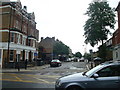
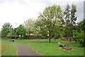
Living in SE26 5HB means residing within a compact residential cluster defined by the postcode itself. This small area covers just 8001 square metres and houses 1631 people. You are stepping into a dense urban environment where every square metre is counted. The population density reaches 203851 people per square kilometre. This figure places SE26 5HB among the most tightly packed neighbourhoods in the United Kingdom. Despite the intense density, the location remains a functional residential zone. You will find a mix of daily activities and housing options within this limited footprint. The area serves as a specific postcode area covering a small residential cluster. Prospective buyers should view this space as part of the wider Lewisham or Sydenham districts. This high density suggests a lively street scene with limited untouched green space. The proximity to other transport hubs and shops defines the character of life here. You gain convenience but pay for it with noise and little outdoor room. SE26 5HB functions as a microcosm of London suburbia where efficiency outweighs space.
- Area Type
- Postcode
- Area Size
- 8001 m²
- Population
- 1631
- Population Density
- 7925 people/km²
The property market in SE26 5HB is characterised by a significant presence of house owners. The data shows that 54 percent of households own their homes. This indicates a stable market with fewer short-term turnover rates often seen in pure rental zones. The predominant accommodation type consists of houses. You are unlikely to find high-rise blocks or converted commercial units within this specific cluster. The low accommodation count of just 1631 properties limits the variety of listings available at any one time. Buyers here are generally looking for traditional domestic settings rather than shared apartment living. This ownership rate suggests the area attracts those seeking to put down roots. The housing stock is not split evenly between ownership and renting, creating a balanced but owner-leaning environment. Prices for these houses will reflect the high density and prime London location. You should expect competition for the limited number of homes available. Sellers in this postcode command strong positions due to supply constraints.
House Prices in SE26 5HB
Showing 14 properties
| Address | Type | Beds | Baths | Last Sale Price | Last Sale Date | |
|---|---|---|---|---|---|---|
| The Dolphin, 121 Sydenham Road, London, SE26 5HB | Terraced | - | - | - | - | |
| Sydenham Kebab Shop, 137 Sydenham Road, London, SE26 5HB | Retail | - | - | - | - | |
| 163A Sydenham Road, London, SE26 5HB | Flat | - | - | - | - | |
| 167A Sydenham Road, London, SE26 5HB | Maisonette | - | - | - | - | |
| Flat Above, 169 Sydenham Road, London, SE26 5HB | Flat | - | - | - | - | |
| 169A Sydenham Road, London, SE26 5HB | Flat | - | - | - | - | |
| Flat Above, 167 Sydenham Road, London, SE26 5HB | Flat | - | - | - | - | |
| Flat 3, 139-151 Sydenham Road, London, SE26 5HB | Flat | - | - | - | - | |
| Flat 5, 139-151 Sydenham Road, London, SE26 5HB | Flat | - | - | - | - | |
| Flat 2, 139-151 Sydenham Road, London, SE26 5HB | Flat | - | - | - | - |
Energy Efficiency in SE26 5HB
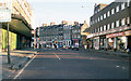
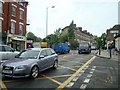
Your lifestyle in SE26 5HB revolves around convenient access to major retail and transport hubs. The area sits near five retail outlets, including Lidl Lower, Tesco Sydenham, and Sainsburys Lewisham. These supermarkets provide all the essentials for daily grocery shopping and household needs. You can walk or take a short bus ride to stock up on fresh produce at Lidl Lower. Five rail stations lie nearby, offering Sydenham Station, Penge East, and Lower Sydenham as key interchange points. Commuters can catch trains to central London or connect to other lines across the network. Three metro tram stops serve Beckenham Road, Avenue Road, and Harrington Road for local travel. Additionally, five ferry terminals are accessible via Greenwich Pier, Masthouse Terrace Pier, and Greenland Surrey Quays Pier. These options allow you to cross the Thames or visit Greenwich easily. You have multiple modes of transport for getting to work or leisure. Shopping and commuting become straightforward tasks rather than planning exercises.
Amenities
Schools
| Rank | School | Type | Entry gender | Ages |
|---|
Explore more schools in this area
Go to Schools tabDemographics
The community in SE26 5HB reflects a mature population with a median age of 47 years. The most common age range consists of adults between 30 and 64 years. This demographic structure indicates an area dominated by established residents rather than young families or students. Home ownership stands at 54 percent, meaning slightly more than half of the households own their property. The remaining homes are occupied by renters who contribute to the rental market activity. You will primarily encounter detached or semi-detached houses rather than apartments or flats. The predominant ethnic group is White, which shapes the cultural landscape of the neighbourhood. This age profile often correlates with people who have settled in the area for a considerable time. A quarter of the residents are either elderly or under thirty, creating a multi-generational feel. The housing stock supports a working-age population that values stability. You are entering a community where long-term residency is the norm.
Household Size
Accommodation Type
Tenure
Ethnic Group
Religion
Household Composition
Age
Household Deprivation
NS-SEC
Explore more demographic insights in this area
Go to Demographics tabPlanning
Planning Constraints
- Flood RiskPremium
- Ramsar Wetland SitesPremium
- Area of Outstanding Natural BeautyPremium
- Protected Nature ReservePremium
- Protected WoodlandPremium