Area Overview for SE26 4SU
Photos of SE26 4SU


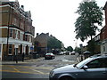
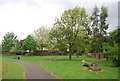


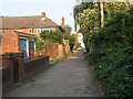

100 photos from this area
Area Information
Key information about the SE26 4SU including its size, population, and administrative classification.
- Area Type
- Postcode
- Area Size
- 6431 m²
- Population
- 1571
- Population Density
- 6702 people/km²
House Prices in SE26 4SU
20
Properties
£345,571
Average Sold Price
£124,000
Lowest Price
£690,000
Highest Price
Showing 20 properties
| Address | Type | Beds | Baths | Last Sale Price | Last Sale Date | |
|---|---|---|---|---|---|---|
| 38 Silverdale, London, SE26 4SU | Flat | 2 | 1 | £450,000 | Aug 2025 | |
| 52 Silverdale, London, SE26 4SU | house | 4 | 2 | £690,000 | Nov 2024 | |
| 48 Silverdale, London, SE26 4SU | Terraced | 4 | 1 | £565,000 | Mar 2024 | |
| 40 Silverdale, London, SE26 4SU | Terraced | 4 | 2 | £234,000 | Jul 2006 | |
| 50 Silverdale, London, SE26 4SU | house | - | - | £222,000 | Jun 2005 | |
| 44 Silverdale, London, SE26 4SU | Terraced | - | - | £133,998 | May 2000 | |
| 46 Silverdale, London, SE26 4SU | Terraced | - | - | £124,000 | Nov 1999 | |
| Flat 2, 34 Silverdale, London, SE26 4SU | Flat | - | - | - | - | |
| 42 Silverdale, London, SE26 4SU | Terraced | - | - | - | - | |
| Flat 9, 34 Silverdale, London, SE26 4SU | Flat | - | - | - | - |
Page 1 of 2
Energy Efficiency in SE26 4SU
Amenities
Schools
| Rank | School | Type | Entry gender | Ages |
|---|
Explore more schools in this area
Go to Schools tabDemographics
Household Size
Family (3-5 people)
most common
Accommodation Type
Flats
most common
Tenure
35
majority
Ethnic Group
White
most common
Religion
N/A
most common
Household Composition
N/A
most common
Age
47
median
Adults (30-64 years)
most common
Household Deprivation
N/A
with no deprivation
NS-SEC
36
in Lower managerial occupations
Explore more demographic insights in this area
Go to Demographics tabPlanning
Planning Constraints
- Flood RiskPremium
- Ramsar Wetland SitesPremium
- Area of Outstanding Natural BeautyPremium
- Protected Nature ReservePremium
- Protected WoodlandPremium