Area Overview for SE25 6PL
Photos of SE25 6PL


Area Information
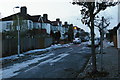
Living in SE25 6PL means settling into a specific residential cluster defined by a precise postcode designation in England. This small area covers a land area of 1366 square metres, containing a total population of 1758 residents. The density here is high, placing the number of people per square kilometre at a significant figure that reflects a concentrated urban environment rather than a sprawling suburban estate. You are situated in a setting where every square metre is accounted for, creating a tight-knit neighbourhood structure. The local environment is characterised by this compact footprint, which influences how daily life moves within the boundaries of the cluster. When considering homes in SE25 6PL, you are entering a market defined by its small scale and high occupancy rates. The area functions as a distinct residential unit within the broader South Croydon landscape, separated by its specific geography. Persons living here experience a community size that remains manageable, with the total headcount of 1758 people forming the entire demographic base of this postcode. This concentration affects the pace of life, ensuring that services are close to hand while the community retains a defined identity. There are no vague descriptions here; the reality is a small, dense pocket of London living where the local population is fully integrated into the postcode's character.
- Area Type
- Postcode
- Area Size
- 1366 m²
- Population
- 1758
- Population Density
- 14626 people/km²
The property market in SE25 6PL is heavily influenced by the fact that flats are the predominant accommodation type available to buyers and tenants in this postcode. With a home ownership rate of just 37% for the 1758 people who live here, the area functions largely as a rental market rather than an owner-occupied estate. This dynamic is particularly relevant if you are considering purchasing homes in SE25 6PL, as you will encounter fewer detached or semi-detached houses compared to the high number of apartments. The local housing stock is built to accommodate a high-density population within a small 1366 square metre area, prioritising vertical living over sprawling suburbs. For those looking to buy, the low rate of ownership indicates that flipping the market structure could be challenging, as most residents are already on an ownership ladder or operating within the rental sector. The dominance of flats aligns with the median age of 47, suggesting a demand for affordable, low-maintenance living spaces rather than large family homes. You should expect a inventory where leasehold flats outnumber freehold properties significantly. This market composition makes SE25 6PL a distinct choice compared to areas where owner-occupiers hold a larger majority of the housing stock.
House Prices in SE25 6PL
Showing 1 properties
| Address | Type | Beds | Baths | Last Sale Price | Last Sale Date | |
|---|---|---|---|---|---|---|
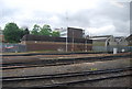
| South Norwood Delivery Office, Holmesdale Road, South Norwood, London, SE25 6PL | Office | - | - | - | - |
Energy Efficiency in SE25 6PL
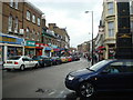
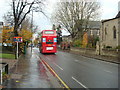
Your daily life in SE25 6PL revolves around proximity, with five key retail locations within practical reach. You can shop for groceries and essentials at Aldi South, Tesco South, and Sainsburys Crystal, ensuring that food shopping and household needs are met without a long journey. These supermarkets provide a convenient backbone for family errands, fitting the needs of the 1758 residents who call this 1366 square metre area home. The availability of three major supermarket chains simplifies logistics for anyone living in the wider SE25 6PL cluster. Transport links are integrated into your lifestyle, with five rail stations and five tram stops located near the postcode. Norwood Junction Station, Selhurst Station, and Thornton Heath Station offer direct train connections, while Harrington Road Tram Stop, Woodside Tram Stop, and Blackhorse Lane Tram Stop provide lighter rail access. This combination means that commuting to central London or exploring surrounding boroughs is efficient. You do not need to rely on a private car for most trips, as the public transport network is dense and accessible. Living in SE25 6PL means having your journey planning simplified by the sheer number of stations and stops located in your immediate vicinity.
Amenities
Schools
| Rank | School | Type | Entry gender | Ages |
|---|
Explore more schools in this area
Go to Schools tabDemographics
The community in SE25 6PL is dominated by adults, with the median age standing at 47 years. The most common age range for residents is between 30 and 64 years, indicating a population that is firmly established in their careers and families. This demographic profile suggests a stable group of homeowners and long-term renters who have put down roots in the South London neighbourhood. You will find that the area is not defined by very young families or retirees, but by a broad span of working-age adults navigating mid-life responsibilities. Home ownership in SE25 6PL currently stands at 37%, which means that roughly one-third of the housing stock is owned outright or with a mortgage. Conversely, the majority of the population rents their accommodation, reflecting a market heavily skewed toward tenancy rather than ownership. Flats are the predominant accommodation type in this specific postcode, catering to the preferences and space requirements of the local adult population. The residents are also predominantly White, mirroring the broader ethnographic trends found in many parts of South London. Understanding these figures helps you grasp the social fabric of the area, where a majority of households may be tenants in flat-style dwellings.
Household Size
Accommodation Type
Tenure
Ethnic Group
Religion
Household Composition
Age
Household Deprivation
NS-SEC
Explore more demographic insights in this area
Go to Demographics tabPlanning
Planning Constraints
- Flood RiskPremium
- Ramsar Wetland SitesPremium
- Area of Outstanding Natural BeautyPremium
- Protected Nature ReservePremium
- Protected WoodlandPremium