Area Overview for SE25 6EN
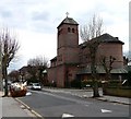
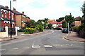
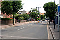
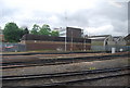
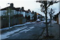
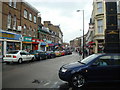
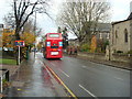
Photos of SE25 6EN


Area Information
Living in SE25 6EN means calling a small residential cluster home within the SE25 postcode area of south-east London. This specific postcode covers a defined group of addresses where 2,039 people call home. You will find yourself in an environment dominated by flats rather than detached houses, reflecting the urban density typical of this part of Croydon. Daily life here revolves around practical convenience and proximity to major transport hubs. The area sits less than a mile from South Norwood and Norwood Junction, placing you within easy reach of substantial retail parks and multiple railway stations. You can walk to five tram stops, including Harrington Road and woodside, making the Crystal Palace and Nine Elms connections achievable without a car. While the location offers immediate access to essential services and rapid rail links, the high density of flats suggests a community living in tighter proximity than rural or suburban zones. This area functions as a practical base for commuters who prioritise access over spacious gardens, though you must balance the convenience of location with other local factors.
- Area Type
- Postcode
- Area Size
- Not available
- Population
- 2039
- Population Density
- 7238 people/km²
The property market in SE25 6EN is defined by a high concentration of flats. This accommodation type dominates the landscape, meaning standard detached or semi-detached family homes are rare within this specific postcode. Thirty-eight per cent of residents own their property, which is lower than the national average for many family houses. This statistic highlights that the majority of people here are renters in social or private rental sectors. When you look at homes in SE25 6EN, you will find they are likely leasehold properties situated in blocks of flats. This market structure makes the area attractive to those seeking low-maintenance urban living but less suitable for buyers who require large gardens or extensive private outdoor space. The ownership figures suggest a liquidity market where rental demand remains steady. Investors or professionals working nearby may find value in purchasing flats, but families looking for terraced or detached properties will need to expand their search radius beyond this single postcode to find suitable housing stock.
House Prices in SE25 6EN
No properties found in this postcode.
Energy Efficiency in SE25 6EN
Amenities within practical reach of SE25 6EN are plentiful and concentrated, primarily in the South Norwood and Norwood Junction retail parks. You can find five nearby retail options including Aldi South, Tesco South, and Sainsburys South Norwood. These supermarkets ensure you have immediate access to groceries and daily essentials without needing to travel far. Transport infrastructure supports this lifestyle, with five rail stations and five tram stops located minutes away. You can walk to Norwood Junction to catch trains or use the Harrington Road and Arena tram stops for rapid links across south London. While the data does not list specific cafes or parks, the density of retail and transport suggests a living arrangement focused on convenience. This cluster of amenities means your weekly shopping and commuting needs are met locally. Life here is straightforward; you buy your bread from the Tesco South and wait for your train at Norwood Junction. The area functions efficiently for daily errands, though it lacks the vast green spaces or leisure facilities found in larger municipal centres.
Amenities
Schools
Families considering SE25 6EN have access to several educational institutions nearby, though you must check Ofsted ratings individually as some are yet to be rated or insufficient data exists. The area is close to Bridge To School, which operates as other-educated provider. You will also find Harris Aspire Academy and Harris Professional Skills Sixth Form nearby. The latter is specifically a sixth form college for older students. Beckhamad College is situated near this postcode and operates as a special school. This mix indicates that while there may not be multiple primary or secondary schools with published ratings immediately adjacent, you have access to special needs education and sixth-form options. The presence of Harris Professional Skills Sixth Form makes sense given the area's demographic skew towards adults aged 30-64. If you have school-aged children, you may need to travel slightly further for comprehensive primary or secondary education, as the listed institutions cater to specific educational niches or age groups.
| Rank | School | Type | Entry gender | Ages |
|---|
Explore more schools in this area
Go to Schools tabDemographics
The community within SE25 6EN has a distinct age profile, with a median age of 47 years. Adult residents between the ages of 30 and 64 form the most common age range, indicating a population with established careers or raising children. Thirty-eight per cent of the residents own their homes, while the remaining majority rent their accommodation. This lower ownership rate aligns with the fact that flats dominate the accommodation type in this postcode. The resident population is predominantly White, though the area contains some ethnic diversity. The sheer number of people in this small cluster—just over 2,000—means you will encounter a mix of long-term renters and owners within a confined set of streets. The absence of children in the primary age bracket, given that adults 30-64 are the most common group, often implies a neighbourhood of couples, professionals, or older licensees rather than a hyper-family environment. You are购房ing or renting into an area defined by its urban apartment living rather than traditional family housing stock.
Household Size
Accommodation Type
Tenure
Ethnic Group
Religion
Household Composition
Age
Household Deprivation
NS-SEC
Explore more demographic insights in this area
Go to Demographics tabPlanning
Planning Constraints
- Flood RiskPremium
- Ramsar Wetland SitesPremium
- Area of Outstanding Natural BeautyPremium
- Protected Nature ReservePremium
- Protected WoodlandPremium