Area Overview for SE25 6DE
Photos of SE25 6DE
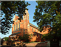
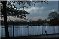
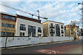
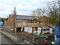
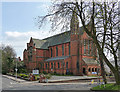
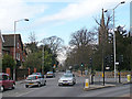
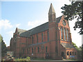
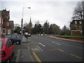
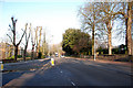
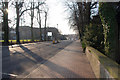
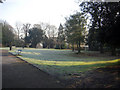
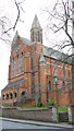
100 photos from this area
Area Information
Key information about the SE25 6DE including its size, population, and administrative classification.
- Area Type
- Postcode
- Area Size
- 6196 m²
- Population
- 1704
- Population Density
- 6132 people/km²
House Prices in SE25 6DE
16
Properties
£314,808
Average Sold Price
£92,000
Lowest Price
£560,000
Highest Price
Showing 16 properties
| Address | Type | Beds | Baths | Last Sale Price | Last Sale Date | |
|---|---|---|---|---|---|---|
| 143 South Norwood Hill, South Norwood, London, SE25 6DE | Terraced | 3 | 1 | £560,000 | Jul 2025 | |
| 145 South Norwood Hill, South Norwood, London, SE25 6DE | Terraced | 3 | 1 | £532,000 | May 2024 | |
| 163 South Norwood Hill, South Norwood, London, SE25 6DE | Terraced | 3 | 1 | £460,000 | Oct 2019 | |
| 165 South Norwood Hill, South Norwood, London, SE25 6DE | Terraced | 3 | 1 | £555,000 | Sep 2019 | |
| 151 South Norwood Hill, South Norwood, London, SE25 6DE | Semi-detached | 3 | - | £410,000 | Oct 2015 | |
| 157 South Norwood Hill, South Norwood, London, SE25 6DE | Semi-detached | 3 | - | £300,000 | Mar 2010 | |
| 167 South Norwood Hill, South Norwood, London, SE25 6DE | Terraced | 3 | 1 | £264,500 | Feb 2010 | |
| 153 South Norwood Hill, South Norwood, London, SE25 6DE | Terraced | - | - | £230,000 | Aug 2009 | |
| 169 South Norwood Hill, South Norwood, London, SE25 6DE | Terraced | - | - | £245,000 | Sep 2003 | |
| 149 South Norwood Hill, South Norwood, London, SE25 6DE | Terraced | - | - | £155,000 | Feb 2000 |
Page 1 of 2
Energy Efficiency in SE25 6DE
Amenities
Schools
| Rank | School | Type | Entry gender | Ages |
|---|
Explore more schools in this area
Go to Schools tabDemographics
Household Size
Family (3-5 people)
most common
Accommodation Type
Houses
most common
Tenure
70
majority
Ethnic Group
White
most common
Religion
N/A
most common
Household Composition
N/A
most common
Age
47
median
Adults (30-64 years)
most common
Household Deprivation
N/A
with no deprivation
NS-SEC
42
in Lower managerial occupations
Explore more demographic insights in this area
Go to Demographics tabPlanning
Planning Constraints
- Flood RiskPremium
- Ramsar Wetland SitesPremium
- Area of Outstanding Natural BeautyPremium
- Protected Nature ReservePremium
- Protected WoodlandPremium