Area Overview for SE24 9DE
Photos of SE24 9DE
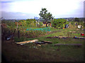
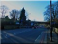
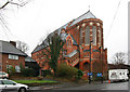
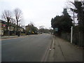
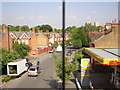
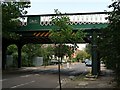
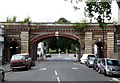

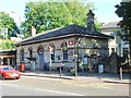
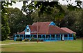
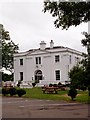
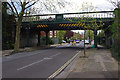
100 photos from this area
Area Information
Key information about the SE24 9DE including its size, population, and administrative classification.
- Area Type
- Postcode
- Area Size
- 8318 m²
- Population
- 1658
- Population Density
- 7990 people/km²
House Prices in SE24 9DE
30
Properties
£632,568
Average Sold Price
£107,750
Lowest Price
£1,340,000
Highest Price
Showing 30 properties
| Address | Type | Beds | Baths | Last Sale Price | Last Sale Date | |
|---|---|---|---|---|---|---|
| 40 Guernsey Grove, London, SE24 9DE | Detached | 3 | 1 | £1,027,000 | May 2023 | |
| 18A Guernsey Grove, London, SE24 9DE | Retail | 3 | - | £675,000 | Aug 2022 | |
| 26 Guernsey Grove, London, SE24 9DE | Terraced | 5 | 2 | £1,340,000 | Jul 2022 | |
| 32 Guernsey Grove, London, SE24 9DE | house | - | - | £1,125,000 | Aug 2021 | |
| 30 Guernsey Grove, London, SE24 9DE | house | - | - | £1,133,500 | Nov 2018 | |
| 24 Guernsey Grove, London, SE24 9DE | house | - | - | £741,000 | Dec 2012 | |
| 12A Guernsey Grove, London, SE24 9DE | Terraced | 3 | 1 | £292,000 | Jun 2007 | |
| 2 Guernsey Grove, London, SE24 9DE | Terraced | 4 | - | £230,000 | Jan 2004 | |
| 16A Guernsey Grove, London, SE24 9DE | Flat | 2 | 1 | £139,995 | Nov 2000 | |
| 6 Guernsey Grove, London, SE24 9DE | Bungalow | 3 | 2 | £147,000 | Jul 1999 |
Page 1 of 3
Energy Efficiency in SE24 9DE
Amenities
Schools
| Rank | School | Type | Entry gender | Ages |
|---|
Explore more schools in this area
Go to Schools tabDemographics
Household Size
Family (3-5 people)
most common
Accommodation Type
Houses
most common
Tenure
11
majority
Ethnic Group
White
most common
Religion
N/A
most common
Household Composition
N/A
most common
Age
47
median
Adults (30-64 years)
most common
Household Deprivation
N/A
with no deprivation
NS-SEC
29
in Lower managerial occupations
Explore more demographic insights in this area
Go to Demographics tabPlanning
Planning Constraints
- Flood RiskPremium
- Ramsar Wetland SitesPremium
- Area of Outstanding Natural BeautyPremium
- Protected Nature ReservePremium
- Protected WoodlandPremium