Area Overview for SE22 9PW
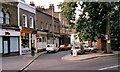
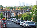
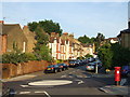
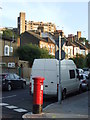
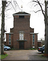
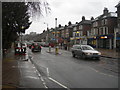
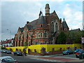
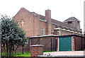
Photos of SE22 9PW


Area Information
This specific postcode cluster represents a highly concentrated residential environment within SE22 9PW. Occupying a small footprint, the area houses exactly 1,936 residents, creating an intimate scale that differs from larger London neighbourhoods. The population density suggests a setting where local streets are familiar and community interactions are likely frequent. Living in SE22 9PW means navigating a defined zone where the immediate surroundings dominate daily experience. The compact nature of the site could appeal to those seeking a contained environment without the sprawl of wider suburban developments. It is a distinct pocket within the broader Dulwich and southeast London network where residents rely on proximity rather than vast distances for their immediate needs. The limited population size often correlates with a sense of enclosure and stability.
- Area Type
- Postcode
- Area Size
- Not available
- Population
- 1936
- Population Density
- 12168 people/km²
SE22 9PW operates as a hybrid market defined by a mix of flats and a majority rate of owner-occupied homes. With fifty-three percent of residents owning their properties, the area possesses a strong element of permanence rarely found in purely rental zones. This ownership level suggests that many households have invested significantly in the value of their homes over time. The predominance of flats indicates that the housing stock is likely vertically oriented, catering to buyers who prefer elevated living or who lack ground-level space. For those seeking homes in SE22 9PW, the market offers a chance to enter a stable environment where residents are more likely to be invested in the neighbourhood long term. You will find less transient activity here than in areas dominated by short-let or student housing. The blend of ownership and flat living creates a specific demand profile for interior space and building amenities rather than extensive gardens.
House Prices in SE22 9PW
No properties found in this postcode.
Energy Efficiency in SE22 9PW
Residents of SE22 9PW benefit from immediate access to a wide range of retail, rail, and leisure options within practical reach. Five supermarkets serve the local population, including Sainsburys London, Co-op Dulwich, and M&S Dulwich, ensuring daily food shopping requires no long journey. Transport networks are extensive with five nearby rail stations, including North Dulwich, West Dulwich, and Forest Hill. The extensive rail network allows you to reach central London without using a car. Five metro stations are also accessible, such as Stockwell and Deptford Bridge, offering alternative rapid transit links. You can also reach three ferry destinations like Masthouse Terrace Pier or Vauxhall St George Wharf Pier, providing rare direct waterfront access. Three bus hubs, including the Green Line Coach Station, supplement road travel. This dense amenity cluster means your daily needs are met locally while transport options remain open if you need to travel further.
Amenities
Schools
Families residing in SE22 9PW have access to St Anthony's Catholic Primary School as their nearest educational facility. The school classification is primary, which serves children from the early years through to the key stage two years. This is the only primary school listed in the immediate vicinity for this postcode. Parents must plan their school runs to this single institution if they choose the local attendance zone. The presence of a Catholic primary school indicates a specific religious educational offering is available close to home. There are no secondary schools listed in the immediate data for this specific cluster. Consequently, older children in homes in SE22 9PW will commute further for secondary education. Prospective buyers should verify catchment boundaries directly with the school before making a purchase, as one primary school serves the entire local demand for early education.
| Rank | School | Type | Entry gender | Ages |
|---|
Explore more schools in this area
Go to Schools tabDemographics
The community profile for SE22 9PW reflects a mature demographic, with a median age of forty-seven years. Adults between thirty and sixty-four years old form the most common age range, indicating a population that has largely settled into family life or career establishment. Home ownership stands at fifty-three percent, suggesting a solid base of owner-occupiers who have made a long-term commitment to the locality. This majority ownership rate often contributes to investment stability and a quieter street atmosphere compared to high-rental zones. The accommodation type is predominantly flats, meaning the built environment consists largely of upper-floor living or purpose-built apartment blocks rather than detached houses. White ethnicity remains the predominant group, shaping the cultural fabric of this specific postcode. These figures paint a picture of a stable, established community where long-term residents form the majority of the social landscape.
Household Size
Accommodation Type
Tenure
Ethnic Group
Religion
Household Composition
Age
Household Deprivation
NS-SEC
Explore more demographic insights in this area
Go to Demographics tabPlanning
Planning Constraints
- Flood RiskPremium
- Ramsar Wetland SitesPremium
- Area of Outstanding Natural BeautyPremium
- Protected Nature ReservePremium
- Protected WoodlandPremium