Area Overview for SE22 9PN
Photos of SE22 9PN
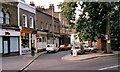
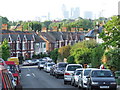
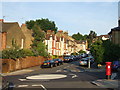
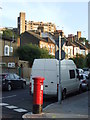

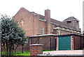
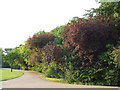
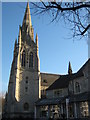
85 photos from this area
Area Information
Key information about the SE22 9PN including its size, population, and administrative classification.
- Area Type
- Postcode
- Area Size
- 5324 m²
- Population
- 1891
- Population Density
- 13565 people/km²
House Prices in SE22 9PN
49
Properties
£725,725
Average Sold Price
£242,000
Lowest Price
£1,079,000
Highest Price
Showing 49 properties
| Address | Type | Beds | Baths | Last Sale Price | Last Sale Date | |
|---|---|---|---|---|---|---|
| 181 Landells Road, London, SE22 9PN | Terraced | 3 | 1 | £965,000 | Nov 2025 | |
| 162 Landells Road, London, SE22 9PN | house | 2 | 1 | £865,000 | Aug 2025 | |
| 187 Landells Road, London, SE22 9PN | Terraced | 3 | 2 | £850,000 | Mar 2025 | |
| 156 Landells Road, London, SE22 9PN | Flat | - | - | £917,800 | Sep 2024 | |
| 166 Landells Road, London, SE22 9PN | Terraced | 3 | 1 | £970,000 | Sep 2024 | |
| 185 Landells Road, London, SE22 9PN | Terraced | 2 | 1 | £1,000,000 | Feb 2024 | |
| 179A Landells Road, London, SE22 9PN | Terraced | 3 | 2 | £1,079,000 | Dec 2023 | |
| 171 Landells Road, London, SE22 9PN | Flat | 3 | 2 | £875,000 | Jun 2023 | |
| 189 Landells Road, London, SE22 9PN | Terraced | 3 | 2 | £723,500 | Jun 2023 | |
| 191 Landells Road, London, SE22 9PN | Terraced | 2 | 1 | £605,000 | Jul 2022 |
Page 1 of 5
Energy Efficiency in SE22 9PN
Amenities
Schools
| Rank | School | Type | Entry gender | Ages |
|---|
Explore more schools in this area
Go to Schools tabDemographics
Household Size
Family (3-5 people)
most common
Accommodation Type
Houses
most common
Tenure
53
majority
Ethnic Group
White
most common
Religion
N/A
most common
Household Composition
N/A
most common
Age
47
median
Adults (30-64 years)
most common
Household Deprivation
N/A
with no deprivation
NS-SEC
58
in Lower managerial occupations
Explore more demographic insights in this area
Go to Demographics tabPlanning
Planning Constraints
- Flood RiskPremium
- Ramsar Wetland SitesPremium
- Area of Outstanding Natural BeautyPremium
- Protected Nature ReservePremium
- Protected WoodlandPremium