Area Overview for SE22 8ZJ
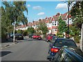
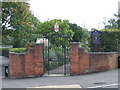
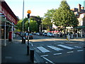
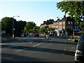
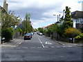
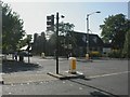
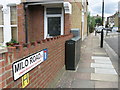
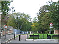
Photos of SE22 8ZJ


Area Information
The postcode SE22 8ZJ represents a specific residential cluster within the broader London landscape, home to a population of 1,527 people. This small geographical area offers a distinct local environment for those seeking homes in this specific reference zone. Daily life here is characterised by a concentration of households rather than sprawling development, creating a contained community feel. You will find that this location is situated close to key transport hubs including North Dulwich and Denmark Hill Station. Proximity to major metro points such as Stockwell and Kennington Station means you have extensive journey options for commuting. The area also benefits from water access through piers like Vauxhall St George Wharf Pier and Millbank Pier, which are within practical reach of residents. Living in SE22 8ZJ provides access to several retail locations including M&S Dulwich and Co-op Dulwich. The layout of flats suggests a vertical urban environment typical of inner London residential clusters. You do not need to travel far for coffee, groceries, or public transport links. The存在感 of nearby facilities like Green Line Coach Station and Victoria Coach Station Arrivals highlights the area's connectivity to the wider city. This postcode covers a small footprint, meaning the feel of the neighbourhood can be intimate despite its proximity to larger metropolitan nodes.
- Area Type
- Postcode
- Area Size
- Not available
- Population
- 1527
- Population Density
- 12158 people/km²
The property market in SE22 8ZJ is defined by a stock composed primarily of flats, with 44% of households owning their property outright or via mortgage. This ownership rate indicates a balanced market where investment and primary residence motives coexist. As a postcode covering a small residential cluster, you will find that housing choices are constrained by the available land, resulting in a high density of flat living. Those looking for detached houses or semi-detached properties in this exact postcode may face limited options compared to outer London areas. The prevalence of flats suggests a building typology suited to urban living, often designed for single professionals, couples, or small families who value low maintenance and central access to amenities. Buyers considering SE22 8ZJ should expect a competitive environment typical of city postcode zones where supply does not meet demand. The 44% ownership figure also hints at a gradual phasing of older blocks or a specific development history that pre-dates the boom in detached housing. If you are renting here, you join a large cohort of residents who value location over square footage. The market dynamics here are driven by proximity to employment centres and transport links rather than garden space or large plots. Understanding the flat-dominated stock is essential when assessing your living requirements for this area.
House Prices in SE22 8ZJ
No properties found in this postcode.
Energy Efficiency in SE22 8ZJ
Your lifestyle in SE22 8ZJ is heavily influenced by the concentration of amenities within practical daily reach. Retail options include M&S Dulwich, Co-op Dulwich, and M&S East Dulwich Supermarket, offering a steady supply of groceries and household essentials. You do not need to drive to find fresh food or household goods five minutes from your door. Transport connectivity is exceptional, with five rail stations close by, including North Dulwich and Denmark Hill Station. Metro access via Stockwell, Oval, and Kennington Station provides rapid access to Central London and surrounding boroughs. Five ferry piers such as Vauxhall St George Wharf Pier and Millbank Pier offer water-based leisure and travel opportunities. Bus connections include the Green Line Coach Station, Victoria Coach Station, and arrivals at London Victoria Coach Station, facilitating long-distance travel for work or holidays. Dining and shopping conveniences are embedded in the local fabric. The presence of these specific venues like Co-op Dulwich ensures you can complete weekly shopping runs efficiently. Transport hubs like North Dulwich Station allow easy commutes to Blandford Road and other local attractions. For weekend trips, the nearby ferry terminals provide a different perspective from the usual tube routes. This dense amenity network means you can dine, shop, and travel without leaving your neighbourhood.
Amenities
Schools
| Rank | School | Type | Entry gender | Ages |
|---|
Explore more schools in this area
Go to Schools tabDemographics
The community in SE22 8ZJ has a median age of 47 years, with the majority of residents falling into the adult age range of 30 to 64 years. This demographic profile indicates an area populated by mature adults rather than young families or recent students. Forty-four per cent of households in this zone own their homes, suggesting a significant proportion of the population has long-term financial stability and a stake in the local property market. The remaining accommodation is split between owners and renters, reflecting a mixed but settled community structure. Flats form the predominant accommodation type, which aligns with the density expected in a small postcode cluster of this size. The resident population is predominantly White, reflecting the historical development patterns of this specific London location. With 1,527 people living here, every individual contributes to the local character and social fabric. You will encounter neighbours who are likely established in the area for many years, fostering a sense of familiarity. The age profile means that local schools tend to serve children from outside this immediate cluster, as the resident demographic consists mainly of working adults. Family life in SE22 8ZJ may involve caring for older children or grandchildren rather than raising school-aged youngsters within the immediate vicinity.
Household Size
Accommodation Type
Tenure
Ethnic Group
Religion
Household Composition
Age
Household Deprivation
NS-SEC
Explore more demographic insights in this area
Go to Demographics tabPlanning
Planning Constraints
- Flood RiskPremium
- Ramsar Wetland SitesPremium
- Area of Outstanding Natural BeautyPremium
- Protected Nature ReservePremium
- Protected WoodlandPremium
- Crime RiskPremium