Area Overview for SE22 8SU
Photos of SE22 8SU


Area Information
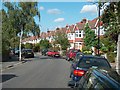
SE22 8SU represents a compact residential cluster covering just 3.7 hectares, yet it hosts a population of 1,674 people. This high population density of 45,821 people per square kilometre indicates a tightly packed living environment typical of specific London postcode zones. The area functions as a defined residential pocket where homes are situated close together. You are entering a space designed for people rather than sprawl, where every square metre serves a domestic purpose. This level of density means daily life involves frequent interaction with neighbours and quick access to surrounding London infrastructure. The neighbourhood feels intense and established rather than sprawling or developing. Living in SE22 8SU offers a clear trade-off. You gain exceptional convenience and proximity to transport hubs at the cost of wider green space within the immediate boundary. The area is characterised by its efficiency and focus on housing availability. It is not a large village or open suburban estate, but a concentrated locality where residents navigate a shared, dense environment. This distinction is vital when deciding if you require more private grounds or a bustling, compact setting for your home.
- Area Type
- Postcode
- Area Size
- 3.7 hectares
- Population
- 1674
- Population Density
- 5943 people/km²
The housing stock in SE22 8SU is characterised by houses, as this is the predominant accommodation type listed for the area. With 70% of homes owner-occupied, the market here reflects a community focused on property ownership rather than renting. This high ownership rate suggests that new buyers entering the market may face significant competition from existing owners looking to move up or down market. The limited land size of 3.7 hectares restricts the volume of new builds, meaning supply relies heavily on existing stock. If you are searching for homes in SE22 8SU, expect to find established properties rather than new developments. The mix of owner-occupied houses indicates a market where investment holds value and residents are financially committed to their properties. This environment is less dynamic regarding rental turnover, which can be positive for your return on investment if you purchase. However, the high density of 45,821 people per square kilometre intensifies demand on this specific housing stock. Consequently, finding a property within this small postcode may require moving quickly or broadening your search to the immediate surrounding streets where similar houses are located.
House Prices in SE22 8SU
Showing 3 properties
| Address | Type | Beds | Baths | Last Sale Price | Last Sale Date | |
|---|---|---|---|---|---|---|
| Top Field, Alleyns School, Townley Road, London, SE22 8SU | Leisure | - | - | - | - | |
| The Cottage, Alleyns School, Townley Road, London, SE22 8SU | Bungalow | - | - | - | - | |
| Townley Lodge, Alleyns School, Townley Road, London, SE22 8SU | Office | - | - | - | - |
Energy Efficiency in SE22 8SU
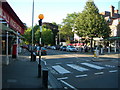
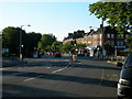
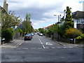
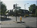
Residents of SE22 8SU enjoy practical access to a wide network of amenities within practical reach. You can access five railway stations, including North Dulwich, Herne Hill Station, and Denmark Hill Station. These rail links provide direct connections to central London and beyond. For shopping needs, five retail locations are available, featuring M&S Dulwich, Co-op Dulwich, and Sainsburys London. These venues ensure your daily grocery and household requirements are met without long commutes. Public transport options extend beyond rail, with five metro stations such as Stockwell Station, Oval, and Kennington Station nearby. Fleet services like Vauxhall St George Wharf Pier, Millbank Pier, and Lambeth Pier offer ferry connections. Additionally, three major bus and coach stations, including the Green Line Coach Station and Victoria Coach Station, serve the wider network. This dense mix of transport modes means you rarely need a car for daily travel. The presence of a supermarket and multiple transit hubs creates a self-sufficient lifestyle where convenience is maximised. Living in SE22 8SU means your essential services are just moments away.
Amenities
Schools
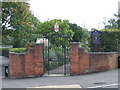
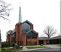
Families considering schools near SE22 8SU will find Alleyn's School as the named independent option in the data. This is the only educational institution specifically identified for this postcode area. The presence of an independent school indicates that the area is well-served by private education, which typically implies a higher fee structure and selective entry requirements. There is no data provided for state-funded schools in the immediate vicinity, so none are listed here. This gap in the dataset suggests that while independent education is available, state primary or secondary schools may be located further away or without specific listings for this micro-neighbourhood. You must research outside this specific list to find state options. The availability of Alleyn's School supports the demographic profile of adults aged 30 to 64 and owner-occupiers who can afford private tuition. However, the exclusive nature of independent schooling in this data means you cannot assume equal access to local state complexes without further verification. When planning education for your children in SE22 8SU, this single independent option is your confirmed starting point.
| Rank | School | Type | Entry gender | Ages |
|---|
Explore more schools in this area
Go to Schools tabDemographics
The community within SE22 8SU is defined by an older, established demographic profile. The median age stands at 47 years, with adults between 30 and 64 years old representing the most common age range. This data confirms an area dominated by established families and professionals rather than students or young singles. You will find a predominantly white population group here, reflecting long-standing settlement patterns typical of the zone. Home ownership is a defining feature of the local lifestyle, with 70% of residents owning their homes outright. This significant majority suggests a stable community with strong local ties and less transient turnover than many other London pockets. Most residents live in houses, which aligns with the high ownership rate and the family-oriented age profile. The combination of a high proportion of house owners and a mature age group creates a settled environment. You are looking at a neighbourhood where long-term residents have likely invested deeply in their immediate surroundings. This demographic stability often translates into lower rental volatility and a community focused on maintaining existing infrastructure rather than rapid development.
Household Size
Accommodation Type
Tenure
Ethnic Group
Religion
Household Composition
Age
Household Deprivation
NS-SEC
Explore more demographic insights in this area
Go to Demographics tabPlanning
Planning Constraints
- Flood RiskPremium
- Ramsar Wetland SitesPremium
- Area of Outstanding Natural BeautyPremium
- Protected Nature ReservePremium
- Protected WoodlandPremium