Area Overview for SE22 0QT
Photos of SE22 0QT
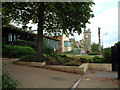
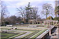
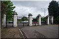
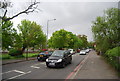
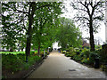
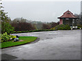
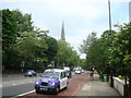
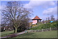
100 photos from this area
Area Information
Key information about the SE22 0QT including its size, population, and administrative classification.
- Area Type
- Postcode
- Area Size
- 1.6 hectares
- Population
- 1880
- Population Density
- 8267 people/km²
House Prices in SE22 0QT
39
Properties
£849,917
Average Sold Price
£155,000
Lowest Price
£2,360,000
Highest Price
Showing 39 properties
| Address | Type | Beds | Baths | Last Sale Price | Last Sale Date | |
|---|---|---|---|---|---|---|
| 60 Underhill Road, London, SE22 0QT | Maisonette | 3 | 1 | £600,000 | Sep 2023 | |
| 44 Underhill Road, London, SE22 0QT | Semi-detached | 5 | 4 | £2,360,000 | Oct 2022 | |
| 32 Underhill Road, London, SE22 0QT | house | 6 | 2 | £1,250,000 | Mar 2022 | |
| 66 Underhill Road, London, SE22 0QT | house | - | - | £1,020,000 | Nov 2020 | |
| 42 Underhill Road, London, SE22 0QT | house | - | - | £1,632,000 | Dec 2019 | |
| 36 Underhill Road, London, SE22 0QT | Flat | - | - | £600,000 | Feb 2017 | |
| 80 Underhill Road, London, SE22 0QT | Semi-detached | 4 | - | £1,100,000 | Jun 2015 | |
| 42A Underhill Road, London, SE22 0QT | house | 5 | 2 | £1,550,000 | May 2014 | |
| 54 Underhill Road, London, SE22 0QT | Semi-detached | 5 | - | £890,000 | Oct 2013 | |
| 56 Underhill Road, London, SE22 0QT | house | 4 | 2 | £995,000 | Sep 2013 |
Page 1 of 4
Energy Efficiency in SE22 0QT
Amenities
Schools
| Rank | School | Type | Entry gender | Ages |
|---|
Explore more schools in this area
Go to Schools tabDemographics
Household Size
One person
most common
Accommodation Type
Flats
most common
Tenure
49
majority
Ethnic Group
White
most common
Religion
N/A
most common
Household Composition
N/A
most common
Age
47
median
Adults (30-64 years)
most common
Household Deprivation
N/A
with no deprivation
NS-SEC
53
in Lower managerial occupations
Explore more demographic insights in this area
Go to Demographics tabPlanning
Planning Constraints
- Flood RiskPremium
- Ramsar Wetland SitesPremium
- Area of Outstanding Natural BeautyPremium
- Protected Nature ReservePremium
- Protected WoodlandPremium