Area Overview for SE22 0BE
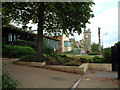
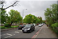
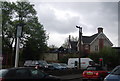
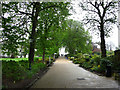
Photos of SE22 0BE


Area Information
Living in SE22 0BE offers a snapshot of residential life within a specific postcode cluster covering 2753 square metres. This small geographical unit houses a population of 1936 people, creating a tightly knit environment where neighbours are often neighbours as well. The area functions as a concentrated residential zone rather than a sprawling suburb, meaning daily commutes and local errands involve short, predictable journeys. You will find that the community character is defined by its density and compact layout, distinguishing it from larger, more dispersed neighbourhoods. The core identity of the area revolves around its residential function, serving as a home base for families and individuals who value proximity to local services. Your daily routine here will likely involve navigating a compact space where every square metre is utilised for housing. This density can foster strong community bonds, though it may also mean less open green space directly within the immediate boundary. If you are considering homes in this postcode, you are looking at a location defined by its specific address and immediate surroundings rather than expansive regional planning zones. The area stands as a distinct pocket of London where the scale of living is determined by the specific limits of this small postcode cluster.
- Area Type
- Postcode
- Area Size
- 2753 m²
- Population
- 1936
- Population Density
- 12168 people/km²
The housing stock in SE22 0BE is characterised primarily by flats, which utilise the limited 2753 square metre area efficiently. Data confirms that 53% of local households own their homes, pointing towards a market with a strong contingent of long-term residents. This ownership rate suggests that a significant portion of the property market consists of owners rather than landlords or investors flipping properties. Because the accommodation type is overwhelmingly flats, you will find freehold or leasehold apartments as the standard offering rather than detached houses or villas. This structure is typical for urban postcode clusters where land is at a premium and vertical construction is the norm. If you are looking to buy or rent, you should expect a market focused on second-floor or ground-floor apartments locally. The presence of a majority of owners often stabilises property values and reduces the noise of constant redevelopment common in purely rental districts. When evaluating homes in SE22 0BE, your focus will be on the specifics of the flat rather than the footprint of a larger house. The market here rewards those who understand the value of a prime location within a high-density living environment.
House Prices in SE22 0BE
Showing 24 properties
| Address | Type | Beds | Baths | Last Sale Price | Last Sale Date | |
|---|---|---|---|---|---|---|
| 255 Friern Road, London, SE22 0BE | Flat | 2 | 1 | £280,000 | Nov 2025 | |
| 283 Friern Road, London, SE22 0BE | Flat | - | - | £349,000 | Aug 2024 | |
| 251 Friern Road, London, SE22 0BE | Flat | - | - | £310,000 | Jun 2021 | |
| 279 Friern Road, London, SE22 0BE | Flat | - | - | £345,000 | Jan 2021 | |
| 267 Friern Road, London, SE22 0BE | Flat | - | - | £355,000 | Nov 2018 | |
| 281 Friern Road, London, SE22 0BE | Flat | - | - | - | - | |
| 261 Friern Road, London, SE22 0BE | Flat | - | - | - | - | |
| 271 Friern Road, London, SE22 0BE | Flat | - | - | - | - | |
| 253 Friern Road, London, SE22 0BE | Flat | - | - | - | - | |
| 247 Friern Road, London, SE22 0BE | Flat | - | - | - | - |
Energy Efficiency in SE22 0BE
Your daily life in SE22 0BE benefits from a wide array of amenities within practical reach. For your grocery needs, shops such as Sainsburys London, Co-op Dulwich, and M&S Dulwich are just a short trip away. You can rely on these specific retailers for your weekly shopping without needing to travel far. Transport links are similarly extensive, with multiple rail stations including North Dulwich, Forest Hill Station, and West Dulwich nearby. For those who prefer the tube, options abound at Elverson Road, Deptford Bridge, and Stockwell Station. If you enjoy sea views or travel by water, ferry piers like Masthouse Terrace Pier, Vauxhall St George Wharf Pier, and Greenland Surrey Quays Pier are accessible for weekend escapes. Bus connections are supported by routes linking to Green Line Coach Station and Victoria Coach Station. This diversity of transport and retail options means you can handle daily tasks efficiently. Living here places you within a short distance of major commercial hubs and cultural attractions, blending the convenience of city living with local residential comforts.
Amenities
Schools
Families residing in SE22 0BE have access to specific educational institutions immediately nearby. The most prominent school for younger children is St Anthony's Catholic Primary School, which is located close to the postcode. This primary institution serves as a key educational resource for residents seeking state or faith-based education for their children in the early years. While there is only one type of school listed in the immediate vicinity, it indicates a concentration of primary-level education within the local cluster. If you are looking at schools near SE22 0BE, St Anthony's Catholic Primary School stands out as the main option directly accessible to this demographic. The absence of secondary schools in the provided list means that older children may need to travel further for further education. However, having a dedicated primary school close by offers convenience for parents within this small residential area. The presence of this specific school name gives you a concrete reference point for your research into education quality and catchment areas for the SE22 0BE postcode.
| Rank | School | Type | Entry gender | Ages |
|---|
Explore more schools in this area
Go to Schools tabDemographics
The community within SE22 0BE reflects a mature demographic profile, with a median age of 47 years. Most residents fall into the adult age range of 30 to 64 years, suggesting a population that is likely further along in their life cycle compared to national averages. You will find that 53% of households in this postcode own their homes, indicating a significant level of stability and long-term settlement among residents. The remaining homeownership rate suggests a balanced mix of owned and rented accommodation. Housing style is dominated by flats, which aligns with the compact area size and high population density of 703,135 people per square kilometre. This high density figure highlights the efficiency of the space usage, typical for central London locations. The predominant ethnic group is White, which defines the current cultural makeup of the residents. When you look at the accommodation types, you see a clear preference for flat living over detached or semi-detached properties, reflecting the urban nature of the postcode. The age profile suggests that families with older children, empty nesters, and retirees form a substantial part of the resident base. Understanding these numbers helps you gauge the neighbourly atmosphere and potential tenant profiles for rentals in the area.
Household Size
Accommodation Type
Tenure
Ethnic Group
Religion
Household Composition
Age
Household Deprivation
NS-SEC
Explore more demographic insights in this area
Go to Demographics tabPlanning
Planning Constraints
- Flood RiskPremium
- Ramsar Wetland SitesPremium
- Area of Outstanding Natural BeautyPremium
- Protected Nature ReservePremium
- Protected WoodlandPremium