Area Overview for SE21 8DN
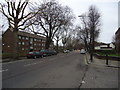
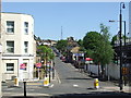
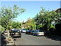
Photos of SE21 8DN


Area Information
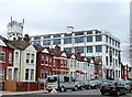
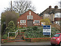
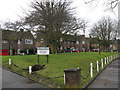
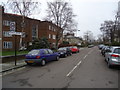
Living in SE21 8DN offers a defined residential experience within the postcodes of South London. This specific location covers a small cluster of homes serving a population of 1,462 people. You can expect a self-contained neighbourhood where daily life revolves around immediate local access rather than distant urban centres. The area functions as a quiet residential pocket, detached from the chaos of major transport hubs while remaining well-connected by road. Homebuyers seeking a settled, community-focused environment will find this postcode delivers exactly that. It is a place where the scale of operations remains manageable, avoiding the density and noise often found in larger boroughs. The character of SE21 8DN is shaped by its modest size and its blend of flats and private dwellings. Residents here enjoy a straightforward existence with clear boundaries between public and private spaces. When you choose this address, you are selecting a spot known for its privacy and low traffic volume. The area maintains a consistent identity regardless of seasonal changes or shifting property trends.
- Area Type
- Postcode
- Area Size
- Not available
- Population
- 1462
- Population Density
- 9587 people/km²
The property market in SE21 8DN is characterised by a strong leaning towards owner-occupation and specific housing formats. With 56 per cent of residents owning their homes, the market functions differently from areas where landlords dominate the rental scene. Flats are the predominant accommodation type, meaning you will encounter a high density of apartment living rather than detached suburbs. This housing stock suits buyers seeking convenience and lower maintenance, particularly given the area's flat-based structure. If you are looking to purchase properties in SEM2 8DN, your options align with this specific architectural profile. The small population of 1,462 suggests limited inventory compared to larger postcodes, which may require focus on engaged buying strategies. Home ownership here is not just a statistic; it reflects a community invested in local development and neighbourliness. When assessing homes in SE21 8DN, you should anticipate a market driven by resident longevity and practical living needs rather than speculative investment.
House Prices in SE21 8DN
No properties found in this postcode.
Energy Efficiency in SE21 8DN
Amenities within practical reach of SE21 8DN provide ample options for shopping and leisure. You have immediate access to five retail outlets, including the notableTesco Dulwich, Cook West, and Tesco West. These supermarkets ensure you can stock up on groceries and essentials without travelling far from postcodes. Transport links are extensive, with five rail stations nearby such as West Dulwich, West Norwood Station, and Tulse Hill Station. Five metro options like Clapham South and Beckenham Road Tram Stop offer additional flexibility for your commute. Furthermore, five ferry services, including Vauxhall St George Wharf Pier and Battersea Power Station Pier, provide water-based transport connections. Three major bus hubs, including Green Line Coach Station and Victoria Coach Station, facilitate regional travel. This variety means you can choose the mode of transport that fits your schedule perfectly. Living in SE21 8DN grants you a lifestyle where essential services and major travel nodes are all within convenient striking distance.
Amenities
Schools
| Rank | School | Type | Entry gender | Ages |
|---|
Explore more schools in this area
Go to Schools tabDemographics
The community within SE21 8DN reflects a mature and established demographic profile. The median age stands at 47 years, indicating that the area attracts families and professionals settled in their careers. Most residents fall into the adult age range of 30 to 64 years, suggesting stability and long-term residency. You will find that 56 per cent of households own their homes, which points to a significant level of equity and commitment to the locality. This high ownership rate contrasts with areas dominated by the private rental sector. Flats form the predominant accommodation type, offering a versatile living solution for couples or small families looking for low-maintenance housing. The area remains demographically homogenous, with White residents forming the predominant ethnic group. This consistency provides a predictable social environment where neighbours know each other. For those prioritising a stable, non-transient community, the data confirms that SE21 8DN caters to people who have put down roots and intend to stay.
Household Size
Accommodation Type
Tenure
Ethnic Group
Religion
Household Composition
Age
Household Deprivation
NS-SEC
Explore more demographic insights in this area
Go to Demographics tabPlanning
Planning Constraints
- Flood RiskPremium
- Ramsar Wetland SitesPremium
- Area of Outstanding Natural BeautyPremium
- Protected Nature ReservePremium
- Protected WoodlandPremium
- Crime RiskPremium