Area Overview for SE21 8AX
Photos of SE21 8AX
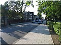
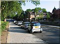
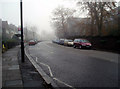
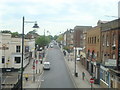
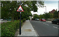

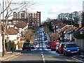
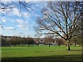
100 photos from this area
Area Information
Key information about the SE21 8AX including its size, population, and administrative classification.
- Area Type
- Postcode
- Area Size
- 8218 m²
- Population
- 1555
- Population Density
- 10367 people/km²
House Prices in SE21 8AX
30
Properties
£807,550
Average Sold Price
£300,000
Lowest Price
£1,220,000
Highest Price
Showing 30 properties
| Address | Type | Beds | Baths | Last Sale Price | Last Sale Date | |
|---|---|---|---|---|---|---|
| 129 South Croxted Road, London, SE21 8AX | Semi-detached | 4 | 2 | £1,150,000 | Aug 2023 | |
| 157 South Croxted Road, London, SE21 8AX | house | - | - | £1,150,000 | Nov 2022 | |
| 113 South Croxted Road, London, SE21 8AX | house | - | - | £800,000 | Jan 2022 | |
| 149 South Croxted Road, London, SE21 8AX | house | - | - | £1,076,000 | May 2021 | |
| 155 South Croxted Road, London, SE21 8AX | house | - | - | £1,025,000 | Mar 2021 | |
| 145 South Croxted Road, London, SE21 8AX | Semi-detached | 6 | 2 | £1,047,000 | May 2019 | |
| 141 South Croxted Road, London, SE21 8AX | Semi-detached | 4 | 1 | £940,000 | Sep 2018 | |
| 133 South Croxted Road, London, SE21 8AX | Terraced | 5 | 3 | £970,000 | Apr 2017 | |
| 131 South Croxted Road, London, SE21 8AX | Semi-detached | 4 | 2 | £1,220,000 | May 2016 | |
| 109 South Croxted Road, London, SE21 8AX | Semi-detached | 4 | - | £932,500 | Jul 2014 |
Page 1 of 3
Energy Efficiency in SE21 8AX
Amenities
Schools
| Rank | School | Type | Entry gender | Ages |
|---|
Explore more schools in this area
Go to Schools tabDemographics
Household Size
Family (3-5 people)
most common
Accommodation Type
Houses
most common
Tenure
53
majority
Ethnic Group
White
most common
Religion
N/A
most common
Household Composition
N/A
most common
Age
47
median
Adults (30-64 years)
most common
Household Deprivation
N/A
with no deprivation
NS-SEC
51
in Lower managerial occupations
Explore more demographic insights in this area
Go to Demographics tabPlanning
Planning Constraints
- Flood RiskPremium
- Ramsar Wetland SitesPremium
- Area of Outstanding Natural BeautyPremium
- Protected Nature ReservePremium
- Protected WoodlandPremium