Area Overview for SE21 7BW
Photos of SE21 7BW


Area Information
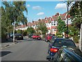
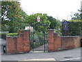
SE21 7BW is a specific postcode covering a small residential cluster with a population of 1,713 people. You are looking at a contained environment rather than a sprawling district, which offers a distinct sense of locality. The area functions as a quiet residential hub where daily life revolves around home and immediate local services. This postcode acts as a strategic stopover for commuters, situated near major transport hubs while maintaining a sheltered domestic feel. Living in SE21 7BW means relying on nearby stations and shops rather than having extensive amenities located within the immediate street. The character here is defined by its density and exclusivity as a small unit of the Greater London property market. You will find that estate agents often package this postcode with surrounding larger areas, yet the specific geography dictates a tighter, more intimate way of living. The location serves as a practical base for households managing work in South London or central business districts. With 73% of residents owning their homes, the community feels stabilised and long-term focused. You should expect a neighbourhood where people have put down roots and invest in their surroundings. The area lacks the anonymity of larger urban sprawls, fostering a more direct interaction between neighbours. There are no parks or green belts listed within the immediate definition of SE21 7BW, so outdoor activities depend on visiting surrounding districts. This postcode represents a specific slice of London housing, ideal for those who prioritise ownership and community stability over expansive urban sprawl.
- Area Type
- Postcode
- Area Size
- Not available
- Population
- 1713
- Population Density
- 2909 people/km²
The property market in SE21 7BW is dominated by owner-occupied homes, with 73% of residents holding their own property titles. Houses make up the primary accommodation type, creating a landscape of detached or semi-detached structures rather than blocks of flats. This distribution suggests that buying into SE21 7BW secures a private dwelling in a low-turnover environment. You will find fewer purpose-built rental schemes compared to areas closer to Vauxhall or Stockwell. The market here reflects the mature preferences of a population centred on adults aged 30 to 64. For a buyer, this postcode indicates a stable asset class where owners have invested significantly in their homes. The volume of only 1,713 residents limits the speed at which properties move, meaning competition is often lower than in high-density hubs like Herne Hill or Dulwich. You should anticipate a market where house prices reflect the value of established tenure rather than speculative development yields. This structure is ideal for cash buyers or those with strong mortgages seeking security over short-term gains. The residential character is defined by the prevalence of private homes, which often attract families or retirees seeking more space than a flat provides. There are minimal new-builds in this specific cluster, as the data points to an established stock. Buyers looking at homes in SE21 7BW are effectively entering a market where the majority of residents are settled owners. This dynamic creates a predictable property value trajectory that aligns with the area's reputation for stability. If you prioritise ownership rights and a traditional house over a rental-style flat, this postcode matches your requirements perfectly.
House Prices in SE21 7BW
No properties found in this postcode.
Energy Efficiency in SE21 7BW
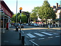
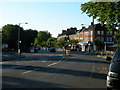
Living in SE21 7BW relies on proximity to a well-distributed network of key amenities within practical reach. Residents can shop at Budgens Dulwich, Sainsburys London, and M&S Dulwich for everyday groceries and household essentials. You do not need to travel far for basic needs, as these retailers sit close to the residential cluster. Travel beyond the postcode expands your options significantly, with five named rail stations, five metro points, and five nearby ferry piers available. North Dulwich, Herne Hill, and West Dulwich offer rail links, while Stockwell, Oval, and Clapham South provide tube access. The area also connects to broader London transport via bus lines to Green Line Coach Station and Victoria Coach Station. Ferries from Vauxhall St George Wharf Pier, Millbank Pier, and Battersea Power Station Pier give you river access to the city. This density of transport options ensures that your commute routes are varied and efficient. You have rail, tube, bus, and water options all within a short journey time. Retail choices ensure you can stock up on supplies without leaving the vicinity of your home. While SE21 7BW itself is a residential cluster, its lifestyle is enhanced by the immediate availability of these services. You can combine a quiet home environment with easy access to comprehensive retail and transport networks. This balance is what makes the area attractive to buyers who value convenience without urban noise. The specific presence of outlets like Budgens and Sainsburys makes your daily routine practical and efficient. Transport links allow you to reach central destinations quickly while enjoying a localized community feel.
Amenities
Schools
| Rank | School | Type | Entry gender | Ages |
|---|
Explore more schools in this area
Go to Schools tabDemographics
The people living in SE21 7BW are generally older than the national average, with a median age of 47 years. You are looking at a community where the most common age range is adults between 30 and 64 years old. This demographic profile indicates an area populated by families, professionals, and established residents rather than students or young singles. The population of 1,713 reflects a established settlement rather than a rapidly changing development site. Home ownership stands high at 73%, a figure that signals financial stability and a strong attachment to the neighbourhood. You can expect houses to be the predominant accommodation type throughout SE21 7BW, fitting the profile of a traditional residential zone. The area contains 1,713 residents who predominantly identify as White, creating a cohesive local cultural identity. These demographics contrast with areas nearer to Dupont or other major university districts where rental populations skew younger. The 73% ownership rate means that tenancy changes are less frequent than in high-rental zones. This stability often translates to better-maintained properties and longer-term neighbourhood improvements. There are few young families with children under five in this specific postcode, as the data centres on the adult population. The community is built around households where adults manage dual incomes or single careers. Living in SE21 7BW fits those seeking a mature environment with established neighbours rather than transient populations. The high ownership rate supports a steady property market where prices reflect local value retention. You are not buying into a development where turnover is rapid; you are entering a settled market where residents have stayed for the long term.
Household Size
Accommodation Type
Tenure
Ethnic Group
Religion
Household Composition
Age
Household Deprivation
NS-SEC
Explore more demographic insights in this area
Go to Demographics tabPlanning
Planning Constraints
- Flood RiskPremium
- Ramsar Wetland SitesPremium
- Area of Outstanding Natural BeautyPremium
- Protected Nature ReservePremium
- Protected WoodlandPremium