Area Overview for SE20 8FJ
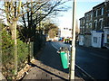
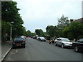
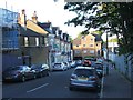
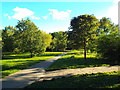
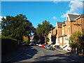
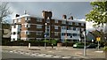
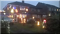
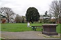
Photos of SE20 8FJ


Area Information
Living in SE20 8FJ offers a distinct experience defined by its compact residential nature. This specific postcode covers a small residential cluster containing just 2761 square metres. Despite the limited physical footprint, the area houses a population of 1335 people. This density results in a population figure that suggests a tightly packed environment. You will find yourself in a setting where neighbours are invariably close by. The scale of the area creates an intimate living situation where quiet streets and shared neighbourhoods characterise daily life. Prospective buyers should appreciate that this is not a sprawling district but a concentrated slice of South London housing. The small size means local services are often within immediate walking distance. Your commute to other London hubs will depend on the surrounding transport links rather than the internal reach of the postcode itself. Understanding these boundaries helps you visualise the footprint of your future home. Living here means embracing a smaller, more contained community environment.
- Area Type
- Postcode
- Area Size
- 2761 m²
- Population
- 1335
- Population Density
- 16241 people/km²
Homes in SE20 8FJ are characterised by a shift towards apartment living. Flats dominate the local housing stock, reflecting the constraints of the small residential cluster. The prevalence of this accommodation type is evident when you consider the area size of 2761 square metres versus the population of 1335. A home ownership rate of 53% suggests a balanced market where nearly half of the properties are let. This split implies a mix of owner-occupied flats and rental units available in the immediate vicinity. Buyers looking at this area should prepare for a landscape of multi-unit developments rather than detached houses. The concentration of flats supports a community life that often revolves around shared corridors and ground-floor access. This market structure provides entry points for those seeking city living without the footprint of a traditional suburban home. Understanding that flats are the rule rather than the exception is crucial for your search strategy. The existing mix of ownership adds a layer of stability to the local property values.
House Prices in SE20 8FJ
Showing 21 properties
Energy Efficiency in SE20 8FJ
Your daily life in SE20 8FJ benefits from proximity to numerous practical amenities. Five notable retail locations sit within your practical reach, including Co-op Anerley, Tesco Crystal, and Tesco Penge. You can easily stock up on groceries or pick up essentials with a short journey. Transport options are extensive, with five railway stations nearby. Anerley Station, Crystal Palace Station, and Penge West Station provide direct rail access to central London. Overground and tram networks further enhance mobility. Harrington Road Tram Stop, Avenue Road Tram Stop, and Beckenham Road Tram Stop offer alternative routes into the city. Additionally, five ferry terminals are accessible, including Masthouse Terrace Pier, Greenwich Pier, and Vauxhall St George Wharf Pier. These waterways connect you to international destinations and provide leisure options. The combination of retail chains, rail lines, and river crossings ensures that daily errands and leisure trips are logistically simple. You have significant choices for travel and shopping without leaving the immediate South London context.
Amenities
Schools
Families considering schools near SE20 8FJ have a specific option in their vicinity. Orchard Lodge is the only other school listed within the practical reach of this postcode. It operates as a standard school rather than a primary or secondary institution specifically categorised in the immediate data. While this limits the number of formal educational choices directly embedded in the 2761 square metre zone, it indicates the presence of educational infrastructure nearby. You will find that the nearest schooling requires families to look slightly beyond the immediate flat streets for the main registration points for young children. This setup is common in small clusters where primary facilities are often located a short walk away. The presence of Orchard Lodge confirms that the area is not entirely devoid of educational services. Parents should plan their routes carefully, as the single listed option may not cover all age groups or specific catchment requirements without further local council validation.
| Rank | School | Type | Entry gender | Ages |
|---|
Explore more schools in this area
Go to Schools tabDemographics
The community in SE20 8FJ is defined by a mature demographic profile. You will primarily encounter Adults aged between 30 and 64 years. This age range represents the most common group residing in the area. The median age stands at 47 years, which skews the tone of the neighbourhood towards established households. Over half of the residents own their homes, with a home ownership level of 53%. This figure indicates a stable residential base where long-term settlement is common. Flats form the predominant accommodation type. This structural choice aligns with the high density found within these 2761 square metres. The area is largely ethnically diverse, though White remains the predominant ethnic group. You should expect a quiet, settled atmosphere typical of this age profile. The mix of homeowners and the lack of single-family homes suggests a reliance on shared facilities within the flat complexes. Daily interactions in this sector of SE20 often reflect the needs of this specific age bracket.
Household Size
Accommodation Type
Tenure
Ethnic Group
Religion
Household Composition
Age
Household Deprivation
NS-SEC
Explore more demographic insights in this area
Go to Demographics tabPlanning
Planning Constraints
- Flood RiskPremium
- Ramsar Wetland SitesPremium
- Area of Outstanding Natural BeautyPremium
- Protected Nature ReservePremium
- Protected WoodlandPremium