Area Overview for SE20 8AN
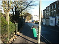
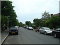
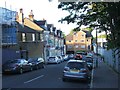
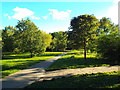
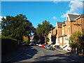
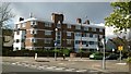
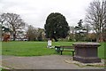
Photos of SE20 8AN


Area Information
Buying a home in SE20 8AN means entering a specific residential cluster defined by tight geographical boundaries. This postcode covers just 554 square metres, indicating a small, concentrated neighbourhood rather than a sprawling district. Despite its compact physical size, the area supports a population of 1,867 residents. Life here revolves around a dense community where neighbours are likely known on a first-name basis due to the limited space. You will find yourself living in an environment designed for convenience, with significant amenities packed into a very small footprint. The high population density suggests a lively street scene where daily activities happen quickly and efficiently. Whether you are walking to a nearby shop or catching a tram, the proximity of services to this small postcode is a defining characteristic of your daily routine. Expect a neighbourhood that prioritises immediate accessibility over expansive green space, creating a distinct urban living experience within the broader London context. Understanding the scale of 554 m² helps buyers appreciate the focused nature of this location, where everything is right on your doorstep.
- Area Type
- Postcode
- Area Size
- 554 m²
- Population
- 1867
- Population Density
- 5974 people/km²
The housing landscape in SE20 8AN is defined by a rental market rather than homeownership. Only 30% of residents own their homes, meaning seven out of every ten people in this postcode are tenants. This statistic is crucial for buyers understanding the local ecosystem, as the prevailing culture revolves around renting rather than long-term ownership. Accommodation types consist mainly of flats, which is typical for postcodes with such high population density and limited square metreage. You will not find many detached or semi-detached houses in a 554 m² area covering this small residential cluster. Instead, the market focuses on blocks of flats suited to urban living. Whether you are purchasing a flat to rent out or aiming to secure a property in this niche market, the data suggests a landscape dominated by investor-backed or let-to-own units. The low ownership percentage indicates that demand likely exceeds supply for quality rental properties. Buyers should view this area as a strategic investment in a high-density, flat-heavy market where the traditional suburban home is absent.
House Prices in SE20 8AN
Showing 11 properties
Energy Efficiency in SE20 8AN
Living in SE20 8AN offers immediate access to a wide variety of amenities despite the tiny footprint of the area. Retail options include Co-op Anerley, Tesco Crystal, and Budgens Penge, all within practical reach for grocery shopping and daily essentials. Transport links are extensive, with five rail stations nearby including Anerley Station, Penge West Station, and Crystal Palace Station. You can also access five metro stops such as Avenue Road Tram Stop and Beckenham Road Tram Stop. Ferry crossings are available from Greenwich Pier, Masthouse Terrace Pier, and Vauxhall St George Wharf Pier, though these are some distance away. The concentration of five retail outlets and five rail stations in the vicinity highlights the convenience of this location. Daily life involves short trips to well-known supermarket chains and major transport hubs. This density of services ensures that you do not need to travel far for goods or public transit. The lifestyle is characterised by convenience, with essentials and travel options located just steps from your front door in this high-density residential zone.
Amenities
Schools
Families considering schools near SE20 8AN have two primary options located within the local cluster. Anerley Primary School is available for younger children, offering education within easy reach of the postcodes. James Dixon Primary School is also a key option, serving the area's primary education needs. Both institutions are of the primary type, catering to children from the early years up to the completion of compulsory education. The data lists James Dixon Primary School twice, indicating it is a significant fixture in this educational landscape. There is no information in the provided data regarding secondary schools, so families must rely on these primary institutions for the earliest years of schooling. The proximity of these schools to the 554 m² postcode means commuters do not face long travel times to get educational services. For parents, having Anerley Primary and James Dixon Primary on offer provides a straightforward local education route. These schools form the backbone of the educational environment for the 1,867 people residing in this specific residential cluster.
| Rank | School | Type | Entry gender | Ages |
|---|
Explore more schools in this area
Go to Schools tabDemographics
The community living in SE20 8AN reflects an older, predominantly English population. The median age stands at 47 years, with the largest group of residents falling within the 30 to 64-year-old bracket. This demographic profile suggests the area is stable, with many established households rather than transient young professionals. Cultural heritage is heavily weighted towards White ethnic groups, meaning you will encounter a community with significant British traditions and customs. When viewing homes in SE20 8AN, you are entering an area defined by this mature demographic structure. Household stability is indicated by housing tenure, where only 30% of residents own their homes. This low ownership rate implies that the majority of the population rents, likely contributing to a dynamic but not owner-occupied neighbourhood character. Accommodation types are primarily flats, which aligns with the high density of the postcode. If you are considering moving to this area, you are buying into a setting where the average resident is middle-aged and the housing stock is largely non-owner occupied. These facts shape the social atmosphere and the likely composition of your immediate neighbours.
Household Size
Accommodation Type
Tenure
Ethnic Group
Religion
Household Composition
Age
Household Deprivation
NS-SEC
Explore more demographic insights in this area
Go to Demographics tabPlanning
Planning Constraints
- Flood RiskPremium
- Ramsar Wetland SitesPremium
- Area of Outstanding Natural BeautyPremium
- Protected Nature ReservePremium
- Protected WoodlandPremium