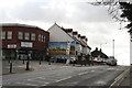
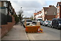
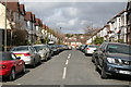
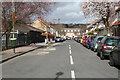
Area Overview for SE20 7TF
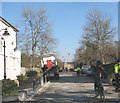
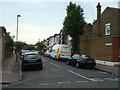
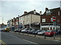
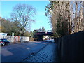
Photos of SE20 7TF
Area Information
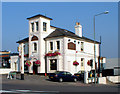
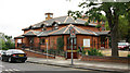
SE20 7TF represents a specific residential cluster within the Penge & Cator ward of the London Borough of Bromley. This small area sits approximately 3.7 miles north east of Bromley town centre, offering proximity to the historic Cator estates. The population stands at 1,665 residents, creating a relatively contained community compared to the wider suburbs. Penge itself began as a hamlet attached to the manor of Battersea before becoming an independent urban district in 1900. The neighbourhood is defined by Victorian expansion that made it a fashionable suburb near the Crystal Palace. You will find landmarks such as the Crooked Billet, the oldest public house in Penge, dating back to at least 1601. The area also contains historic structures like the Free Watermen and Lightermen's Almshouses on Beckenham Road. Thomas Crapper, the plumber who developed the U-bend, retired to an address in this vicinity around Thornsett Road. For those seeking homes in SE20 7TF, the location offers a mix of historical depth and modern accessibility. The postcode covers a tight-knit group of dwellings that benefit from established transport links and local heritage without the sprawl of larger developments. Living here means being part of a community with deep roots, from the 1839 arrival of the London and Croydon Railway to the wartime resilience against damage like that suffered by the pub in WWII.
- Area Type
- Postcode
- Area Size
- Not available
- Population
- 1665
- Population Density
- 7213 people/km²
Housing in SE20 7TF revolves around flats and a predominantly rental market. With home ownership standing at only 39%, the area functions largely as a rental hub rather than an owner-occupied enclave. This statistic indicates that over three-quarters of residents do not own their dwellings. You will find a concentration of flats which aligns with the Victorian-era development of Penge and its status as a fashionable suburb. This housing stock offers the convenience of living in a smaller footprint within a dense urban cluster. For buyers looking at homes in SE20 7TF, the landscape is defined by multiple occupancy and tenancy. The high proportion of renters means the market may be competitive for purchasers seeking to break into the area. Conversely, the stability of the tenant base can support consistent rental yields for investors. The accommodation type is explicitly listed as flats, distinguishing it from surrounding areas with more single-family homes. If you prefer the lifestyle of a shared building with proximity to neighbours and local amenities, this profile fits well. However, those seeking a garden or separate house may need to look immediately neighbouring or slightly further out. The 39% ownership figure provides a clear indicator of the market's orientation towardsAccessibility and rental demand over long-term family ownership.
House Prices in SE20 7TF
Showing 1 properties
| Address | Type | Beds | Baths | Last Sale Price | Last Sale Date | |
|---|---|---|---|---|---|---|
| Ancaster, 61 Croydon Road, Penge, London, SE20 7TF | retail_financial | - | - | - | - |
Energy Efficiency in SE20 7TF
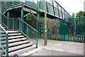
Daily life in SE20 7TF is supported by a practical network of retail and transport hubs. Retail choices include Budgens Penge, Sainsburys Penge, and Aldi Anerley, giving you quick access to groceries and essentials. You do not need to travel far to restock or shop. Transport options further enhance your ability to stroll or commute. Five metro stops and five rail stations are noted within easy reach, including stations at Kent House and Anerley. Beyond shops and transport, the lifestyle includes access to four ferry terminals such as Greenwich Pier, which offers leisure travel on the Thames. The area is built around the convenience of having these five categories of amenities practically within reach. The Crooked Billet pub serves as a historic landmark for social gatherings, dating back to 1601. Historic almshouses like the Free Watermen and Lightermen's Almshouses add character to the streetscape on Beckenham Road. For residents, this means a low-stress routine where shops, transit, and leisure are walking distance. You can combine a morning train ride with a grocery run at Budgens on the same circuit of your day. This density of services defines the neighbourhood's efficient and congenial pace, making it viable for busy professionals and families alike.
Amenities
Schools
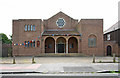
Families considering living in SE20 7TF should note the availability of primary education nearby. The area lists two specific primary institutions that serve the immediate locality. These are St Anthony's Roman Catholic Primary School and St Anthony's Catholic Primary School. Both schools are designated as primary institutions within the data provided for the postcode. The availability of these options means families have immediate access to state-funded education without needing to travel far into central Bromley or beyond. The presence of two schools with similar names suggests a strong provision of Roman Catholic education in the vicinity. When researching schools near SE20 7TF, you will find these two names associated with the cluster. While the data does not provide specific Ofsted ratings or enrolment figures, the existence of named schools confirms educational infrastructure. For residents, this proximity simplifies daily commutes for parents dropping off or collecting children. The dual presence of St Anthony's schools indicates a catered need for religious education alongside secular instruction. Parents in the area benefit from this local network which supports the demographic of working adults and families in the 30 to 64 age range.
| Rank | School | Type | Entry gender | Ages |
|---|
Explore more schools in this area
Go to Schools tabDemographics
The community in SE20 7TF is characterised by a distinct age profile and household composition. The median age of residents is 47 years, with adults aged between 30 and 64 years forming the most common age range. This demographic skew suggests an area suited to established families and professionals rather than young students or retirees. Home ownership stands at 39%, indicating that a majority of residents likely rent their properties or live with family. You are more likely to encounter flats than detached houses or terraced homes. The predominant ethnic group is White, though this does not preclude a diverse range of cultural influences within the 1,665 residents who call the postcode home. Data shows a high concentration of flats, whichaligns with the suburb's Victorian heritage and urban density. This profile contrasts with areas where single-family detached homes dominate. The older median age often correlates with higher stability in the street but may mean less presence of young children in some sections. When buying or renting in SE20 7TF, expect to engage with a demographic that appreciates the convenience of flat living and established neighbourhood routines. The 39% ownership rate suggests a significant market opportunity for landlords or investors alongside the bonds of tenancy.
Household Size
Accommodation Type
Tenure
Ethnic Group
Religion
Household Composition
Age
Household Deprivation
NS-SEC
Explore more demographic insights in this area
Go to Demographics tabPlanning
Planning Constraints
- Flood RiskPremium
- Ramsar Wetland SitesPremium
- Area of Outstanding Natural BeautyPremium
- Protected Nature ReservePremium
- Protected WoodlandPremium