Area Overview for SE20 7HQ
Photos of SE20 7HQ
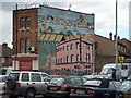
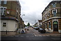
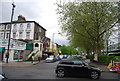
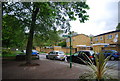
100 photos from this area
Area Information
Key information about the SE20 7HQ including its size, population, and administrative classification.
- Area Type
- Postcode
- Area Size
- 1.0 hectares
- Population
- 1715
- Population Density
- 10432 people/km²
House Prices in SE20 7HQ
25
Properties
£263,450
Average Sold Price
£43,000
Lowest Price
£450,000
Highest Price
Showing 25 properties
| Address | Type | Beds | Baths | Last Sale Price | Last Sale Date | |
|---|---|---|---|---|---|---|
| 2 Parkside Close, Penge, London, SE20 7HQ | house | 2 | - | £425,000 | May 2021 | |
| 7 Parkside Close, Penge, London, SE20 7HQ | Terraced | 2 | 1 | £388,000 | Dec 2020 | |
| 16 Parkside Close, Penge, London, SE20 7HQ | Terraced | 2 | 1 | £425,000 | Dec 2020 | |
| 6 Parkside Close, Penge, London, SE20 7HQ | house | 2 | - | £205,000 | Nov 2019 | |
| 19 Parkside Close, Penge, London, SE20 7HQ | Semi-detached | 2 | 1 | £410,000 | Mar 2019 | |
| 10 Parkside Close, Penge, London, SE20 7HQ | house | 2 | 1 | £410,000 | Jun 2018 | |
| 25 Parkside Close, Penge, London, SE20 7HQ | Flat | - | - | £300,000 | Feb 2018 | |
| 14 Parkside Close, Penge, London, SE20 7HQ | house | 3 | 2 | £450,000 | Sep 2017 | |
| 15 Parkside Close, Penge, London, SE20 7HQ | house | 2 | 1 | £336,000 | Mar 2014 | |
| 13 Parkside Close, Penge, London, SE20 7HQ | Terraced | 2 | - | £105,000 | Jan 2011 |
Page 1 of 3
Energy Efficiency in SE20 7HQ
Amenities
Schools
| Rank | School | Type | Entry gender | Ages |
|---|
Explore more schools in this area
Go to Schools tabDemographics
Household Size
One person
most common
Accommodation Type
Flats
most common
Tenure
28
majority
Ethnic Group
White
most common
Religion
N/A
most common
Household Composition
N/A
most common
Age
47
median
Adults (30-64 years)
most common
Household Deprivation
N/A
with no deprivation
NS-SEC
36
in Lower managerial occupations
Explore more demographic insights in this area
Go to Demographics tabPlanning
Planning Constraints
- Flood RiskPremium
- Ramsar Wetland SitesPremium
- Area of Outstanding Natural BeautyPremium
- Protected Nature ReservePremium
- Protected WoodlandPremium