Area Overview for SE2 9LU
Photos of SE2 9LU
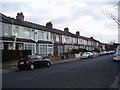
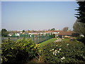
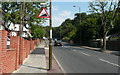
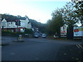
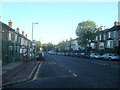
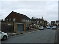
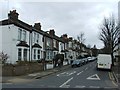
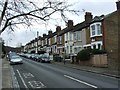
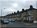
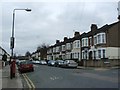
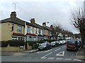
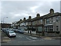
63 photos from this area
Area Information
Key information about the SE2 9LU including its size, population, and administrative classification.
- Area Type
- Postcode
- Area Size
- 8194 m²
- Population
- 1734
- Population Density
- 6865 people/km²
House Prices in SE2 9LU
28
Properties
£235,808
Average Sold Price
£79,500
Lowest Price
£421,500
Highest Price
Showing 28 properties
| Address | Type | Beds | Baths | Last Sale Price | Last Sale Date | |
|---|---|---|---|---|---|---|
| 85 Mottisfont Road, Abbey Wood, SE2 9LU | Terraced | 3 | 1 | £421,500 | Dec 2022 | |
| 89 Mottisfont Road, Abbey Wood, SE2 9LU | Retail | 3 | 1 | £380,000 | Mar 2022 | |
| 133 Mottisfont Road, Abbey Wood, SE2 9LU | Flat | - | - | £184,000 | Mar 2021 | |
| 125 Mottisfont Road, Abbey Wood, SE2 9LU | house | - | - | £350,000 | Nov 2020 | |
| 123 Mottisfont Road, Abbey Wood, SE2 9LU | house | 3 | - | £305,000 | Mar 2020 | |
| 87 Mottisfont Road, Abbey Wood, SE2 9LU | Terraced | 3 | 1 | £320,000 | Dec 2019 | |
| 111 Mottisfont Road, Abbey Wood, SE2 9LU | house | 3 | - | £257,000 | Jun 2015 | |
| 113 Mottisfont Road, Abbey Wood, SE2 9LU | Terraced | 3 | - | £170,000 | Sep 2012 | |
| 97 Mottisfont Road, Abbey Wood, SE2 9LU | Flat | 2 | 1 | £144,000 | Nov 2007 | |
| 101 Mottisfont Road, Abbey Wood, SE2 9LU | Semi-detached | - | - | £165,000 | Feb 2005 |
Page 1 of 3
Energy Efficiency in SE2 9LU
Amenities
Schools
| Rank | School | Type | Entry gender | Ages |
|---|
Explore more schools in this area
Go to Schools tabDemographics
Household Size
Family (3-5 people)
most common
Accommodation Type
Houses
most common
Tenure
37
majority
Ethnic Group
White
most common
Religion
N/A
most common
Household Composition
N/A
most common
Age
47
median
Adults (30-64 years)
most common
Household Deprivation
N/A
with no deprivation
NS-SEC
21
in Lower managerial occupations
Explore more demographic insights in this area
Go to Demographics tabPlanning
Planning Constraints
- Flood RiskPremium
- Ramsar Wetland SitesPremium
- Area of Outstanding Natural BeautyPremium
- Protected Nature ReservePremium
- Protected WoodlandPremium