Area Overview for SE2 9HJ
Photos of SE2 9HJ
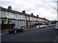
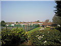
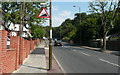
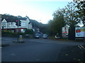
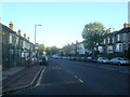
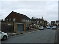
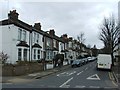
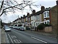
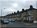
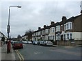
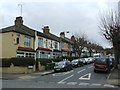
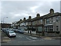
63 photos from this area
Area Information
Key information about the SE2 9HJ including its size, population, and administrative classification.
- Area Type
- Postcode
- Area Size
- 1.1 hectares
- Population
- 2195
- Population Density
- 10243 people/km²
House Prices in SE2 9HJ
34
Properties
£256,501
Average Sold Price
£60,518
Lowest Price
£527,000
Highest Price
Showing 34 properties
| Address | Type | Beds | Baths | Last Sale Price | Last Sale Date | |
|---|---|---|---|---|---|---|
| 62 Blithdale Road, Abbey Wood, SE2 9HJ | Terraced | 4 | 2 | £527,000 | Mar 2025 | |
| 56 Blithdale Road, Abbey Wood, SE2 9HJ | house | - | - | £460,000 | Jun 2023 | |
| 18 Blithdale Road, Abbey Wood, SE2 9HJ | Semi-detached | 2 | 1 | £450,000 | Nov 2022 | |
| 52 Blithdale Road, Abbey Wood, SE2 9HJ | Retail | 2 | 1 | £415,000 | Nov 2022 | |
| 24 Blithdale Road, Abbey Wood, SE2 9HJ | Semi-detached | 3 | 1 | £425,000 | Feb 2022 | |
| 68 Blithdale Road, Abbey Wood, SE2 9HJ | house | - | - | £240,000 | Mar 2020 | |
| 38 Blithdale Road, Abbey Wood, SE2 9HJ | Semi-detached | 3 | 1 | £392,000 | Apr 2018 | |
| 26 Blithdale Road, Abbey Wood, SE2 9HJ | house | 3 | - | £198,000 | Nov 2012 | |
| 54 Blithdale Road, Abbey Wood, SE2 9HJ | house | 2 | 1 | £187,500 | Sep 2011 | |
| 34 Blithdale Road, Abbey Wood, SE2 9HJ | Semi-detached | - | - | £190,000 | Jan 2008 |
Page 1 of 4
Energy Efficiency in SE2 9HJ
Amenities
Schools
| Rank | School | Type | Entry gender | Ages |
|---|
Explore more schools in this area
Go to Schools tabDemographics
Household Size
Family (3-5 people)
most common
Accommodation Type
Houses
most common
Tenure
48
majority
Ethnic Group
asian_total
most common
Religion
N/A
most common
Household Composition
N/A
most common
Age
47
median
Adults (30-64 years)
most common
Household Deprivation
N/A
with no deprivation
NS-SEC
23
in Lower managerial occupations
Explore more demographic insights in this area
Go to Demographics tabPlanning
Planning Constraints
- Flood RiskPremium
- Ramsar Wetland SitesPremium
- Area of Outstanding Natural BeautyPremium
- Protected Nature ReservePremium
- Protected WoodlandPremium