Area Overview for SE2 0XZ
Photos of SE2 0XZ
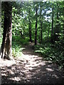
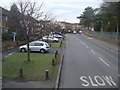
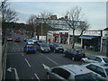
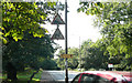
100 photos from this area
Area Information
Key information about the SE2 0XZ including its size, population, and administrative classification.
- Area Type
- Postcode
- Area Size
- 9394 m²
- Population
- 2495
- Population Density
- 4947 people/km²
House Prices in SE2 0XZ
16
Properties
£219,444
Average Sold Price
£70,000
Lowest Price
£443,000
Highest Price
Showing 16 properties
| Address | Type | Beds | Baths | Last Sale Price | Last Sale Date | |
|---|---|---|---|---|---|---|
| 15 Rutherglen Road, Abbey Wood, SE2 0XZ | Detached | 3 | 1 | £443,000 | Jul 2025 | |
| 27 Rutherglen Road, Abbey Wood, SE2 0XZ | Semi-detached | 3 | 2 | £382,000 | Dec 2018 | |
| 23 Rutherglen Road, Abbey Wood, SE2 0XZ | Terraced | 3 | 1 | £190,000 | Feb 2013 | |
| 9 Rutherglen Road, Abbey Wood, SE2 0XZ | house | - | - | £205,000 | Jun 2011 | |
| 31 Rutherglen Road, Abbey Wood, SE2 0XZ | house | - | - | £225,000 | Mar 2010 | |
| 19 Rutherglen Road, Abbey Wood, SE2 0XZ | house | 3 | - | £153,000 | Jan 2010 | |
| 21 Rutherglen Road, Abbey Wood, SE2 0XZ | Terraced | - | - | £195,000 | Oct 2006 | |
| 11 Rutherglen Road, Abbey Wood, SE2 0XZ | Semi-detached | - | - | £112,000 | Sep 2000 | |
| 13 Rutherglen Road, Abbey Wood, SE2 0XZ | Semi-detached | - | - | £70,000 | Feb 2000 | |
| 1 Rutherglen Road, Abbey Wood, SE2 0XZ | Semi-detached | - | - | - | - |
Page 1 of 2
Energy Efficiency in SE2 0XZ
Amenities
Schools
| Rank | School | Type | Entry gender | Ages |
|---|
Explore more schools in this area
Go to Schools tabDemographics
Household Size
Family (3-5 people)
most common
Accommodation Type
Houses
most common
Tenure
38
majority
Ethnic Group
White
most common
Religion
N/A
most common
Household Composition
N/A
most common
Age
47
median
Adults (30-64 years)
most common
Household Deprivation
N/A
with no deprivation
NS-SEC
26
in Lower managerial occupations
Explore more demographic insights in this area
Go to Demographics tabPlanning
Planning Constraints
- Flood RiskPremium
- Ramsar Wetland SitesPremium
- Area of Outstanding Natural BeautyPremium
- Protected Nature ReservePremium
- Protected WoodlandPremium