Area Overview for SE19 3HL
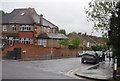
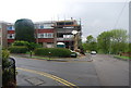
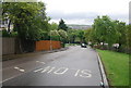
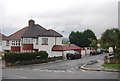
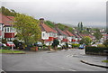
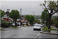
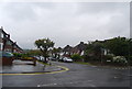
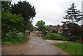
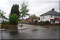
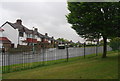
Photos of SE19 3HL


Area Information
SE19 3HL represents a specific residential cluster within the wider fabric of south London. This postcode area covers 3,625 square metres and serves a population of 1,931 residents. The density here is notably high, with 532,717 people per square kilometre across this small footprint. Living in SE19 3HL means residing in a tight-knit environment where properties are closely packed. The area falls under the London Borough of Croydon, aligning with regions such as Norbury Park, though this specific postcode cluster operates as a distinct small-scale dwelling zone. Daily life in this location offers immediate proximity to essential services due to its compact nature. You will find that the close quarters foster a sense of community, even if the specific ward statistics differ from neighbouring areas. The historical context of the region, with links to estates like Norbury Manor and Norbury Hall, provides depth to the character of homes in this postcode. While the immediate geography is small, residents benefit from access to larger green spaces and amenities found just outside this boundary. The area is entirely residential, removing commercial noise from the immediate street life while ensuring you remain close to the bustle of surrounding towns. Understanding the exact boundaries of this postcode helps you visualise the scale of your potential new neighbourhood. It is a straightforward choice for those seeking density without the vastness of the wider borough. The community in SE19 3HL displays clear demographics shaped by its housing stock and location. The median age for residents is 47, indicating a mature population with significant stability. Adults between 30 and 64 years represent the most common age range within the cluster. Home ownership stands at a remarkably high level of 75%, suggesting a neighbourhood where residents have established long-term roots rather than fleeting tenancies. Houses form the primary accommodation type, distinguishing this postcode from areas dominated by flats or apartments. This predominance of house ownership aligns with the settled nature of the demographic. The area is predominantly White, reflecting the established patterns of settlement in parts of south London. With a population of 1,931 residents spread over a small area, the community feels intimate. High ownership rates mean you are likely to live amongst families or couples who have been in their homes for many years. This stability often translates into better-kept properties and a quieter residential atmosphere compared to student-heavy areas. The age profile suggests that if you consider buying a home here, you are entering a market of peers. There are no signs of transient populations, fostering an environment where neighbours know each other. This is a secure demographic landscape ideal for those seeking permanence over rapid change. The housing market in SE19 3HL is defined by its exclusivity to houses and high ownership rates. For 75% of the households in this postcode, the residents are owner-occupiers. This statistic paints a clear picture: this is not a rental-heavy zone nor a destination for young tenants seeking flats. The accommodation type data confirms that houses dominate the landscape, limiting the availability of leasehold properties or apartments within these specific boundaries. When you look at homes in SE19 3HL, you are generally choosing a freehold or leasehold house. This structure often appeals to buyers looking to raise families or those wanting a garden. The low population density relative to the very high overall figures reflects the compact nature of the land, meaning every plot is valuable. You will find that the market here caters to established buyers rather than first-time renters. The high ownership percentage suggests that properties are passed down through generations or sold to buyers with significant clearing power. If you are selling, the demand comes from those who want a house in a secure area rather than investors chasing rental yields on flats. The specific postcode limits the pool of properties, so competition can be keen if the right style of house becomes available. You are essentially buying into a heritage of ownership that has defined the area for decades. Families considering schools near SE19 3HL have a selection of options within close reach of this postcode. St Joseph's College appears prominently in local listings as both a primary institution and an academy with a 'good' Ofsted rating. This dual presence gives students and parents a familiar anchor for their educational journey. Silburn Reid is another notable nearby school, classified as 'other' in local directories, offering alternative educational pathways for the community. The proximity of these institutions means that daily commutes for students are short, integrating education into the local fabric seamlessly. Living in SE19 3HL places you adjacent to a mix of school types, from primary to academy stages. The presence of St Joseph's College as an academy with a 'good' rating provides a reliable educational standard for younger children. While Silburn Reid serves a different segment of the school age population, the variety ensures that different educational philosophies and specialisms are available. You do not need to travel far to secure schooling for your children. The schools listed cater to the specific needs of the local demographic, aligning with the family-oriented nature of the area. This educational accessibility is a core benefit for buyers prioritising school catchment zones. The combination of high-quality academies and local provision reinforces the family-friendly status of the neighbourhood. Digital connectivity for residents of SE19 3HL supports modern working lifestyles effectively. Fixed broadband quality scores 83 out of 100, indicating a very good connection standard for internet-dependent tasks. Mobile coverage scores higher at 85 out of 100, ensuring reliable phone service and mobile data usage throughout the day. This level of connectivity means you can work from home without significant interruption, provided your specific street has standard infrastructure. The strong mobile signal supports daily communication, navigation, and entertainment needs without the frustration of dropped calls. For those relying on video conferencing or cloud storage for their jobs, these scores represent a solid foundation. Living in SE19 3HL grants you access to transport networks beyond just digital links, though the data highlights the virtual connectivity scores primarily. The high broadband score places the area well above the threshold for remote workers requiring standard stability. You can expect fast downloads and smooth streaming for the household. The mobile network reliability ensures that emergencies or urgent matters are handled without connectivity issues. This digital infrastructure is a practical asset for any homebuyer planning to utilise their home for professional purposes. The scores reflect a robust underpinning for the services you require in a modern household. Residents of SE19 3HL enjoy practical access to a wide array of nearby amenities within their daily reach. Retail options include Lidl West, Tesco Streatham, and Co-op Thornton, securing your grocery and shopping needs. Five rail stations, five metro stops, and five ferry piers are listed as accessible connections, including West Norwood Station and Tooting Bec Station. This extensive list suggests that while the postcode is small, it does not suffer from isolation. Victoria Coach Station and Green Line Coach Station are within practical reach, offering long-distance travel links. You can walk to Gipsy Hill Station or the Harrington Road Tram Stop for local commuting. The presence of multiple transport modes means you can choose driving, train, or tram based on your schedule. This connectivity removes the feeling of being stuck in a rural corner despite the postcode size. Leisure and transport hubs like Plantation Wharf Pier and Battersea Power Station Pier are also nearby, adding variety to your sights. The proximity of these five major ferry docks implies good access to river crossings. You do not need to drive far to find a shop, a station, or a pier. The lifestyle here balances the quiet of a house with the convenience of a major urban location. Five bus stations or coach expansions are listed, such as London Victoria Coach Station Arrivals, indicating a transport-rich environment. This blend ensures you maintain your independence while staying connected to the wider city. Safety and environmental assessments for SE19 3HL present a reassuring picture for prospective residents. The flood risk level is marked as 'pass' with a score of 0, indicating low flood risk coverage. This means you are not living in a zone prone to water accumulation during heavy rains. Ramsar wetland sites, Areas of Outstanding Natural Beauty, and protected nature reserves or woodlands are all absent from this specific area, as indicated by 'pass' scores of 0. This lack of protected land constraints means there are fewer limitations on development or planning changes in the immediate vicinity. The crime risk level also receives a 'pass' rating. With a safety score of 72 out of 100, the area has below-average crime rates. This lower risk translates directly to a safer neighbourhood for families and individuals alike. The data confirms that you are not living in a high-risk zone for property crime or disturbance. Environmental protections are minimal here, allowing for flexible land use but without the restrictions found in parks or conservation zones. The absence of protected woodlands or reserves suggests a more purely residential construction history. Your peace of mind is backed by these solid assessments. You can move forward knowing the environmental and safety parameters are favorable. The low crime score and environmental freedom make this a low-stress location to call home. Who typically lives in SE19 3HL and what does the community feel like? The community is mature and settled, with a median age of 47. Adults aged 30 to 64 make up the largest group, and 75% of residents own their homes. The predominant ethnic group is White. Houses are the main accommodation type, creating a neighbourhood focused on long-term residency rather than short-term tenancies. What schools are near SE19 3HL? Families have access to St Joseph's College, which operates as both a primary school and an academy with a 'good' Ofsted rating. Silburn Reid is another key nearby institution listed as 'other'. These schools serve the local population of 1,931 residents, ensuring education is within easy reach. How good are the transport and internet links in this area? Digital connectivity is strong, with fixed broadband scoring 83/100 and mobile coverage scoring 85/100. Residents have access to five rail stations, five metro stops, and five ferry piers nearby. West Norwood Station and Tooting Bec Station are specific examples of the transport options accessible to you. Is SE19 3HL a safe place to live? Yes, the area has low crime risk with a safety score of 72/100, indicating below-average crime rates. Environmental protections are non-existent, meaning no flood risks or planning constraints from nature reserves or woodlands limit development. The flood risk score is 0, confirming a safe environment.
- Area Type
- Postcode
- Area Size
- 3625 m²
- Population
- 1931
- Population Density
- 3228 people/km²
The housing market in SE19 3HL is defined by its exclusivity to houses and high ownership rates. For 75% of the households in this postcode, the residents are owner-occupiers. This statistic paints a clear picture: this is not a rental-heavy zone nor a destination for young tenants seeking flats. The accommodation type data confirms that houses dominate the landscape, limiting the availability of leasehold properties or apartments within these specific boundaries. When you look at homes in SE19 3HL, you are generally choosing a freehold or leasehold house. This structure often appeals to buyers looking to raise families or those wanting a garden. The low population density relative to the very high overall figures reflects the compact nature of the land, meaning every plot is valuable. You will find that the market here caters to established buyers rather than first-time renters. The high ownership percentage suggests that properties are passed down through generations or sold to buyers with significant clearing power. If you are selling, the demand comes from those who want a house in a secure area rather than investors chasing rental yields on flats. The specific postcode limits the pool of properties, so competition can be keen if the right style of house becomes available. You are essentially buying into a heritage of ownership that has defined the area for decades. Families considering schools near SE19 3HL have a selection of options within close reach of this postcode. St Joseph's College appears prominently in local listings as both a primary institution and an academy with a 'good' Ofsted rating. This dual presence gives students and parents a familiar anchor for their educational journey. Silburn Reid is another notable nearby school, classified as 'other' in local directories, offering alternative educational pathways for the community. The proximity of these institutions means that daily commutes for students are short, integrating education into the local fabric seamlessly. Living in SE19 3HL places you adjacent to a mix of school types, from primary to academy stages. The presence of St Joseph's College as an academy with a 'good' rating provides a reliable educational standard for younger children. While Silburn Reid serves a different segment of the school age population, the variety ensures that different educational philosophies and specialisms are available. You do not need to travel far to secure schooling for your children. The schools listed cater to the specific needs of the local demographic, aligning with the family-oriented nature of the area. This educational accessibility is a core benefit for buyers prioritising school catchment zones. The combination of high-quality academies and local provision reinforces the family-friendly status of the neighbourhood. Digital connectivity for residents of SE19 3HL supports modern working lifestyles effectively. Fixed broadband quality scores 83 out of 100, indicating a very good connection standard for internet-dependent tasks. Mobile coverage scores higher at 85 out of 100, ensuring reliable phone service and mobile data usage throughout the day. This level of connectivity means you can work from home without significant interruption, provided your specific street has standard infrastructure. The strong mobile signal supports daily communication, navigation, and entertainment needs without the frustration of dropped calls. For those relying on video conferencing or cloud storage for their jobs, these scores represent a solid foundation. Living in SE19 3HL grants you access to transport networks beyond just digital links, though the data highlights the virtual connectivity scores primarily. The high broadband score places the area well above the threshold for remote workers requiring standard stability. You can expect fast downloads and smooth streaming for the household. The mobile network reliability ensures that emergencies or urgent matters are handled without connectivity issues. This digital infrastructure is a practical asset for any homebuyer planning to utilise their home for professional purposes. The scores reflect a robust underpinning for the services you require in a modern household. Residents of SE19 3HL enjoy practical access to a wide array of nearby amenities within their daily reach. Retail options include Lidl West, Tesco Streatham, and Co-op Thornton, securing your grocery and shopping needs. Five rail stations, five metro stops, and five ferry piers are listed as accessible connections, including West Norwood Station and Tooting Bec Station. This extensive list suggests that while the postcode is small, it does not suffer from isolation. Victoria Coach Station and Green Line Coach Station are within practical reach, offering long-distance travel links. You can walk to Gipsy Hill Station or the Harrington Road Tram Stop for local commuting. The presence of multiple transport modes means you can choose driving, train, or tram based on your schedule. This connectivity removes the feeling of being stuck in a rural corner despite the postcode size. Leisure and transport hubs like Plantation Wharf Pier and Battersea Power Station Pier are also nearby, adding variety to your sights. The proximity of these five major ferry docks implies good access to river crossings. You do not need to drive far to find a shop, a station, or a pier. The lifestyle here balances the quiet of a house with the convenience of a major urban location. Five bus stations or coach expansions are listed, such as London Victoria Coach Station Arrivals, indicating a transport-rich environment. This blend ensures you maintain your independence while staying connected to the wider city. Safety and environmental assessments for SE19 3HL present a reassuring picture for prospective residents. The flood risk level is marked as 'pass' with a score of 0, indicating low flood risk coverage. This means you are not living in a zone prone to water accumulation during heavy rains. Ramsar wetland sites, Areas of Outstanding Natural Beauty, and protected nature reserves or woodlands are all absent from this specific area, as indicated by 'pass' scores of 0. This lack of protected land constraints means there are fewer limitations on development or planning changes in the immediate vicinity. The crime risk level also receives a 'pass' rating. With a safety score of 72 out of 100, the area has below-average crime rates. This lower risk translates directly to a safer neighbourhood for families and individuals alike. The data confirms that you are not living in a high-risk zone for property crime or disturbance. Environmental protections are minimal here, allowing for flexible land use but without the restrictions found in parks or conservation zones. The absence of protected woodlands or reserves suggests a more purely residential construction history. Your peace of mind is backed by these solid assessments. You can move forward knowing the environmental and safety parameters are favorable. The low crime score and environmental freedom make this a low-stress location to call home. Who typically lives in SE19 3HL and what does the community feel like? The community is mature and settled, with a median age of 47. Adults aged 30 to 64 make up the largest group, and 75% of residents own their homes. The predominant ethnic group is White. Houses are the main accommodation type, creating a neighbourhood focused on long-term residency rather than short-term tenancies. What schools are near SE19 3HL? Families have access to St Joseph's College, which operates as both a primary school and an academy with a 'good' Ofsted rating. Silburn Reid is another key nearby institution listed as 'other'. These schools serve the local population of 1,931 residents, ensuring education is within easy reach. How good are the transport and internet links in this area? Digital connectivity is strong, with fixed broadband scoring 83/100 and mobile coverage scoring 85/100. Residents have access to five rail stations, five metro stops, and five ferry piers nearby. West Norwood Station and Tooting Bec Station are specific examples of the transport options accessible to you. Is SE19 3HL a safe place to live? Yes, the area has low crime risk with a safety score of 72/100, indicating below-average crime rates. Environmental protections are non-existent, meaning no flood risks or planning constraints from nature reserves or woodlands limit development. The flood risk score is 0, confirming a safe environment.
House Prices in SE19 3HL
No properties found in this postcode.
Energy Efficiency in SE19 3HL
Residents of SE19 3HL enjoy practical access to a wide array of nearby amenities within their daily reach. Retail options include Lidl West, Tesco Streatham, and Co-op Thornton, securing your grocery and shopping needs. Five rail stations, five metro stops, and five ferry piers are listed as accessible connections, including West Norwood Station and Tooting Bec Station. This extensive list suggests that while the postcode is small, it does not suffer from isolation. Victoria Coach Station and Green Line Coach Station are within practical reach, offering long-distance travel links. You can walk to Gipsy Hill Station or the Harrington Road Tram Stop for local commuting. The presence of multiple transport modes means you can choose driving, train, or tram based on your schedule. This connectivity removes the feeling of being stuck in a rural corner despite the postcode size. Leisure and transport hubs like Plantation Wharf Pier and Battersea Power Station Pier are also nearby, adding variety to your sights. The proximity of these five major ferry docks implies good access to river crossings. You do not need to drive far to find a shop, a station, or a pier. The lifestyle here balances the quiet of a house with the convenience of a major urban location. Five bus stations or coach expansions are listed, such as London Victoria Coach Station Arrivals, indicating a transport-rich environment. This blend ensures you maintain your independence while staying connected to the wider city. Safety and environmental assessments for SE19 3HL present a reassuring picture for prospective residents. The flood risk level is marked as 'pass' with a score of 0, indicating low flood risk coverage. This means you are not living in a zone prone to water accumulation during heavy rains. Ramsar wetland sites, Areas of Outstanding Natural Beauty, and protected nature reserves or woodlands are all absent from this specific area, as indicated by 'pass' scores of 0. This lack of protected land constraints means there are fewer limitations on development or planning changes in the immediate vicinity. The crime risk level also receives a 'pass' rating. With a safety score of 72 out of 100, the area has below-average crime rates. This lower risk translates directly to a safer neighbourhood for families and individuals alike. The data confirms that you are not living in a high-risk zone for property crime or disturbance. Environmental protections are minimal here, allowing for flexible land use but without the restrictions found in parks or conservation zones. The absence of protected woodlands or reserves suggests a more purely residential construction history. Your peace of mind is backed by these solid assessments. You can move forward knowing the environmental and safety parameters are favorable. The low crime score and environmental freedom make this a low-stress location to call home. Who typically lives in SE19 3HL and what does the community feel like? The community is mature and settled, with a median age of 47. Adults aged 30 to 64 make up the largest group, and 75% of residents own their homes. The predominant ethnic group is White. Houses are the main accommodation type, creating a neighbourhood focused on long-term residency rather than short-term tenancies. What schools are near SE19 3HL? Families have access to St Joseph's College, which operates as both a primary school and an academy with a 'good' Ofsted rating. Silburn Reid is another key nearby institution listed as 'other'. These schools serve the local population of 1,931 residents, ensuring education is within easy reach. How good are the transport and internet links in this area? Digital connectivity is strong, with fixed broadband scoring 83/100 and mobile coverage scoring 85/100. Residents have access to five rail stations, five metro stops, and five ferry piers nearby. West Norwood Station and Tooting Bec Station are specific examples of the transport options accessible to you. Is SE19 3HL a safe place to live? Yes, the area has low crime risk with a safety score of 72/100, indicating below-average crime rates. Environmental protections are non-existent, meaning no flood risks or planning constraints from nature reserves or woodlands limit development. The flood risk score is 0, confirming a safe environment.
Amenities
Schools
Families considering schools near SE19 3HL have a selection of options within close reach of this postcode. St Joseph's College appears prominently in local listings as both a primary institution and an academy with a 'good' Ofsted rating. This dual presence gives students and parents a familiar anchor for their educational journey. Silburn Reid is another notable nearby school, classified as 'other' in local directories, offering alternative educational pathways for the community. The proximity of these institutions means that daily commutes for students are short, integrating education into the local fabric seamlessly. Living in SE19 3HL places you adjacent to a mix of school types, from primary to academy stages. The presence of St Joseph's College as an academy with a 'good' rating provides a reliable educational standard for younger children. While Silburn Reid serves a different segment of the school age population, the variety ensures that different educational philosophies and specialisms are available. You do not need to travel far to secure schooling for your children. The schools listed cater to the specific needs of the local demographic, aligning with the family-oriented nature of the area. This educational accessibility is a core benefit for buyers prioritising school catchment zones. The combination of high-quality academies and local provision reinforces the family-friendly status of the neighbourhood. Digital connectivity for residents of SE19 3HL supports modern working lifestyles effectively. Fixed broadband quality scores 83 out of 100, indicating a very good connection standard for internet-dependent tasks. Mobile coverage scores higher at 85 out of 100, ensuring reliable phone service and mobile data usage throughout the day. This level of connectivity means you can work from home without significant interruption, provided your specific street has standard infrastructure. The strong mobile signal supports daily communication, navigation, and entertainment needs without the frustration of dropped calls. For those relying on video conferencing or cloud storage for their jobs, these scores represent a solid foundation. Living in SE19 3HL grants you access to transport networks beyond just digital links, though the data highlights the virtual connectivity scores primarily. The high broadband score places the area well above the threshold for remote workers requiring standard stability. You can expect fast downloads and smooth streaming for the household. The mobile network reliability ensures that emergencies or urgent matters are handled without connectivity issues. This digital infrastructure is a practical asset for any homebuyer planning to utilise their home for professional purposes. The scores reflect a robust underpinning for the services you require in a modern household. Residents of SE19 3HL enjoy practical access to a wide array of nearby amenities within their daily reach. Retail options include Lidl West, Tesco Streatham, and Co-op Thornton, securing your grocery and shopping needs. Five rail stations, five metro stops, and five ferry piers are listed as accessible connections, including West Norwood Station and Tooting Bec Station. This extensive list suggests that while the postcode is small, it does not suffer from isolation. Victoria Coach Station and Green Line Coach Station are within practical reach, offering long-distance travel links. You can walk to Gipsy Hill Station or the Harrington Road Tram Stop for local commuting. The presence of multiple transport modes means you can choose driving, train, or tram based on your schedule. This connectivity removes the feeling of being stuck in a rural corner despite the postcode size. Leisure and transport hubs like Plantation Wharf Pier and Battersea Power Station Pier are also nearby, adding variety to your sights. The proximity of these five major ferry docks implies good access to river crossings. You do not need to drive far to find a shop, a station, or a pier. The lifestyle here balances the quiet of a house with the convenience of a major urban location. Five bus stations or coach expansions are listed, such as London Victoria Coach Station Arrivals, indicating a transport-rich environment. This blend ensures you maintain your independence while staying connected to the wider city. Safety and environmental assessments for SE19 3HL present a reassuring picture for prospective residents. The flood risk level is marked as 'pass' with a score of 0, indicating low flood risk coverage. This means you are not living in a zone prone to water accumulation during heavy rains. Ramsar wetland sites, Areas of Outstanding Natural Beauty, and protected nature reserves or woodlands are all absent from this specific area, as indicated by 'pass' scores of 0. This lack of protected land constraints means there are fewer limitations on development or planning changes in the immediate vicinity. The crime risk level also receives a 'pass' rating. With a safety score of 72 out of 100, the area has below-average crime rates. This lower risk translates directly to a safer neighbourhood for families and individuals alike. The data confirms that you are not living in a high-risk zone for property crime or disturbance. Environmental protections are minimal here, allowing for flexible land use but without the restrictions found in parks or conservation zones. The absence of protected woodlands or reserves suggests a more purely residential construction history. Your peace of mind is backed by these solid assessments. You can move forward knowing the environmental and safety parameters are favorable. The low crime score and environmental freedom make this a low-stress location to call home. Who typically lives in SE19 3HL and what does the community feel like? The community is mature and settled, with a median age of 47. Adults aged 30 to 64 make up the largest group, and 75% of residents own their homes. The predominant ethnic group is White. Houses are the main accommodation type, creating a neighbourhood focused on long-term residency rather than short-term tenancies. What schools are near SE19 3HL? Families have access to St Joseph's College, which operates as both a primary school and an academy with a 'good' Ofsted rating. Silburn Reid is another key nearby institution listed as 'other'. These schools serve the local population of 1,931 residents, ensuring education is within easy reach. How good are the transport and internet links in this area? Digital connectivity is strong, with fixed broadband scoring 83/100 and mobile coverage scoring 85/100. Residents have access to five rail stations, five metro stops, and five ferry piers nearby. West Norwood Station and Tooting Bec Station are specific examples of the transport options accessible to you. Is SE19 3HL a safe place to live? Yes, the area has low crime risk with a safety score of 72/100, indicating below-average crime rates. Environmental protections are non-existent, meaning no flood risks or planning constraints from nature reserves or woodlands limit development. The flood risk score is 0, confirming a safe environment.
| Rank | School | Type | Entry gender | Ages |
|---|
Explore more schools in this area
Go to Schools tabDemographics
The community in SE19 3HL displays clear demographics shaped by its housing stock and location. The median age for residents is 47, indicating a mature population with significant stability. Adults between 30 and 64 years represent the most common age range within the cluster. Home ownership stands at a remarkably high level of 75%, suggesting a neighbourhood where residents have established long-term roots rather than fleeting tenancies. Houses form the primary accommodation type, distinguishing this postcode from areas dominated by flats or apartments. This predominance of house ownership aligns with the settled nature of the demographic. The area is predominantly White, reflecting the established patterns of settlement in parts of south London. With a population of 1,931 residents spread over a small area, the community feels intimate. High ownership rates mean you are likely to live amongst families or couples who have been in their homes for many years. This stability often translates into better-kept properties and a quieter residential atmosphere compared to student-heavy areas. The age profile suggests that if you consider buying a home here, you are entering a market of peers. There are no signs of transient populations, fostering an environment where neighbours know each other. This is a secure demographic landscape ideal for those seeking permanence over rapid change. The housing market in SE19 3HL is defined by its exclusivity to houses and high ownership rates. For 75% of the households in this postcode, the residents are owner-occupiers. This statistic paints a clear picture: this is not a rental-heavy zone nor a destination for young tenants seeking flats. The accommodation type data confirms that houses dominate the landscape, limiting the availability of leasehold properties or apartments within these specific boundaries. When you look at homes in SE19 3HL, you are generally choosing a freehold or leasehold house. This structure often appeals to buyers looking to raise families or those wanting a garden. The low population density relative to the very high overall figures reflects the compact nature of the land, meaning every plot is valuable. You will find that the market here caters to established buyers rather than first-time renters. The high ownership percentage suggests that properties are passed down through generations or sold to buyers with significant clearing power. If you are selling, the demand comes from those who want a house in a secure area rather than investors chasing rental yields on flats. The specific postcode limits the pool of properties, so competition can be keen if the right style of house becomes available. You are essentially buying into a heritage of ownership that has defined the area for decades. Families considering schools near SE19 3HL have a selection of options within close reach of this postcode. St Joseph's College appears prominently in local listings as both a primary institution and an academy with a 'good' Ofsted rating. This dual presence gives students and parents a familiar anchor for their educational journey. Silburn Reid is another notable nearby school, classified as 'other' in local directories, offering alternative educational pathways for the community. The proximity of these institutions means that daily commutes for students are short, integrating education into the local fabric seamlessly. Living in SE19 3HL places you adjacent to a mix of school types, from primary to academy stages. The presence of St Joseph's College as an academy with a 'good' rating provides a reliable educational standard for younger children. While Silburn Reid serves a different segment of the school age population, the variety ensures that different educational philosophies and specialisms are available. You do not need to travel far to secure schooling for your children. The schools listed cater to the specific needs of the local demographic, aligning with the family-oriented nature of the area. This educational accessibility is a core benefit for buyers prioritising school catchment zones. The combination of high-quality academies and local provision reinforces the family-friendly status of the neighbourhood. Digital connectivity for residents of SE19 3HL supports modern working lifestyles effectively. Fixed broadband quality scores 83 out of 100, indicating a very good connection standard for internet-dependent tasks. Mobile coverage scores higher at 85 out of 100, ensuring reliable phone service and mobile data usage throughout the day. This level of connectivity means you can work from home without significant interruption, provided your specific street has standard infrastructure. The strong mobile signal supports daily communication, navigation, and entertainment needs without the frustration of dropped calls. For those relying on video conferencing or cloud storage for their jobs, these scores represent a solid foundation. Living in SE19 3HL grants you access to transport networks beyond just digital links, though the data highlights the virtual connectivity scores primarily. The high broadband score places the area well above the threshold for remote workers requiring standard stability. You can expect fast downloads and smooth streaming for the household. The mobile network reliability ensures that emergencies or urgent matters are handled without connectivity issues. This digital infrastructure is a practical asset for any homebuyer planning to utilise their home for professional purposes. The scores reflect a robust underpinning for the services you require in a modern household. Residents of SE19 3HL enjoy practical access to a wide array of nearby amenities within their daily reach. Retail options include Lidl West, Tesco Streatham, and Co-op Thornton, securing your grocery and shopping needs. Five rail stations, five metro stops, and five ferry piers are listed as accessible connections, including West Norwood Station and Tooting Bec Station. This extensive list suggests that while the postcode is small, it does not suffer from isolation. Victoria Coach Station and Green Line Coach Station are within practical reach, offering long-distance travel links. You can walk to Gipsy Hill Station or the Harrington Road Tram Stop for local commuting. The presence of multiple transport modes means you can choose driving, train, or tram based on your schedule. This connectivity removes the feeling of being stuck in a rural corner despite the postcode size. Leisure and transport hubs like Plantation Wharf Pier and Battersea Power Station Pier are also nearby, adding variety to your sights. The proximity of these five major ferry docks implies good access to river crossings. You do not need to drive far to find a shop, a station, or a pier. The lifestyle here balances the quiet of a house with the convenience of a major urban location. Five bus stations or coach expansions are listed, such as London Victoria Coach Station Arrivals, indicating a transport-rich environment. This blend ensures you maintain your independence while staying connected to the wider city. Safety and environmental assessments for SE19 3HL present a reassuring picture for prospective residents. The flood risk level is marked as 'pass' with a score of 0, indicating low flood risk coverage. This means you are not living in a zone prone to water accumulation during heavy rains. Ramsar wetland sites, Areas of Outstanding Natural Beauty, and protected nature reserves or woodlands are all absent from this specific area, as indicated by 'pass' scores of 0. This lack of protected land constraints means there are fewer limitations on development or planning changes in the immediate vicinity. The crime risk level also receives a 'pass' rating. With a safety score of 72 out of 100, the area has below-average crime rates. This lower risk translates directly to a safer neighbourhood for families and individuals alike. The data confirms that you are not living in a high-risk zone for property crime or disturbance. Environmental protections are minimal here, allowing for flexible land use but without the restrictions found in parks or conservation zones. The absence of protected woodlands or reserves suggests a more purely residential construction history. Your peace of mind is backed by these solid assessments. You can move forward knowing the environmental and safety parameters are favorable. The low crime score and environmental freedom make this a low-stress location to call home. Who typically lives in SE19 3HL and what does the community feel like? The community is mature and settled, with a median age of 47. Adults aged 30 to 64 make up the largest group, and 75% of residents own their homes. The predominant ethnic group is White. Houses are the main accommodation type, creating a neighbourhood focused on long-term residency rather than short-term tenancies. What schools are near SE19 3HL? Families have access to St Joseph's College, which operates as both a primary school and an academy with a 'good' Ofsted rating. Silburn Reid is another key nearby institution listed as 'other'. These schools serve the local population of 1,931 residents, ensuring education is within easy reach. How good are the transport and internet links in this area? Digital connectivity is strong, with fixed broadband scoring 83/100 and mobile coverage scoring 85/100. Residents have access to five rail stations, five metro stops, and five ferry piers nearby. West Norwood Station and Tooting Bec Station are specific examples of the transport options accessible to you. Is SE19 3HL a safe place to live? Yes, the area has low crime risk with a safety score of 72/100, indicating below-average crime rates. Environmental protections are non-existent, meaning no flood risks or planning constraints from nature reserves or woodlands limit development. The flood risk score is 0, confirming a safe environment.
Household Size
Accommodation Type
Tenure
Ethnic Group
Religion
Household Composition
Age
Household Deprivation
NS-SEC
Explore more demographic insights in this area
Go to Demographics tabPlanning
Planning Constraints
- Flood RiskPremium
- Ramsar Wetland SitesPremium
- Area of Outstanding Natural BeautyPremium
- Protected Nature ReservePremium
- Protected WoodlandPremium