Area Overview for SE19 2JH
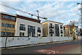
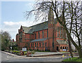
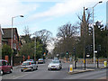
Photos of SE19 2JH


Area Information
The SE19 2JH postcode defines a specific residential cluster covering 8,962 square metres within Greater London. Despite its compact footprint, the area contains a population of 1,514 residents, creating a defined yet intimate community setting. This location sits firmly within the Greater London urban sprawl but avoids the sprawling nature of other outer neighbourhoods. The density here reaches 168,944 people per square kilometre, reflecting a high concentration of housing within a limited geographical boundary. Living in SE19 2JH means residing in a well-defined urban pocket with clear boundaries. The area functions as a contained residential zone where daily life revolves around the immediate surroundings rather than long commutes to distant suburbs. You are close to major transport arteries and local services, yet the area retains a specific identity separate from broader borough trends. This postcode area represents a settled environment where residents benefit from proximity to transport hubs without the anonymity of larger districts. The physical size ensures that the community feels accessible on foot, making it suitable for those seeking a concentration of amenities alongside their home.
- Area Type
- Postcode
- Area Size
- 8962 m²
- Population
- 1514
- Population Density
- 5768 people/km²
The housing stock in SE19 2JH is defined by a flat-based structure, which aligns with the high density of 168,944 people per square kilometre. With 54 per cent of the population owning their homes, the area leans towards owner-occupier status rather than being a purely private rental market. This balance of ownership and tenancy creates a relatively stable environment for both buyers and renters. Because the postcode covers only 8,962 square metres, the housing options are finite and likely consist of existing blocks or iterations rather than speculative new builds. You will find a mix of flats that suit small families, singles, and couples, given the median age of 47 years. This level of home ownership allows residents to modify their living spaces or downsize if their needs change. The accommodation type being flats means buyers should verify floor plans, as square footage is often at a premium in such compact postcodes. The 54 percentage point ownership figure indicates that roughly half of the residents are tenants, suggesting a healthy mix of market rates and rent controls. If you are looking to purchase, the scarcity of properties in such a small area means competition could be fierce for available units. The demographic skew towards adults also implies that few properties will feature child-proofing modifications typical of family-heavy zones.
House Prices in SE19 2JH
No properties found in this postcode.
Energy Efficiency in SE19 2JH
Daily life in SE19 2JH benefits from immediate access to five major retail outlets and five transport hubs. Nearby shoppers can visit Tesco Crystal, Co-op Anerley, or Sainsburys Upper for their weekly groceries, all located within practical reach. Five railway stations lie close by, including Anerley Station and Crystal Palace Station, offering straightforward commutes to central London. The local tram network includes stops at Harrington Road, Avenue Road, and Beckenham Road, providing frequent local links. For river travel, five ferry piers such as Vauxhall St George Wharf Pier and Battersea Power Station Pier are accessible via public transport links. This proximity allows you to combine retail therapy with transit without needing a car. The area functions as a transit corridor linking shopping districts with transport nodes. Residents can grab lunch from alternative local shops before heading to Crystal Palace Station. The concentration of amenities means you spend less time travelling to live. You have the option to walk to these five superstores or take a short tram ride. This lifestyle arrangement suits those who value convenience alongside urban connectivity.
Amenities
Schools
Families living in SE19 2JH have access to Harris City Technology College and Harris City Academy Crystal Palace for their secondary education. Harris City Academy Crystal Palace holds an outstanding Ofsted rating, signalling high educational standards for students in the area. Harris City Technology College operates as a secondary institution, providing comprehensive schooling for teenagers. Phil Edwards Pupil Referral Unit functions as an other type of provider, offering alternative education for children who cannot attend mainstream full-time provision. The presence of an academy with an outstanding rating provides a significant advantage for parents seeking academic excellence near SE19 2JH. Having both a mainstream college and a technology-focused school offers varied educational pathways for your children without requiring long-distance travel. The proximity of these institutions means that schooling is integrated into your daily commute. You do not need to look far for educational options, as the schools are listed as the nearest facilities to this postcode. The mix of school types ensures flexibility if your child's needs change or if they require support through the pupil referral unit. This concentration of educational infrastructure makes the area practical for those prioritising school catchment zones.
| Rank | School | Type | Entry gender | Ages |
|---|
Explore more schools in this area
Go to Schools tabDemographics
The community in SE19 2JH is overwhelmingly composed of adults aged between 30 and 64 years. This age profile indicates a zone settled by working families, empty nesters, or professionals rather than young children seeking their first property. The median age stands at 47 years, reinforcing the picture of an established population. Home ownership is a dominant feature, with 54 per cent of residents owning their homes outright or with a mortgage. This suggests a stable community where long-term settlement is common. The primary accommodation type in this small cluster consists of flats, which is typical for high-density London postcodes. This housing style supports families who require two or more bedrooms within a limited floor space. The predominant ethnic group is White, reflecting the demographic makeup of neighbouring south London areas. Deprivation data is not provided in the current dataset, so financial pressure trends remain unverified for this specific cluster. Nevertheless, the high ownership rate often correlates with financial stability among tenants in similar zones. The age range of 30 to 64 years means fewer children live here compared to inner-city birth rates. The flat-based housing stock caters to households prioritising location over volume.
Household Size
Accommodation Type
Tenure
Ethnic Group
Religion
Household Composition
Age
Household Deprivation
NS-SEC
Explore more demographic insights in this area
Go to Demographics tabPlanning
Planning Constraints
- Flood RiskPremium
- Ramsar Wetland SitesPremium
- Area of Outstanding Natural BeautyPremium
- Protected Nature ReservePremium
- Protected WoodlandPremium