Area Overview for SE19 1HG
Photos of SE19 1HG
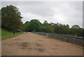
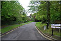
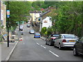
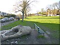
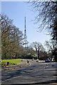
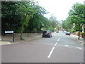
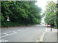
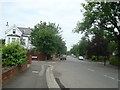
100 photos from this area
Area Information
Key information about the SE19 1HG including its size, population, and administrative classification.
- Area Type
- Postcode
- Area Size
- 7281 m²
- Population
- 1900
- Population Density
- 4149 people/km²
House Prices in SE19 1HG
16
Properties
£668,077
Average Sold Price
£185,000
Lowest Price
£1,380,000
Highest Price
Showing 16 properties
| Address | Type | Beds | Baths | Last Sale Price | Last Sale Date | |
|---|---|---|---|---|---|---|
| 53 Dulwich Wood Avenue, London, SE19 1HG | Detached | 5 | 2 | £725,000 | Feb 2024 | |
| 45 Dulwich Wood Avenue, London, SE19 1HG | Semi-detached | 3 | - | £1,380,000 | Jul 2023 | |
| 29 Dulwich Wood Avenue, London, SE19 1HG | Semi-detached | 3 | 2 | £775,000 | Oct 2020 | |
| 27 Dulwich Wood Avenue, London, SE19 1HG | house | 4 | 2 | £1,200,000 | Apr 2020 | |
| 33 Dulwich Wood Avenue, London, SE19 1HG | Semi-detached | 4 | 1 | £800,000 | Oct 2019 | |
| 47 Dulwich Wood Avenue, London, SE19 1HG | house | 3 | 1 | £760,000 | Jun 2019 | |
| 29A Dulwich Wood Avenue, London, SE19 1HG | Semi-detached | 3 | 1 | £400,000 | Apr 2019 | |
| 55 Dulwich Wood Avenue, London, SE19 1HG | house | - | - | £730,000 | Jan 2015 | |
| 51 Dulwich Wood Avenue, London, SE19 1HG | house | - | - | £730,000 | Oct 2014 | |
| 43 Dulwich Wood Avenue, London, SE19 1HG | house | - | - | £500,000 | Nov 2013 |
Page 1 of 2
Energy Efficiency in SE19 1HG
Amenities
Schools
| Rank | School | Type | Entry gender | Ages |
|---|
Explore more schools in this area
Go to Schools tabDemographics
Household Size
Family (3-5 people)
most common
Accommodation Type
Houses
most common
Tenure
61
majority
Ethnic Group
White
most common
Religion
N/A
most common
Household Composition
N/A
most common
Age
47
median
Adults (30-64 years)
most common
Household Deprivation
N/A
with no deprivation
NS-SEC
50
in Lower managerial occupations
Explore more demographic insights in this area
Go to Demographics tabPlanning
Planning Constraints
- Flood RiskPremium
- Ramsar Wetland SitesPremium
- Area of Outstanding Natural BeautyPremium
- Protected Nature ReservePremium
- Protected WoodlandPremium