Area Overview for SE18 7SU
Photos of SE18 7SU
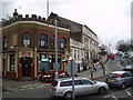
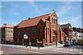
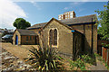
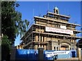
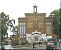


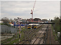
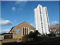
95 photos from this area
Area Information
Key information about the SE18 7SU including its size, population, and administrative classification.
- Area Type
- Postcode
- Area Size
- 1.2 hectares
- Population
- 2043
- Population Density
- 17734 people/km²
House Prices in SE18 7SU
65
Properties
£234,990
Average Sold Price
£11,000
Lowest Price
£485,000
Highest Price
Showing 65 properties
| Address | Type | Beds | Baths | Last Sale Price | Last Sale Date | |
|---|---|---|---|---|---|---|
| 33 Vicarage Park, Plumstead, SE18 7SU | Terraced | 4 | 2 | £485,000 | Jul 2025 | |
| 48 Vicarage Park, Plumstead, SE18 7SU | Terraced | 3 | 2 | £470,000 | Mar 2024 | |
| 39 Vicarage Park, Plumstead, SE18 7SU | Terraced | 4 | 1 | £422,000 | May 2023 | |
| 62 Vicarage Park, Plumstead, SE18 7SU | house | 4 | 1 | £407,680 | Jul 2022 | |
| 46 Vicarage Park, Plumstead, SE18 7SU | house | - | - | £425,000 | Nov 2020 | |
| 40 Vicarage Park, Plumstead, SE18 7SU | Terraced | 3 | 1 | £418,000 | Oct 2019 | |
| 26A Vicarage Park, Plumstead, SE18 7SU | Flat | 2 | 1 | £11,000 | Oct 2019 | |
| 36 Vicarage Park, Plumstead, SE18 7SU | Terraced | 3 | 2 | £390,000 | Jan 2019 | |
| 35 Vicarage Park, Plumstead, SE18 7SU | Terraced | 4 | 1 | £400,000 | Dec 2016 | |
| 42 Vicarage Park, Plumstead, SE18 7SU | house | 2 | - | £328,000 | Aug 2016 |
Page 1 of 7
Energy Efficiency in SE18 7SU
Amenities
Schools
| Rank | School | Type | Entry gender | Ages |
|---|
Explore more schools in this area
Go to Schools tabDemographics
Household Size
Family (3-5 people)
most common
Accommodation Type
Flats
most common
Tenure
22
majority
Ethnic Group
White
most common
Religion
N/A
most common
Household Composition
N/A
most common
Age
47
median
Adults (30-64 years)
most common
Household Deprivation
N/A
with no deprivation
NS-SEC
22
in Lower managerial occupations
Explore more demographic insights in this area
Go to Demographics tabPlanning
Planning Constraints
- Flood RiskPremium
- Ramsar Wetland SitesPremium
- Area of Outstanding Natural BeautyPremium
- Protected Nature ReservePremium
- Protected WoodlandPremium