Area Overview for SE18 6SH
Photos of SE18 6SH


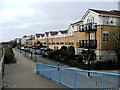
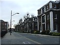
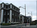
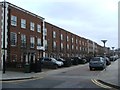
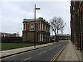


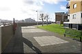
97 photos from this area
Area Information
Key information about the SE18 6SH including its size, population, and administrative classification.
- Area Type
- Postcode
- Area Size
- 1511 m²
- Population
- 1255
- Population Density
- 7977 people/km²
House Prices in SE18 6SH
16
Properties
£221,454
Average Sold Price
£121,500
Lowest Price
£405,000
Highest Price
Showing 16 properties
| Address | Type | Beds | Baths | Last Sale Price | Last Sale Date | |
|---|---|---|---|---|---|---|
| 23 Cornwallis Road, Woolwich, SE18 6SH | Flat | 2 | 1 | £405,000 | Apr 2025 | |
| 25 Cornwallis Road, Woolwich, SE18 6SH | Flat | 2 | 1 | £349,675 | Jul 2020 | |
| 27 Cornwallis Road, Woolwich, SE18 6SH | Flat | - | - | £121,500 | Jan 2019 | |
| 18 Cornwallis Road, Woolwich, SE18 6SH | Flat | - | - | £124,000 | Jun 2018 | |
| 28 Cornwallis Road, Woolwich, SE18 6SH | Flat | - | - | £155,000 | Sep 2015 | |
| 15 Cornwallis Road, Woolwich, SE18 6SH | Flat | 2 | 1 | £210,000 | Apr 2008 | |
| 14 Cornwallis Road, Woolwich, SE18 6SH | Flat | 2 | 1 | £185,000 | Jul 2007 | |
| 13 Cornwallis Road, Woolwich, SE18 6SH | Flat | 2 | 1 | - | - | |
| 20 Cornwallis Road, Woolwich, SE18 6SH | Flat | - | - | - | - | |
| 22 Cornwallis Road, Woolwich, SE18 6SH | Flat | - | - | - | - |
Page 1 of 2
Energy Efficiency in SE18 6SH
Amenities
Schools
| Rank | School | Type | Entry gender | Ages |
|---|
Explore more schools in this area
Go to Schools tabDemographics
Household Size
One person
most common
Accommodation Type
Flats
most common
Tenure
41
majority
Ethnic Group
White
most common
Religion
N/A
most common
Household Composition
N/A
most common
Age
47
median
Adults (30-64 years)
most common
Household Deprivation
N/A
with no deprivation
NS-SEC
49
in Lower managerial occupations
Explore more demographic insights in this area
Go to Demographics tabPlanning
Planning Constraints
- Flood RiskPremium
- Ramsar Wetland SitesPremium
- Area of Outstanding Natural BeautyPremium
- Protected Nature ReservePremium
- Protected WoodlandPremium