Area Overview for SE18 6DF
Photos of SE18 6DF


Area Information
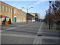
Living in SE18 6DF offers a distinct residential experience within a small cluster centred around the postcode. This specific location houses 1,934 residents, creating a tightly knit community where daily life revolves around immediate practicalities rather than sprawling suburban space. The area functions as a gateway to Woolwich, placing you steps away from major transport hubs and essential services. You will find yourself in a setting defined by high-rise living and efficient connectivity rather than traditional garden suburbs. The character of SE18 6DF is shaped by its density, meaning your neighbours are likely just a street away or living below you. This intensity brings convenience to the forefront of daily living, eliminating the need for long commutes to local amenities. You can walk to supermarkets, ferry piers, and transport stations without waiting for a bus. The area leans heavily towards age-inclusive living, with a significant portion of the population being adults between 30 and 64 years old. While the housing stock is dominated by flats, you gain rapid access to the wider network of Greater London. The postcode serves as a functional base for those who value proximity to waterways and rail links over vast personal gardens. Your days in SE18 6DF are likely defined by efficiency and a focus on the immediate urban environment surrounding your home.
- Area Type
- Postcode
- Area Size
- Not available
- Population
- 1934
- Population Density
- 8205 people/km²
Buying homes in SE18 6DF involves navigating a market heavily skewed towards rental investment and buy-to-let ownership. With only 28% of households classified as home owners, the majority of the property stock consists of privately rented flats. This statistic reveals that the area functions primarily as a high-demand rental zone within South East London. The accommodation type data confirms that flats are the standard housing form here, meaning you will not find detached houses or traditional semi-detached properties with large gardens. If you are considering purchasing, you are looking at a competitive market where prices reflect the convenience and location rather than the presence of outdoor space. The prevalence of rented accommodation suggests that landlords view these flats as assets, often purchasing units specifically to let them out to the working demographic that makes up the 30 to 64 age group. For a buyer, this means supply is finite and demand is driven by commuters and professionals seeking access to Woolwich without needing a car. The lack of traditional family homes means resale value relies heavily on your demand for rental income or your own ability to secure a tenancy. Anyone impressed by the low percentage of owner-occupiers should check current letting yields carefully before making an offer.
House Prices in SE18 6DF
No properties found in this postcode.
Energy Efficiency in SE18 6DF
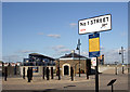
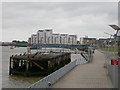
Your daily lifestyle in SE18 6DF is shaped by close proximity to essential retail, leisure, and travel hubs. You will have immediate access to five retail locations, including Lidl Woolwich, Iceland Powis, and Sainsburys Woolwich. These supermarkets ensure you can stock up on groceries without leaving the neighbourhood. Convenience extends to travel, with five ferry terminals nearby offering direct river crossings. Notable ferry points include Woolwich Ferry North Pier, Woolwich Arsenal Pier, and Barrier Gardens Pier. Commuters can easily hop on trains at Woolwich Arsenal Station or Plumstead Station for wider London connectivity. For aviation needs, London City Airport is a short distance away, serving business travellers and those seeking quick UK domestic flights. Your pocket money goes towards simple local purchases or saving for trips driven by the excellent ferry network. The area supports a practical, no-nonsense approach to daily living where shops are a five-minute walk away. You do not need to travel into central Woolwich for basics. This concentration of amenities creates a self-sufficient environment where most errands are completed locally. The variety of transport modes means you are rarely stuck in traffic, as you can often use the river or rail to bypass road congestion entirely.
Amenities
Schools
Families considering living in SE18 6DF have access to a structured range of educational facilities within the immediate neighbourhood. The nearest provision starts with Cyril Henry Nursery School, which caters to the youngest children in the community. For primary education, Mulgrave Infant and Nursery School serves as the local option for younger pupils. Those requiring secondary education or all-through schooling should look towards Saint Mary Magdalene Church of England All Through School, which holds a Good rating from Ofsted. This mix of options ensures that you can send children from nursery age through to secondary levels without needing to travel far from the SE18 6DF postcode. The presence of a highly-rated all-through school is a significant asset for families wishing to avoid frequent address changes. However, the absence of a secondary school listed in the immediate vicinity means older children may eventually need to commute further for their GCSEs. You will need to verify catchment boundaries carefully, as government admissions for Woolwich-area schools can be competitive. The variety in school types allows parents to choose between nursery-focused environments, infant schools for early education, and expansive all-through institutions for their growing offspring.
| Rank | School | Type | Entry gender | Ages |
|---|
Explore more schools in this area
Go to Schools tabDemographics
The community within SE18 6DF is defined by a mature demographic profile. The median age stands at 47 years, indicating that the most common age range for residents falls between 30 and 64 years old. This suggests a neighbourhood populated by working adults and families rather than young students or post-retirees as the primary demographic. Home ownership in this specific postcode is relatively low, with just 28% of households owning their properties outright. The remaining majority reside in rented accommodation, reflecting the nature of the local housing stock. Accommodation types are overwhelmingly flats, which aligns with the high-density building styles common in this corridor of Woolwich. The predominant ethnic group is White, though the area benefits from the demographic diversity typical of South East London. You will find a concentration of professional workers and parents who have opted for flats either due to financial constraints or a preference for low-maintenance urban living. This age distribution means you are less likely to encounter young children playing on the street during peak hours, creating a quieter environment compared to areas with younger populations. The high proportion of renters may imply a more transient feeling for some users, despite the stable age profile of the core residents.
Household Size
Accommodation Type
Tenure
Ethnic Group
Religion
Household Composition
Age
Household Deprivation
NS-SEC
Explore more demographic insights in this area
Go to Demographics tabPlanning
Planning Constraints
- Flood RiskPremium
- Ramsar Wetland SitesPremium
- Area of Outstanding Natural BeautyPremium
- Protected Nature ReservePremium
- Protected WoodlandPremium