Area Overview for SE18 5HB
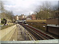
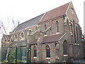
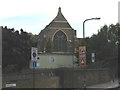
Photos of SE18 5HB


Area Information
SE18 5HB is a small residential cluster in South East London covering an area of 2,992 square metres. The local territory accommodates 1,759 residents within a compact footprint. Living in SE18 5HB means navigating close-quarters accommodation where 587,943 people per square kilometre reside on average in the broader context of this postcode. This specific postcode serves as a defined residential address within a larger metropolitan network. The area functions as a contained living environment where home buyers often look for specific postal clarity rather than broad district identities. Daily life here revolves around immediate proximity to key transport nodes and essential services found nearby. You will find yourself within a framework of dense urban living typical of the postcode system. The location offers a distinct identity based on its precise geographic limits and address registration. Potential buyers interested in SE18 5HB are seeking a specific spatial definition within the wider borough structure. The character of the neighbourhood is shaped by these tight boundaries and the high concentration of residents within a limited square kilometre count. This small scale creates a focused residential environment with direct access to wider amenities immediately surrounding the postcode's perimeter.
- Area Type
- Postcode
- Area Size
- 2992 m²
- Population
- 1759
- Population Density
- 20454 people/km²
The housing stock in SE18 5HB is characterised by a dominance of flats, as indicated by the primary accommodation type data for this postcode. Only 11% of households own their homes, which implies that the majority of residents operate within the private rental sector. You are likely to encounter homes in SE18 5HB that are leasehold properties rather than freehold houses or terraced homes. This market structure means that prospective buyers are often looking at low-stock availability for purchase or considering lease renewal opportunities if they are current residents. The specific postcode SE18 5HB covers a small residential cluster of 2,992 square metres, limiting the variety of property sizes available on the market. The high density means that finding a self-contained living space often requires navigating a competitive rental market rather than a traditional buying ladder. This area lacks the inventory of owner-occupied family homes found in less dense postcodes. The 11% ownership rate signals a community where tenants drive demand for housing availability. When viewing properties near this postcode, expect flats to be the central feature of the inventory. The market dynamics here are defined by proximity to transport and entry-level pricing rather than large family estates.
House Prices in SE18 5HB
Showing 26 properties
| Address | Type | Beds | Baths | Last Sale Price | Last Sale Date | |
|---|---|---|---|---|---|---|
| 26, Carew House, Godfrey Road, Woolwich, SE18 5HB | Flat | 1 | 1 | - | - | |
| 22, Carew House, Godfrey Road, Woolwich, SE18 5HB | Flat | - | - | - | - | |
| 10, Carew House, Godfrey Road, Woolwich, SE18 5HB | Flat | - | - | - | - | |
| 17, Carew House, Godfrey Road, Woolwich, SE18 5HB | Flat | - | - | - | - | |
| 21, Carew House, Godfrey Road, Woolwich, SE18 5HB | Flat | - | - | - | - | |
| 18, Carew House, Godfrey Road, Woolwich, SE18 5HB | Flat | - | - | - | - | |
| 6, Carew House, Godfrey Road, Woolwich, SE18 5HB | Flat | - | - | - | - | |
| 7, Carew House, Godfrey Road, Woolwich, SE18 5HB | Flat | - | - | - | - | |
| 5, Carew House, Godfrey Road, Woolwich, SE18 5HB | Flat | - | - | - | - | |
| 25, Carew House, Godfrey Road, Woolwich, SE18 5HB | Flat | - | - | - | - |
Energy Efficiency in SE18 5HB
Residents of SE18 5HB benefit from immediate access to a wide array of transport and retail options just outside their doorstep. You have five main rail stations nearby, including Woolwich Dockyard, Woolwich Arsenal Station, and Charlton Station, which link you to the rest of the city. For shoppers, you can visit Tesco Frances, Sainsburys Woolwich, and Iceland Powis, all located within practical reach. The area is also a short distance from London City Airport, ensuring quick connections to international destinations. Your daily routine involves easy access to five ferry terminals, such as Barrier Gardens Pier and Woolwich Ferry North Pier, offering alternative river crossings. Additionally, local residents utilise five metro stations like London City Airport, King George V, and Pontoon Dock Station DLR Station for diverse journey planning. Woolwich Arsenal Pier provides further water-side access for both leisure and transport. This concentration of five retail outlets, five rail hubs, and multiple ferry points defines the convenience factor for living in SE18 5HB. You are never far from essential services or leisure opportunities provided by these specific named venues. The lifestyle here is characterised by this dense network of reachable amenities that serve the needs of the 1,759 residents in this small postcode area.
Amenities
Schools
| Rank | School | Type | Entry gender | Ages |
|---|
Explore more schools in this area
Go to Schools tabDemographics
The community in SE18 5HB reflects a defined demographic profile with a median age of 47 years. Researching schools near SE18 5HB or considering the local school catchment is relevant for parents above this age statistic. The most common age range among residents falls between 30 and 64 years, indicating a mature population structure. Home ownership levels in SE18 5HB sit at 11%, meaning the majority of residents live in rented properties. This high rental percentage suggests a dynamic population turnover and a market where leases are more common than freeholds or mortgages. The predominant ethnic group identified for this postcode is Black, contributing to the cultural diversity of the local street scene. You will encounter a community where accommodation types are primarily flats, consistent with the high density of 587,943 people per square kilometre. The low home ownership figure of 11% contrasts sharply with suburban areas, pointing to a distinct lifestyle where renting is the primary path. This demographic data paints a picture of a transient yet established community where long-term ownership is not the standard norm for residents of SE18 5HB. Understanding these figures helps you gauge the typical neighbour and the stability of the local housing stock.
Household Size
Accommodation Type
Tenure
Ethnic Group
Religion
Household Composition
Age
Household Deprivation
NS-SEC
Explore more demographic insights in this area
Go to Demographics tabPlanning
Planning Constraints
- Flood RiskPremium
- Ramsar Wetland SitesPremium
- Area of Outstanding Natural BeautyPremium
- Protected Nature ReservePremium
- Protected WoodlandPremium