Area Overview for SE18 3PS
Photos of SE18 3PS
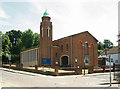

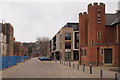

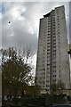
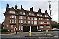
98 photos from this area
Area Information
Key information about the SE18 3PS including its size, population, and administrative classification.
- Area Type
- Postcode
- Area Size
- 9720 m²
- Population
- 1912
- Population Density
- 14856 people/km²
House Prices in SE18 3PS
38
Properties
£394,563
Average Sold Price
£94,000
Lowest Price
£1,550,000
Highest Price
Showing 38 properties
| Address | Type | Beds | Baths | Last Sale Price | Last Sale Date | |
|---|---|---|---|---|---|---|
| 13 Ripon Road, Plumstead, SE18 3PS | Semi-detached | - | - | £1,550,000 | Nov 2017 | |
| 22 Ripon Road, Plumstead, SE18 3PS | house | 3 | - | £315,000 | Oct 2016 | |
| 8 Ripon Road, Plumstead, SE18 3PS | Terraced | 4 | 2 | £325,000 | Nov 2015 | |
| 19 Ripon Road, Plumstead, SE18 3PS | house | - | - | £400,000 | Aug 2015 | |
| 18 Ripon Road, Plumstead, SE18 3PS | Terraced | 3 | 2 | £142,000 | Dec 2010 | |
| 23 Ripon Road, Plumstead, SE18 3PS | Semi-detached | - | - | £192,000 | Aug 2004 | |
| 1 Ripon Road, Plumstead, SE18 3PS | Semi-detached | 1 | 2 | £138,500 | Apr 2002 | |
| 30 Ripon Road, Plumstead, SE18 3PS | Semi-detached | - | - | £94,000 | Dec 2000 | |
| 2 Ripon Road, Plumstead, SE18 3PS | house | 3 | 1 | - | - | |
| 25A Ripon Road, Plumstead, SE18 3PS | Flat | - | - | - | - |
Page 1 of 4
Energy Efficiency in SE18 3PS
Amenities
Schools
| Rank | School | Type | Entry gender | Ages |
|---|
Explore more schools in this area
Go to Schools tabDemographics
Household Size
One person
most common
Accommodation Type
Flats
most common
Tenure
23
majority
Ethnic Group
black_total
most common
Religion
N/A
most common
Household Composition
N/A
most common
Age
47
median
Adults (30-64 years)
most common
Household Deprivation
N/A
with no deprivation
NS-SEC
26
in Lower managerial occupations
Explore more demographic insights in this area
Go to Demographics tabPlanning
Planning Constraints
- Flood RiskPremium
- Ramsar Wetland SitesPremium
- Area of Outstanding Natural BeautyPremium
- Protected Nature ReservePremium
- Protected WoodlandPremium