Area Overview for SE18 3NF
Photos of SE18 3NF
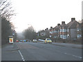
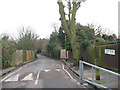
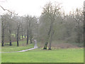
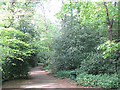


100 photos from this area
Area Information
Key information about the SE18 3NF including its size, population, and administrative classification.
- Area Type
- Postcode
- Area Size
- 7133 m²
- Population
- 1353
- Population Density
- 6352 people/km²
House Prices in SE18 3NF
22
Properties
£261,571
Average Sold Price
£67,000
Lowest Price
£530,000
Highest Price
Showing 22 properties
| Address | Type | Beds | Baths | Last Sale Price | Last Sale Date | |
|---|---|---|---|---|---|---|
| 168 Moordown, Plumstead, SE18 3NF | house | 3 | 1 | £450,000 | May 2024 | |
| 186 Moordown, Plumstead, SE18 3NF | Terraced | 3 | 1 | £510,000 | May 2023 | |
| 166 Moordown, Plumstead, SE18 3NF | Semi-detached | 3 | 1 | £530,000 | Aug 2022 | |
| 170 Moordown, Plumstead, SE18 3NF | Terraced | 3 | 1 | £380,000 | Jul 2018 | |
| 172 Moordown, Plumstead, SE18 3NF | Terraced | 3 | 1 | £325,000 | Feb 2015 | |
| 182 Moordown, Plumstead, SE18 3NF | Terraced | 3 | 1 | £210,500 | Aug 2013 | |
| 162 Moordown, Plumstead, SE18 3NF | Terraced | 3 | 1 | £231,500 | Nov 2011 | |
| 180 Moordown, Plumstead, SE18 3NF | Terraced | 3 | 1 | £231,000 | May 2011 | |
| 150 Moordown, Plumstead, SE18 3NF | Terraced | 5 | 1 | £221,000 | Sep 2009 | |
| 152 Moordown, Plumstead, SE18 3NF | Terraced | 3 | 1 | £247,000 | Jun 2007 |
Page 1 of 3
Energy Efficiency in SE18 3NF
Amenities
Schools
| Rank | School | Type | Entry gender | Ages |
|---|
Explore more schools in this area
Go to Schools tabDemographics
Household Size
Family (3-5 people)
most common
Accommodation Type
Houses
most common
Tenure
69
majority
Ethnic Group
White
most common
Religion
N/A
most common
Household Composition
N/A
most common
Age
47
median
Adults (30-64 years)
most common
Household Deprivation
N/A
with no deprivation
NS-SEC
42
in Lower managerial occupations
Explore more demographic insights in this area
Go to Demographics tabPlanning
Planning Constraints
- Flood RiskPremium
- Ramsar Wetland SitesPremium
- Area of Outstanding Natural BeautyPremium
- Protected Nature ReservePremium
- Protected WoodlandPremium