Area Overview for SE18 1SD
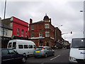
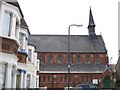
Photos of SE18 1SD


Area Information
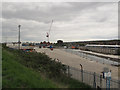
Living in SE18 1SD places you within a specific residential cluster characterised by a population of 2,403 people. This postcode covers a small, tightly knit area in southeast London that forms part of the broader Plumstead neighbourhood. You are located in an environment that balances urban convenience with a sense of local enclosure. The area's small size means that daily life often revolves around熟悉的 local landmarks and a community that knows its residents by name. Daily routines here involve navigating a dense network of transport links that stretch beyond the immediate streets of this cluster. Residents find themselves moments away from five railway stations, multiple ferry piers, and key road junctions like the King George V metro stop. This connectivity transforms the area from an isolated pocket into a central hub for commuting across southeast London. The sheer density of transport options within practical reach defines the rhythm of life for those choosing this location. The character of SE18 1SD is shaped significantly by its housing stock, which dictates the architectural feel of the streets. With flats forming the predominant form of accommodation, the visual identity of the area differs from traditional suburbs with large detached houses. This layout supports a vertical living style while maintaining easy access to amenities found just outside the postcode boundary. You gain a residential experience that is efficient, connected, and distinctly urban without sacrificing proximity to green spaces or local villages.
- Area Type
- Postcode
- Area Size
- Not available
- Population
- 2403
- Population Density
- 13771 people/km²
The property market in SE18 1SD is defined by its heavy reliance on rental living. Only 24% of homes here are owner-occupied, meaning you are likely to encounter a tenant-driven environment if you are browsing listings. This low ownership percentage suggests that the demand for renting in this cluster outstrips the supply of homeowners. For buyers exploring this postcode, the presence of many landlords means a robust private rental sector exists nearby, which could influence future rental yields or resale values. Flats constitute the predominant form of accommodation in SE18 1SD. This architectural choice dictates the scale of the properties available and the layout of the streets. Most homes are likely to be multi-storey dwellings designed to maximise space in a compact postcode area. You will find that these units are built to serve the needs of individuals, couples, or small families who prefer the amenities of city living. The prevalence of flats also means that many entrances are shared, creating a building management dynamic distinct from single-family homes with private garages or large gardens. With a total population of just 2,403, the housing stock is limited, making every property a significant part of the local ecosystem. The mix of tenants and a minority of owners creates a market where acquisition often requires navigating complex leasehold arrangements rather than straightforward freehold transactions. Buyers looking for space may find the footprint of flat living restrictive compared to suburban neighbourhoods. However, the location compensates for this constraint by placing residents at the heart of extensive transport networks.
House Prices in SE18 1SD
No properties found in this postcode.
Energy Efficiency in SE18 1SD
The lifestyle in SE18 1SD is anchored by immediate access to a dense network of retail and transport centres. You have five notable retail options within practical reach, including Iceland Plumstead and Tesco Plumstead. These supermarkets provide daily necessities, fresh groceries, and household essentials without the need for a car journey. The presence of a Co-op Links adds further local banking and shopping convenience to your doorstep. Transport diversity is a defining feature of your daily routine. Five railway stations serve the area, including Woolwich Arsenal Station and Plumstead Station. These hubs offer frequent trains connecting you to central London and Kent. Additionally, five ferry terminals provide water crossings, with Woolwich Arsenal Pier and Woolwich Ferry North Pier being key junctions. These waterways offer not just transport but also scenic routes across the Thames for those wishing to avoid the roads. Your regional connectivity extends to five metro stops, such as Gallicns Reach Station and Cyprus, alongside national expansion at King George V. Five ferry piers broaden your reach, ensuring that river travel is a viable alternative to driving. One airport, London City Airport, sits nearby, making business travel quick and efficient. This layering of rail, water, and road options means that time is never wasted waiting for transport. Living here grants you the freedom to choose your mode of travel based on weather, cost, or convenience.
Amenities
Schools
Families considering schools near SE18 1SD have two primary options, both well-regarded institutions serving the immediate locality. Bannockburn Primary School stands as a key educational facility offering primary education to young residents of this postcode. Its presence ensures that early childhood education is accessible without travelling far from the home. St Patrick's Catholic Primary School operates another primary provision within reach, holding a 'good' Ofsted rating that signals consistent quality in its educational approach. This rating is a crucial consideration for parents evaluating the appropriateness of the local school system. The dual presence of these primary schools means that you are not dependent on a single institution or a long commute to find suitable education for your child. The concentration of primary education suggests that secondary options require a journey beyond the immediate boundaries of SE18 1SD. While this data confirms the availability of strong primary care, it highlights the need for families to plan ahead for secondary schooling in the wider borough. The mix of secular and Catholic provision offers some variety in religious and pedagogical approaches, though both cater to the specific demographic needs of the local population. Living in this area means prioritising proximity to these two established establishments for your child's education.
| Rank | School | Type | Entry gender | Ages |
|---|
Explore more schools in this area
Go to Schools tabDemographics
The community in SE18 1SD reflects a mature demographic profile with a median age of 47 years. You will find that the adult population, aged between 30 and 64 years, forms the largest age group within this postcode. This age distribution suggests a neighbourhood settled by families, professionals, and those seeking stability away from the transient character of younger student areas or hotspots for the very young. Home ownership stands at 24%, indicating that a significant majority of residents live in rented accommodation rather than owning their homes outright. This statistic points to a market where tenancies are common, potentially featuring both private sectors and social housing alongside private rentals. The high proportion of renters shapes the social dynamic, creating a community that is diverse yet potentially less rooted than areas with higher ownership rates. Flats remain the dominant accommodation type, reinforcing the vertical nature of living arrangements throughout the postcode. Ethnic diversity is a defining feature of the area. The Asian population represents the most common ethnic group, contributing to a multicultural atmosphere in a specific London borough. This demographic makeup influences local commerce and social interactions, ensuring that cultural practices and foods are readily accessible within walking distance of every home. Living here means engaging with a community that values cultural exchange alongside the traditional British neighbourhood structure.
Household Size
Accommodation Type
Tenure
Ethnic Group
Religion
Household Composition
Age
Household Deprivation
NS-SEC
Explore more demographic insights in this area
Go to Demographics tabPlanning
Planning Constraints
- Flood RiskPremium
- Ramsar Wetland SitesPremium
- Area of Outstanding Natural BeautyPremium
- Protected Nature ReservePremium
- Protected WoodlandPremium