Area Overview for SE18 1QH
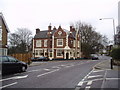
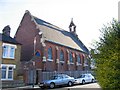
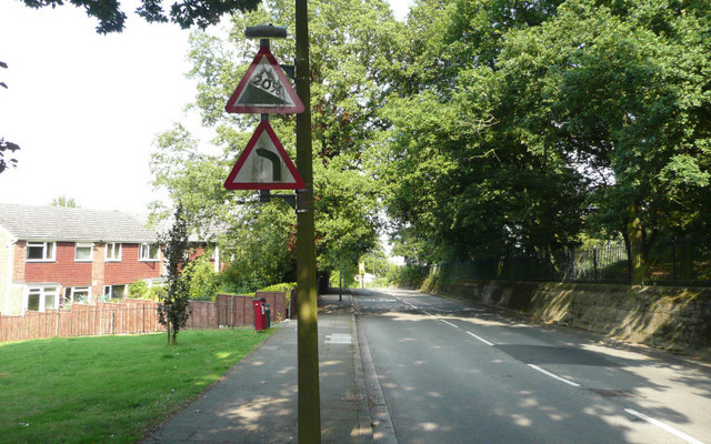
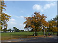
Photos of SE18 1QH


Area Information
Living in SE18 1QH offers a distinct experience defined by its small residential cluster within south-east London. You are part of a community of exactly 1,644 people, creating a neighbourhood that feels intimate yet connected to wider transport hubs. This postcode covers a specific area where daily life balances quiet domesticity with excellent access to London's network. The location is situated near Plumstead and Woolwich, positioning you between riverside developments and established suburban streets. Your daily routine benefits from proximity to several key transport nodes, including Plumstead Station and Woolwich Arsenal Station. You can reach London City Airport with relative ease, making this a practical choice for those who fly frequently or work across the capital. The area avoids significant environmental planning constraints, meaning you do not face restrictions related to flood zones or protected natural landscapes. Instead, the focus remains on standard residential living where you can enjoy a stable home environment without the complexities of conservation areas. For families or individuals seeking a foothold in south-east London, SE18 1QH presents a straightforward option. The population density is low enough to prevent overcrowding while maintaining access to essential services. You will find that the area prioritises safety and utility over dramatic scenery. This practical approach shapes a homebuyer experience centred on reliability and straightforward ownership rather than speculative development or complex planning rules.
- Area Type
- Postcode
- Area Size
- Not available
- Population
- 1644
- Population Density
- 7799 people/km²
The property market in SE18 1QH is characterised by strong owner-occupation, with 55% of households owning their residences. This high percentage suggests a mature market where people have lived in the area for many years and prefer long-term stability over moving frequently. The majority of accommodation types in this postcode are houses, which reflects the historical development of the locality before widespread council housing projects in other sectors. For buyers looking at this small area, the prevalence of house ownership means most transactions involve freehold properties rather than flats or leasehold arrangements common in inner London. This offers greater control over modifications and fewer monthly ground rent considerations. The housing stock density supports a slower-moving market compared to high-rise rental blocks found closer to central business districts. You will encounter estate markets dominated by second-home sales or inherited properties changing hands within the same family line. The combination of a 55% ownership rate and house-dominated stock creates a buyer landscape focused on established values rather than speculative new builds. This area does not cater to young professionals seeking their first flat or investors looking for high-yield rentals. Instead, it serves families and individuals seeking a permanent home with space and privacy. When you search for homes in SE18 1QH, you will find a range of detached and semi-detached properties typical of post-war development. These homes often feature gardens and driveways, providing a step away from the high-density living of central London.
House Prices in SE18 1QH
No properties found in this postcode.
Energy Efficiency in SE18 1QH
Living in SE18 1QH provides convenient access to a range of retail and leisure facilities within your daily reach. You will find five nearby retail outlets, including Co-op Links, Tesco Plumstead, and Tesco Swingate. These supermarkets and convenience stores mean you can complete your weekly grocery shopping without venturing far from home. The presence of multiple Tesco branches indicates a strong food retail infrastructure capable of serving large family baskets or quick essentials. Transport options extend beyond local shops to significant rail hubs like Plumstead Station and Woolwich Arsenal Station. These stations connect you to wider London networks, ensuring you can reach employment centres, leisure venues, and education providers efficiently. You can also utilize ferry services at Woolwich Arsenal Pier and Woolwich Ferry North Pier if train travel proves unreliable. The inclusion of King George V station and Gallions Reach Station offers additional rail choices tailored to different destinations across the capital and Kent. For those interested in aviation, London City Airport lies close by, though mostly serving business travellers. While this amenity may not impact your daily shopping or casual outings, it keeps flights within a short travel time. The mix of rail, ferry, and airport access creates a lifestyle where you can adapt your commute or journey plans based on the specific needs of the day. You are not reliant on a single transport method, which provides security during peak hour congestion or unexpected network failures.
Amenities
Schools
| Rank | School | Type | Entry gender | Ages |
|---|
Explore more schools in this area
Go to Schools tabDemographics
The community in SE18 1QH reflects the broader trends of mid-career Londoners. The median age for residents is 47, indicating that adults aged between 30 and 64 years form the most common demographic group. This suggests a neighbourhood dominated by established households rather than entry-level buyers or students. With almost 55% of residents owning their homes, the area functions primarily as a location for permanent settlement rather than short-term renting. Housing stock is overwhelmingly composed of houses, which aligns with the older demographic profile and higher home ownership rates. The population is predominantly White, mirroring the traditional character of many post-war suburbs in this part of London. You will not find significant diversity statistics to counter this, as current data points to a homogeneous community structure. This demographic stability often translates into a predictable school environment and local support networks familiar with the specific needs of families with children in their teens or adults preparing for retirement. The age profile means you will interact mostly with parents who have settled roots and individuals in their upper middle age. This demographic tends to value stability, noise disturbance minimisation, and good local services. The high level of home ownership indicates that most neighbours have a long-term stake in the property values and street conditions. When considering who lives here, you are looking at a group of people likely to be involved in local governance, school committees, and neighbourhood watch groups due to their settled nature and property investment.
Household Size
Accommodation Type
Tenure
Ethnic Group
Religion
Household Composition
Age
Household Deprivation
NS-SEC
Explore more demographic insights in this area
Go to Demographics tabPlanning
Planning Constraints
- Flood RiskPremium
- Ramsar Wetland SitesPremium
- Area of Outstanding Natural BeautyPremium
- Protected Nature ReservePremium
- Protected WoodlandPremium