Area Overview for SE18 1PD
Photos of SE18 1PD
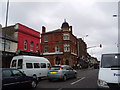
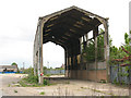
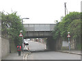
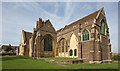
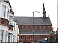
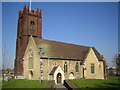
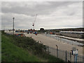
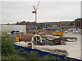
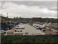
100 photos from this area
Area Information
Key information about the SE18 1PD including its size, population, and administrative classification.
- Area Type
- Postcode
- Area Size
- 1.0 hectares
- Population
- 2163
- Population Density
- 10788 people/km²
House Prices in SE18 1PD
22
Properties
£288,344
Average Sold Price
£48,000
Lowest Price
£425,000
Highest Price
Showing 22 properties
| Address | Type | Beds | Baths | Last Sale Price | Last Sale Date | |
|---|---|---|---|---|---|---|
| 55 Riverdale Road, Plumstead, SE18 1PD | Semi-detached | 2 | 1 | £360,000 | Feb 2024 | |
| 79 Riverdale Road, Plumstead, SE18 1PD | Terraced | 2 | 1 | £425,000 | Sep 2023 | |
| 61 Riverdale Road, Plumstead, SE18 1PD | Retail | 2 | 1 | £335,000 | Feb 2022 | |
| 51A Riverdale Road, Plumstead, SE18 1PD | house | - | - | £347,000 | Jan 2022 | |
| 63 Riverdale Road, Plumstead, SE18 1PD | Terraced | 2 | 1 | £335,000 | Jun 2020 | |
| 77 Riverdale Road, Plumstead, SE18 1PD | Terraced | 2 | 1 | £355,000 | Mar 2020 | |
| 69 Riverdale Road, Plumstead, SE18 1PD | Semi-detached | 3 | 1 | £360,000 | Jul 2018 | |
| 45 Riverdale Road, Plumstead, SE18 1PD | Terraced | 4 | 1 | £370,000 | Jul 2017 | |
| 87 Riverdale Road, Plumstead, SE18 1PD | house | - | - | £345,500 | Dec 2016 | |
| 47 Riverdale Road, Plumstead, SE18 1PD | Terraced | 2 | 1 | £280,000 | Jul 2015 |
Page 1 of 3
Energy Efficiency in SE18 1PD
Amenities
Schools
| Rank | School | Type | Entry gender | Ages |
|---|
Explore more schools in this area
Go to Schools tabDemographics
Household Size
Family (3-5 people)
most common
Accommodation Type
Houses
most common
Tenure
42
majority
Ethnic Group
White
most common
Religion
N/A
most common
Household Composition
N/A
most common
Age
47
median
Adults (30-64 years)
most common
Household Deprivation
N/A
with no deprivation
NS-SEC
21
in Lower managerial occupations
Explore more demographic insights in this area
Go to Demographics tabPlanning
Planning Constraints
- Flood RiskPremium
- Ramsar Wetland SitesPremium
- Area of Outstanding Natural BeautyPremium
- Protected Nature ReservePremium
- Protected WoodlandPremium