Area Overview for SE18 1HL
Photos of SE18 1HL
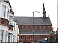
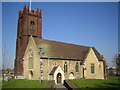
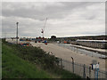
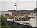
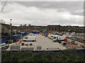
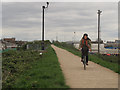
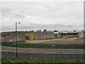
100 photos from this area
Area Information
Key information about the SE18 1HL including its size, population, and administrative classification.
- Area Type
- Postcode
- Area Size
- 6826 m²
- Population
- 2195
- Population Density
- 10243 people/km²
House Prices in SE18 1HL
60
Properties
£255,791
Average Sold Price
£47,950
Lowest Price
£505,000
Highest Price
Showing 60 properties
| Address | Type | Beds | Baths | Last Sale Price | Last Sale Date | |
|---|---|---|---|---|---|---|
| 84 Ceres Road, Plumstead, SE18 1HL | Terraced | 3 | 1 | £505,000 | Jul 2025 | |
| 91 Ceres Road, Plumstead, SE18 1HL | house | - | - | £425,000 | Aug 2024 | |
| 78 Ceres Road, Plumstead, SE18 1HL | Terraced | 3 | 1 | £370,000 | Feb 2024 | |
| 87 Ceres Road, Plumstead, SE18 1HL | house | - | - | £380,000 | Apr 2021 | |
| 103 Ceres Road, Plumstead, SE18 1HL | Terraced | 4 | 1 | £400,000 | Apr 2021 | |
| 89 Ceres Road, Plumstead, SE18 1HL | Terraced | 4 | 3 | £500,000 | Mar 2021 | |
| 82 Ceres Road, Plumstead, SE18 1HL | Terraced | 3 | 1 | £405,000 | Jan 2021 | |
| 80 Ceres Road, Plumstead, SE18 1HL | house | 3 | 1 | £416,000 | Jan 2020 | |
| 76 Ceres Road, Plumstead, SE18 1HL | Terraced | 3 | 1 | £388,000 | Jan 2019 | |
| 72 Ceres Road, Plumstead, SE18 1HL | Terraced | 3 | - | £420,000 | Jul 2017 |
Page 1 of 6
Energy Efficiency in SE18 1HL
Amenities
Schools
| Rank | School | Type | Entry gender | Ages |
|---|
Explore more schools in this area
Go to Schools tabDemographics
Household Size
Family (3-5 people)
most common
Accommodation Type
Houses
most common
Tenure
48
majority
Ethnic Group
asian_total
most common
Religion
N/A
most common
Household Composition
N/A
most common
Age
47
median
Adults (30-64 years)
most common
Household Deprivation
N/A
with no deprivation
NS-SEC
23
in Lower managerial occupations
Explore more demographic insights in this area
Go to Demographics tabPlanning
Planning Constraints
- Flood RiskPremium
- Ramsar Wetland SitesPremium
- Area of Outstanding Natural BeautyPremium
- Protected Nature ReservePremium
- Protected WoodlandPremium