Area Overview for SE18 1DL
Photos of SE18 1DL
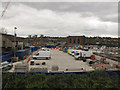
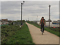
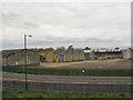
100 photos from this area
Area Information
Key information about the SE18 1DL including its size, population, and administrative classification.
- Area Type
- Postcode
- Area Size
- 3311 m²
- Population
- 1933
- Population Density
- 5367 people/km²
House Prices in SE18 1DL
29
Properties
£212,533
Average Sold Price
£58,000
Lowest Price
£412,000
Highest Price
Showing 29 properties
| Address | Type | Beds | Baths | Last Sale Price | Last Sale Date | |
|---|---|---|---|---|---|---|
| 29 Kentmere Road, Plumstead, SE18 1DL | Terraced | 3 | 2 | £395,000 | Aug 2025 | |
| 15 Kentmere Road, Plumstead, SE18 1DL | Terraced | - | - | £212,500 | Oct 2023 | |
| 13 Kentmere Road, Plumstead, SE18 1DL | house | - | - | £360,000 | Apr 2022 | |
| 5 Kentmere Road, Plumstead, SE18 1DL | house | - | - | £412,000 | Aug 2021 | |
| 37 Kentmere Road, Plumstead, SE18 1DL | Terraced | 3 | - | £342,500 | Sep 2019 | |
| 27 Kentmere Road, Plumstead, SE18 1DL | house | - | - | £350,000 | Feb 2019 | |
| 7 Kentmere Road, Plumstead, SE18 1DL | house | - | - | £159,000 | Aug 2013 | |
| 33 Kentmere Road, Plumstead, SE18 1DL | house | - | - | £185,000 | Nov 2008 | |
| 35 Kentmere Road, Plumstead, SE18 1DL | house | - | - | £170,000 | Jun 2008 | |
| 25 Kentmere Road, Plumstead, SE18 1DL | house | - | - | £165,000 | Aug 2004 |
Page 1 of 3
Energy Efficiency in SE18 1DL
Amenities
Schools
| Rank | School | Type | Entry gender | Ages |
|---|
Explore more schools in this area
Go to Schools tabDemographics
Household Size
Family (3-5 people)
most common
Accommodation Type
Houses
most common
Tenure
35
majority
Ethnic Group
asian_total
most common
Religion
N/A
most common
Household Composition
N/A
most common
Age
47
median
Adults (30-64 years)
most common
Household Deprivation
N/A
with no deprivation
NS-SEC
20
in Lower managerial occupations
Explore more demographic insights in this area
Go to Demographics tabPlanning
Planning Constraints
- Flood RiskPremium
- Ramsar Wetland SitesPremium
- Area of Outstanding Natural BeautyPremium
- Protected Nature ReservePremium
- Protected WoodlandPremium