Area Overview for SE18 1DD
Photos of SE18 1DD
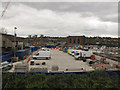
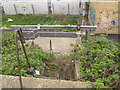
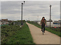
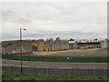
100 photos from this area
Area Information
Key information about the SE18 1DD including its size, population, and administrative classification.
- Area Type
- Postcode
- Area Size
- 2019 m²
- Population
- 1933
- Population Density
- 5367 people/km²
House Prices in SE18 1DD
14
Properties
£185,454
Average Sold Price
£42,500
Lowest Price
£405,500
Highest Price
Showing 14 properties
| Address | Type | Beds | Baths | Last Sale Price | Last Sale Date | |
|---|---|---|---|---|---|---|
| 32 Abery Street, Plumstead, SE18 1DD | house | - | - | £325,000 | Sep 2022 | |
| 34 Abery Street, Plumstead, SE18 1DD | Terraced | 3 | 1 | £405,500 | Feb 2022 | |
| 14 Abery Street, Plumstead, SE18 1DD | Terraced | 1 | 1 | £285,000 | Jul 2019 | |
| 26 Abery Street, Plumstead, SE18 1DD | house | - | - | £157,000 | Oct 2012 | |
| 12 Abery Street, Plumstead, SE18 1DD | house | - | - | £180,000 | Jul 2011 | |
| 22 Abery Street, Plumstead, SE18 1DD | house | - | - | £176,000 | Jul 2008 | |
| 10 Abery Street, Plumstead, SE18 1DD | Terraced | 3 | 1 | £197,000 | Sep 2007 | |
| 28 Abery Street, Plumstead, SE18 1DD | house | - | - | £189,000 | Jun 2007 | |
| 30 Abery Street, Plumstead, SE18 1DD | house | - | - | £149,250 | Feb 2006 | |
| 18 Abery Street, Plumstead, SE18 1DD | Terraced | 2 | 1 | £157,000 | Oct 2005 |
Page 1 of 2
Energy Efficiency in SE18 1DD
Amenities
Schools
| Rank | School | Type | Entry gender | Ages |
|---|
Explore more schools in this area
Go to Schools tabDemographics
Household Size
Family (3-5 people)
most common
Accommodation Type
Houses
most common
Tenure
35
majority
Ethnic Group
asian_total
most common
Religion
N/A
most common
Household Composition
N/A
most common
Age
47
median
Adults (30-64 years)
most common
Household Deprivation
N/A
with no deprivation
NS-SEC
20
in Lower managerial occupations
Explore more demographic insights in this area
Go to Demographics tabPlanning
Planning Constraints
- Flood RiskPremium
- Ramsar Wetland SitesPremium
- Area of Outstanding Natural BeautyPremium
- Protected Nature ReservePremium
- Protected WoodlandPremium