Area Overview for SE17 3NE
Photos of SE17 3NE

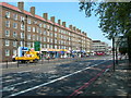
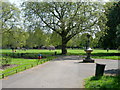
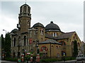
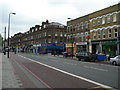

100 photos from this area
Area Information
Key information about the SE17 3NE including its size, population, and administrative classification.
- Area Type
- Postcode
- Area Size
- 6671 m²
- Population
- 1586
- Population Density
- 21608 people/km²
House Prices in SE17 3NE
65
Properties
£279,055
Average Sold Price
£110,000
Lowest Price
£485,000
Highest Price
Showing 65 properties
| Address | Type | Beds | Baths | Last Sale Price | Last Sale Date | |
|---|---|---|---|---|---|---|
| 27 Forsyth Gardens, London, SE17 3NE | Maisonette | - | - | £430,000 | May 2024 | |
| 64 Forsyth Gardens, London, SE17 3NE | Terraced | 4 | 2 | £440,000 | Jul 2023 | |
| 20 Forsyth Gardens, London, SE17 3NE | Maisonette | 3 | 1 | £440,000 | Sep 2022 | |
| 6 Forsyth Gardens, London, SE17 3NE | Maisonette | 3 | 1 | £485,000 | Dec 2018 | |
| 62 Forsyth Gardens, London, SE17 3NE | Maisonette | 4 | 2 | £427,500 | Jan 2017 | |
| 1 Forsyth Gardens, London, SE17 3NE | Maisonette | 4 | 2 | £450,000 | Apr 2016 | |
| 24 Forsyth Gardens, London, SE17 3NE | Maisonette | 3 | 1 | £216,000 | Apr 2015 | |
| 55 Forsyth Gardens, London, SE17 3NE | Maisonette | 3 | 1 | £200,000 | Feb 2010 | |
| 46 Forsyth Gardens, London, SE17 3NE | house | - | - | £190,000 | Mar 2009 | |
| 60 Forsyth Gardens, London, SE17 3NE | Flat | 3 | 1 | £280,000 | Mar 2008 |
Page 1 of 7
Energy Efficiency in SE17 3NE
Amenities
Schools
| Rank | School | Type | Entry gender | Ages |
|---|
Explore more schools in this area
Go to Schools tabDemographics
Household Size
One person
most common
Accommodation Type
Flats
most common
Tenure
17
majority
Ethnic Group
black_total
most common
Religion
N/A
most common
Household Composition
N/A
most common
Age
47
median
Adults (30-64 years)
most common
Household Deprivation
N/A
with no deprivation
NS-SEC
27
in Lower managerial occupations
Explore more demographic insights in this area
Go to Demographics tabPlanning
Planning Constraints
- Flood RiskPremium
- Ramsar Wetland SitesPremium
- Area of Outstanding Natural BeautyPremium
- Protected Nature ReservePremium
- Protected WoodlandPremium