Area Overview for SE17 3AR
Photos of SE17 3AR
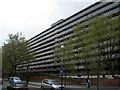
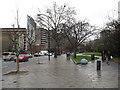
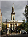
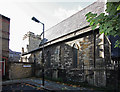
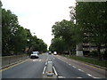
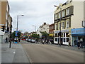
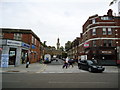
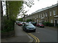
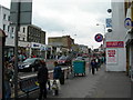
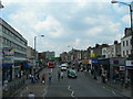
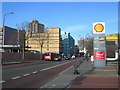

100 photos from this area
Area Information
Key information about the SE17 3AR including its size, population, and administrative classification.
- Area Type
- Postcode
- Area Size
- 1629 m²
- Population
- 1374
- Population Density
- 21402 people/km²
House Prices in SE17 3AR
48
Properties
£267,303
Average Sold Price
£54,000
Lowest Price
£530,000
Highest Price
Showing 48 properties
| Address | Type | Beds | Baths | Last Sale Price | Last Sale Date | |
|---|---|---|---|---|---|---|
| 138 Amelia Street, London, SE17 3AR | Flat | - | - | £415,000 | Mar 2025 | |
| 74 Amelia Street, London, SE17 3AR | Flat | - | - | £435,000 | Feb 2023 | |
| 136 Amelia Street, London, SE17 3AR | Flat | - | - | £441,500 | Sep 2021 | |
| 76 Amelia Street, London, SE17 3AR | Flat | - | - | £530,000 | Nov 2020 | |
| 106 Amelia Street, London, SE17 3AR | Flat | - | - | £337,600 | Jan 2014 | |
| 62 Amelia Street, London, SE17 3AR | Flat | - | - | £290,000 | Oct 2012 | |
| 116 Amelia Street, London, SE17 3AR | Flat | 2 | 1 | £270,000 | Feb 2012 | |
| 102 Amelia Street, London, SE17 3AR | Flat | - | - | £220,000 | Sep 2010 | |
| 58 Amelia Street, London, SE17 3AR | Flat | 2 | 1 | £250,000 | Jun 2008 | |
| 140 Amelia Street, London, SE17 3AR | Flat | - | - | £224,000 | Aug 2006 |
Page 1 of 5
Energy Efficiency in SE17 3AR
Amenities
Schools
| Rank | School | Type | Entry gender | Ages |
|---|
Explore more schools in this area
Go to Schools tabDemographics
Household Size
One person
most common
Accommodation Type
Flats
most common
Tenure
20
majority
Ethnic Group
White
most common
Religion
N/A
most common
Household Composition
N/A
most common
Age
47
median
Adults (30-64 years)
most common
Household Deprivation
N/A
with no deprivation
NS-SEC
38
in Lower managerial occupations
Explore more demographic insights in this area
Go to Demographics tabPlanning
Planning Constraints
- Flood RiskPremium
- Ramsar Wetland SitesPremium
- Area of Outstanding Natural BeautyPremium
- Protected Nature ReservePremium
- Protected WoodlandPremium