Area Overview for SE17 1FF
Photos of SE17 1FF
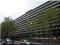
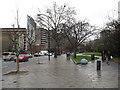


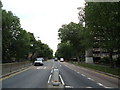
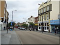

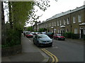
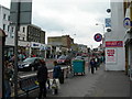
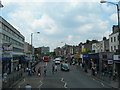
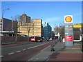
100 photos from this area
Area Information
Key information about the SE17 1FF including its size, population, and administrative classification.
- Area Type
- Postcode
- Area Size
- 1.0 hectares
- Population
- 1250
- Population Density
- 23063 people/km²
House Prices in SE17 1FF
22
Properties
£1,196,086
Average Sold Price
£960,000
Lowest Price
£1,571,400
Highest Price
Showing 22 properties
| Address | Type | Beds | Baths | Last Sale Price | Last Sale Date | |
|---|---|---|---|---|---|---|
| 67 Wansey Street, London, SE17 1FF | Terraced | 3 | 2 | £960,000 | Jul 2025 | |
| 65 Wansey Street, London, SE17 1FF | Terraced | 3 | 2 | £990,000 | Jan 2025 | |
| 55 Wansey Street, London, SE17 1FF | Terraced | 3 | 2 | £1,220,000 | Sep 2024 | |
| 49 Wansey Street, London, SE17 1FF | Terraced | 3 | 2 | £1,200,000 | Jul 2024 | |
| 51 Wansey Street, London, SE17 1FF | Terraced | 3 | 2 | £1,220,000 | Jun 2024 | |
| 47 Wansey Street, London, SE17 1FF | Terraced | 3 | 2 | £985,000 | Aug 2023 | |
| 53 Wansey Street, London, SE17 1FF | Terraced | 3 | 2 | £985,000 | Aug 2023 | |
| 57 Wansey Street, London, SE17 1FF | Terraced | 3 | 2 | £985,000 | Aug 2023 | |
| 33 Wansey Street, London, SE17 1FF | Detached | 3 | 2 | £985,000 | Aug 2023 | |
| 41 Wansey Street, London, SE17 1FF | Terraced | 3 | 2 | £985,000 | Aug 2023 |
Page 1 of 3
Energy Efficiency in SE17 1FF
Amenities
Schools
| Rank | School | Type | Entry gender | Ages |
|---|
Explore more schools in this area
Go to Schools tabDemographics
Household Size
Two person
most common
Accommodation Type
Flats
most common
Tenure
32
majority
Ethnic Group
White
most common
Religion
N/A
most common
Household Composition
N/A
most common
Age
22
median
Adults (30-64 years)
most common
Household Deprivation
N/A
with no deprivation
NS-SEC
58
in Lower managerial occupations
Explore more demographic insights in this area
Go to Demographics tabPlanning
Planning Constraints
- Flood RiskPremium
- Ramsar Wetland SitesPremium
- Area of Outstanding Natural BeautyPremium
- Protected Nature ReservePremium
- Protected WoodlandPremium