Area Overview for SE16 7RH
Photos of SE16 7RH
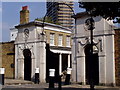
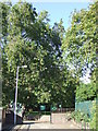
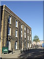
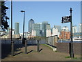
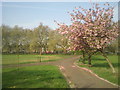
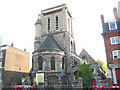
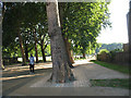

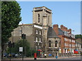
100 photos from this area
Area Information
Key information about the SE16 7RH including its size, population, and administrative classification.
- Area Type
- Postcode
- Area Size
- 6102 m²
- Population
- 2070
- Population Density
- 6603 people/km²
House Prices in SE16 7RH
26
Properties
£393,193
Average Sold Price
£162,000
Lowest Price
£617,500
Highest Price
Showing 26 properties
| Address | Type | Beds | Baths | Last Sale Price | Last Sale Date | |
|---|---|---|---|---|---|---|
| 23 Cunard Walk, London, SE16 7RH | Semi-detached | 3 | 2 | £500,000 | Jul 2025 | |
| 5 Cunard Walk, London, SE16 7RH | Terraced | 2 | 1 | £617,500 | Jul 2023 | |
| 15 Cunard Walk, London, SE16 7RH | Terraced | 2 | 2 | £535,000 | Mar 2023 | |
| 21 Cunard Walk, London, SE16 7RH | Semi-detached | 2 | 1 | £610,000 | Jan 2023 | |
| 11 Cunard Walk, London, SE16 7RH | Semi-detached | 3 | 2 | £480,000 | Nov 2022 | |
| 9 Cunard Walk, London, SE16 7RH | Terraced | 3 | 2 | £492,600 | Oct 2022 | |
| 27 Cunard Walk, London, SE16 7RH | house | 2 | 1 | £435,000 | Jan 2021 | |
| 41 Cunard Walk, London, SE16 7RH | Semi-detached | 2 | 1 | £480,000 | Mar 2017 | |
| 13 Cunard Walk, London, SE16 7RH | Semi-detached | 3 | 2 | £510,000 | Nov 2016 | |
| 39 Cunard Walk, London, SE16 7RH | house | - | - | £383,000 | Sep 2015 |
Page 1 of 3
Energy Efficiency in SE16 7RH
Amenities
Schools
| Rank | School | Type | Entry gender | Ages |
|---|
Explore more schools in this area
Go to Schools tabDemographics
Household Size
Two person
most common
Accommodation Type
Flats
most common
Tenure
39
majority
Ethnic Group
White
most common
Religion
N/A
most common
Household Composition
N/A
most common
Age
47
median
Adults (30-64 years)
most common
Household Deprivation
N/A
with no deprivation
NS-SEC
64
in Lower managerial occupations
Explore more demographic insights in this area
Go to Demographics tabPlanning
Planning Constraints
- Flood RiskPremium
- Ramsar Wetland SitesPremium
- Area of Outstanding Natural BeautyPremium
- Protected Nature ReservePremium
- Protected WoodlandPremium