Area Overview for SE16 4EP
Photos of SE16 4EP


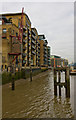
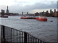
100 photos from this area
Area Information
Key information about the SE16 4EP including its size, population, and administrative classification.
- Area Type
- Postcode
- Area Size
- 8345 m²
- Population
- 1468
- Population Density
- 16588 people/km²
House Prices in SE16 4EP
94
Properties
£164,779
Average Sold Price
£116,250
Lowest Price
£352,500
Highest Price
Showing 94 properties
| Address | Type | Beds | Baths | Last Sale Price | Last Sale Date | |
|---|---|---|---|---|---|---|
| 60, Hartley House, Chambers Street, London, SE16 4EP | Flat | - | - | £141,000 | Feb 2025 | |
| 14, Hartley House, Chambers Street, London, SE16 4EP | Flat | - | - | £116,250 | Jul 2023 | |
| 83, Hartley House, Chambers Street, London, SE16 4EP | Flat | - | - | £202,000 | Dec 2022 | |
| 51, Hartley House, Chambers Street, London, SE16 4EP | Flat | - | - | £150,000 | Dec 2022 | |
| 15, Hartley House, Chambers Street, London, SE16 4EP | Flat | - | - | £144,000 | Oct 2022 | |
| 38, Hartley House, Chambers Street, London, SE16 4EP | Flat | - | - | £123,750 | Jun 2022 | |
| 85, Hartley House, Chambers Street, London, SE16 4EP | Flat | - | - | £125,000 | Mar 2022 | |
| 23, Hartley House, Chambers Street, London, SE16 4EP | Flat | - | - | £258,000 | Dec 2021 | |
| 59, Hartley House, Chambers Street, London, SE16 4EP | Flat | - | - | £160,750 | Dec 2021 | |
| 11, Hartley House, Chambers Street, London, SE16 4EP | Flat | - | - | £219,800 | Dec 2021 |
Page 1 of 10
Energy Efficiency in SE16 4EP
Amenities
Schools
| Rank | School | Type | Entry gender | Ages |
|---|
Explore more schools in this area
Go to Schools tabDemographics
Household Size
One person
most common
Accommodation Type
Flats
most common
Tenure
29
majority
Ethnic Group
White
most common
Religion
N/A
most common
Household Composition
N/A
most common
Age
47
median
Adults (30-64 years)
most common
Household Deprivation
N/A
with no deprivation
NS-SEC
39
in Lower managerial occupations
Explore more demographic insights in this area
Go to Demographics tabPlanning
Planning Constraints
- Flood RiskPremium
- Ramsar Wetland SitesPremium
- Area of Outstanding Natural BeautyPremium
- Protected Nature ReservePremium
- Protected WoodlandPremium